Refine your search for walks in Réserve naturelle nationale des Contamines-Montjoie
Réserve naturelle nationale des Contamines-Montjoie walks


 The Jovet lakes
 Visorando Member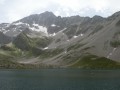
 9.43 mi
 +3,310 ft
 -3,310 ft
 7h 15
7h 15
 Average
 Departure from Les Contamines-Montjoie (Haute-Savoie)
On the border between the Mont Blanc, Beaufortain and Tarentaise massifs, this hike will take you through alpine pastures to discover the Lacs Jovets at an altitude of over 2,100 metres.
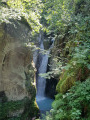
Combe Noire waterfall
 Association / Club / Walk leader
 3.15 mi
+1,102 ft
-1,086 ft
2h 25
Average
Departure from Les Contamines-Montjoie (Haute-Savoie)
3.15 mi
+1,102 ft
-1,086 ft
2h 25
Average
Departure from Les Contamines-Montjoie (Haute-Savoie)
Combe Noire waterfall and its impressive torrential potholes.
The Tré la Tête refuge as seen from Notre-Dame de la Gorge
 6.43 mi
+2,635 ft
-2,608 ft
5h 15
6.43 mi
+2,635 ft
-2,608 ft
5h 15
 Difficult
Departure from Les Contamines-Montjoie (Haute-Savoie)
Difficult
Departure from Les Contamines-Montjoie (Haute-Savoie)
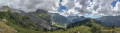
A lovely circular starting from the Notre-Dame de la Gorge car park. The path alternates between refreshing forests, meadows and breathtaking views. Among other things, you will see a natural bridge carved into the rock, a Roman bridge and the Combe Noire waterfall.
Refuge des Conscrits
 6.25 mi
+5,472 ft
-804 ft
6 hrs
6.25 mi
+5,472 ft
-804 ft
6 hrs
 Very difficult
Departure from Les Contamines-Montjoie (Haute-Savoie)
Very difficult
Departure from Les Contamines-Montjoie (Haute-Savoie)
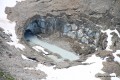
A magical new route to the heart of the Mont Blanc massif.
High-altitude atmosphere and proximity to the great Alpine glaciers!
Col de la Croix du Bonhomme refuge
 8.29 mi
+3,274 ft
-3,281 ft
6h 40
Difficult
Departure from Beaufort (Savoie) (Savoie)
8.29 mi
+3,274 ft
-3,281 ft
6h 40
Difficult
Departure from Beaufort (Savoie) (Savoie)
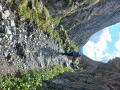
One- or two-day hike through the pastures.
Col de la Fenêtre circular from Notre-Dame de la Gorge
 7.99 mi
+3,481 ft
-3,474 ft
6h 40
Difficult
Departure from Les Contamines-Montjoie (Haute-Savoie)
7.99 mi
+3,481 ft
-3,474 ft
6h 40
Difficult
Departure from Les Contamines-Montjoie (Haute-Savoie)
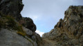
A magnificent circular starting from Notre-Dame de la Gorge. The ascent of the Col de la Fenêtre will take you to a strategic point on the border between the Mont Blanc massif and the Beaufortain. From this narrow pass, you will enjoy a remarkable view of Mont Blanc to the east, Lac de la Girotte and the slopes of Hauteluce to the west.
Circular route to the Tête Nord des Fours, via the Chemin du Curé and the Crête des Gittes
 10.78 mi
+4,226 ft
-4,206 ft
10 hrs
Very difficult
Departure from Beaufort (Savoie) (Savoie)
10.78 mi
+4,226 ft
-4,206 ft
10 hrs
Very difficult
Departure from Beaufort (Savoie) (Savoie)
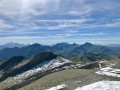
This is a lovely circular route in the Beaufortain, approaching the Mont Blanc massif, allowing you to explore historic and unique routes such as the Chemin du Curé or the Crête des Gittes. The view from the summit over the Alps, from Monte Rosa to the Ecrins, is exceptional.
The section from the Col du Bonhomme to the refuge and on to the Col des Fours is very busy in summer, as it forms part of the Tour du Mont Blanc or one of its variants.
Tour du Beaufortain
 57.03 mi
+18,586 ft
-18,638 ft
7 days
Average
Departure from Hauteluce (Savoie)
57.03 mi
+18,586 ft
-18,638 ft
7 days
Average
Departure from Hauteluce (Savoie)
The Beaufortain, between Albertville and Bourg-Saint-Maurice, offers a 7-day tour that will take you on a journey through a landscape reminiscent of Switzerland.
stage 1 of the TMB
8.63 mi
+2,411 ft
-4,409 ft
6h 05
Difficult
Departure from Saint-Gervais-les-Bains (Haute-Savoie)
stage 1 of the TMB: Les Houches to Les Contamines-Monjoie via the Col du Tricot
To refuge de Tré la Tete
8.48 mi
+2,690 ft
-2,684 ft
6h 15
Average
Departure from Les Contamines-Montjoie (Haute-Savoie)
A circular walk from Les Contamines Montjoie up to the Refuge de tré la Tete and views of the Tré la Tete glacier, then descending to Combe Noire to the waterfalls before returning past the pretty chapel of Notre Dame de la Gorge.
Tré la Tête mountain refuge and return via Combe Noire and La Sololieu
 7.24 mi
+2,946 ft
-2,949 ft
5h 55
Difficult
Departure from Les Contamines-Montjoie (Haute-Savoie)
7.24 mi
+2,946 ft
-2,949 ft
5h 55
Difficult
Departure from Les Contamines-Montjoie (Haute-Savoie)
A lovely circular walk combining woodland, panoramic views, a refuge, a waterfall and a remarkable natural area.
Val Montjoie circular
6.49 mi
+1,519 ft
-1,512 ft
4h 20
Average
Departure from Saint-Gervais-les-Bains (Haute-Savoie)
Circular route starting from La Gruvaz, suitable for mountain biking, running, walking or snowshoeing.
The Curé passage
10.65 mi
+2,900 ft
-4,199 ft
7h 25
Difficult
Departure from Beaufort (Savoie) (Savoie)
Lake Gittaz and the Curé passage.
Les Houches - Refuge Nant Borrant
 9.85 mi
+3,140 ft
-4,344 ft
7h 15
Difficult
Departure from Saint-Gervais-les-Bains (Haute-Savoie)
9.85 mi
+3,140 ft
-4,344 ft
7h 15
Difficult
Departure from Saint-Gervais-les-Bains (Haute-Savoie)
stage1 of the Tour du Mont Blanc: from Les Houches to the Refuge de Nant Borrant (in the commune of Les Contamines Montjoie) via the Col du Tricot variant.
TMB 2011
 72.58 mi
+24,705 ft
-26,109 ft
7 days
Difficult
Departure from Saint-Gervais-les-Bains (Haute-Savoie)
72.58 mi
+24,705 ft
-26,109 ft
7 days
Difficult
Departure from Saint-Gervais-les-Bains (Haute-Savoie)
Completed from 27 June to 4 July 2011, with 4 hikers, 2 tents, in almost complete autonomy (food provided for 7 days, only bread and a few items were purchased along the route).
The cable car and bus were used to shorten some stages and we needed about a day more to complete the Brévent balcony opposite the Mont Blanc massif.
The return to the starting point will be by public transport, bus or train...
Chalet de Roselette - Refuge de la Croix du Bonhomme
6.16 mi
+3,261 ft
-1,358 ft
5h 40
Average
Departure from Les Contamines-Montjoie (Haute-Savoie)
From Roselette to the Croix du Bonhomme via a short section of the Tour du Mont Blanc variant.
Les Houches - Refuge de La Balme
16.71 mi
+4,154 ft
-4,469 ft
11h 20
Difficult
Departure from Saint-Gervais-les-Bains (Haute-Savoie)
Itinéraire de la traversée des Alpes. Départ des Houches pour rejoindre le Beaufortain. Itinéraire classique et tranquille passant par Bionassay et les Contamines Montjoie pour aller jusqu’au refuge de la Balme. Cet itinéraire est commun à celui du tour du Mont Blanc.
Circuit of the Roselette, Prés, Balme and Nant Borrant stream huts
8.65 mi
+2,913 ft
-2,920 ft
6h 30
Difficult
Departure from Les Contamines-Montjoie (Haute-Savoie)
A circular hike or trail run with stunning views over the Val Montjoie, the nature reserve and the Mont Blanc massif. Passing through four refuges on the GR® du Tour du Beaufortain (Roselette and Prés) and the TMB (Balme, Nant Borrant), the sections are short, allowing you to top up your water supplies or take a coffee or lunch break.
From Les Houches to the Refuge de la Balme
 15.34 mi
+4,954 ft
-2,654 ft
11h 20
Difficult
Departure from Les Houches (Haute-Savoie)
15.34 mi
+4,954 ft
-2,654 ft
11h 20
Difficult
Departure from Les Houches (Haute-Savoie)
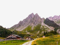
This sixth stage of the GTA GR®5, which is shared with the GR® TMB, takes place in the Mont Blanc massif and then the Beaufortain massif. From Les Houches, the route follows the Maison Neuve chairlift and reaches the Terrain chalets before climbing up to the Col de Voza. The GR®5 descends due south along a wide path towards the Refuge du Fioux and then reaches the hamlet of Bionnassay. It crosses the Torrent de Bionnassay valley and turns sharply westwards before reaching the hamlet of Champel. From there, the path heads south to reach La Gruvaz, from where it descends westwards into the Bon Nant stream, which it crosses to run along the left bank towards the south. It returns to the right bank, passes through Les Contamines-Montjoie following the stream’s axis due south, and goes past the remarkable chapel of Notre-Dame de la Gorge. Continuing to follow the Bon Stream valley, the GR®5 climbs to a natural bridge and crosses a gorge at the Pont Romain de la Téna to reach the Refuge de la Balme.
Les Contamines to Les Chapieux - Tour Mont Blanc
10.10 mi
+4,334 ft
-3,097 ft
8h 25
Difficult
Departure from Les Contamines-Montjoie (Haute-Savoie)
This 2nd stage of the Tour Mont Blanc (TMB) follows the river Le Bonnant upstream to climb over the Col du Bonhomme at 2,329m. Let's do it!
The TMB is a classic long-distance footpath that goes around Mont Blanc, passing from France into Italy and through Switzerland before returning to France.
Tour Mont Blanc in 11 stages
101.99 mi
+36,204 ft
-35,778 ft
11 days
Difficult
Departure from Les Houches (Haute-Savoie)
The Tour Mont Blanc (TMB) is a classic long-distance footpath that goes around Mont Blanc, passing from France into Italy and through Switzerland before returning to France. These 11 stages are one way of doing it but you can make your own version of the TMB. The classic route begins and ends in Les Houches and takes an anticlockwise direction around Mont Blanc and the adjacent peaks. There is a total of 164 km (102 miles) walking these 11 routes and a positive height gain of over 10,000m. Certainly a challenging adventure but well worth the effort. Let's do it!
⚠️ This route passes through nature reserves. Please respect the regulations in force. See practical information.
Col de la Fenetre
7.73 mi
+1,296 ft
-3,596 ft
4h 40
Average
Departure from Les Contamines-Montjoie (Haute-Savoie)
This walk starts from the top of the gondola at Le Signal. It is an interesting walk, up to and through the Col de la Fenetre. The descent takes you back down through alpine pastures and into the valley leading back to Les Contamines-Montjoie.
⚠️ Please note that you need to park at (A) and not (D) for this walk ⚠️
Refuge de La Balme - Bourg Saint Maurice
7.05 mi
+2,615 ft
-3,117 ft
5h 30
Average
Departure from Les Contamines-Montjoie (Haute-Savoie)
Itinéraire de la traversée des Alpes. Départ du Refuge de la Balme jusqu’aux Chapieux. Cette étape nous fait entrer dans un monde minéral (Col de la Croix du Bonhomme) et nous permet d'avoir un magnifique panorama sur la belle région du Beaufortain.
Refuge Nant Borrant - Refuge des Mottets
 9.72 mi
+4,452 ft
-3,018 ft
8h 20
Difficult
Departure from Les Contamines-Montjoie (Haute-Savoie)
9.72 mi
+4,452 ft
-3,018 ft
8h 20
Difficult
Departure from Les Contamines-Montjoie (Haute-Savoie)
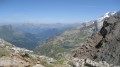
Stage2 of the Tour du Mont Blanc: from the Nant Borrant mountain hut (Contamines-Montjoie) to the Mottets mountain hut (Bourg-Saint-Maurice) via the Col des Fours route.