


 Country:

 City:
City:


🧭 Full details of this walk:
👉 go.peregrin.be/n008f
Here you’ll find a detailed description, tips based on on-site reconnaissance, points of interest, the IGN map and any updates to the route.


This circular walk reveals several different facets of the Upper Meuse as you walk along.
After a climb through the woods, the ridges reveal three successive viewpoints, including the Drapeau viewpoint, offering a panoramic view of the Meuse, Waulsort, its castle and the limestone cliffs that shape the valley.
The route then reaches the riverbanks before heading up the Cascatelles valley, where the stream runs alongside the path amongst the small waterfalls. The return journey across the agricultural plateaus offers a final change of scenery before reaching Falmignoul.


🧭 Full details of this walk:
👉 go.peregrin.be/n008f
Here you’ll find a detailed description, tips based on on-site reconnaissance, points of interest, the IGN map and any updates to the route.
Parking available at the starting point
Falmignoul, the Rocher de Freyr and the waterfall 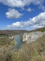 9.20 mi
+876 ft
-873 ft
5h 00
Moderate
9.20 mi
+876 ft
-873 ft
5h 00
Moderate
 Departure from Dinant (Province de Namur)
From Falmignoul to the banks of the Meuse, medium version
Departure from Dinant (Province de Namur)
From Falmignoul to the banks of the Meuse, medium version 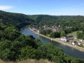 6.38 mi
+794 ft
-794 ft
3h 40
Moderate
Departure from Dinant (Province de Namur)
From Falmignoul to the banks of the Meuse, challenging version
6.38 mi
+794 ft
-794 ft
3h 40
Moderate
Departure from Dinant (Province de Namur)
From Falmignoul to the banks of the Meuse, challenging version 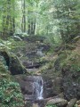 5.72 mi
+1,083 ft
-1,079 ft
3h 35
Moderate
Departure from Dinant (Province de Namur)
The Cascatelles from Falmignoul
5.72 mi
+1,083 ft
-1,079 ft
3h 35
Moderate
Departure from Dinant (Province de Namur)
The Cascatelles from Falmignoul  4.41 mi
+669 ft
-643 ft
2h 35
Moderate
Departure from Dinant (Province de Namur)
Circular route starting from Falmagne
4.41 mi
+669 ft
-643 ft
2h 35
Moderate
Departure from Dinant (Province de Namur)
Circular route starting from Falmagne 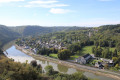 8.59 mi
+787 ft
-787 ft
4h 40
Moderate
Departure from Dinant (Province de Namur)
From Falmagne to Furfooz
8.59 mi
+787 ft
-787 ft
4h 40
Moderate
Departure from Dinant (Province de Namur)
From Falmagne to Furfooz  9.93 mi
+1,175 ft
-1,188 ft
5h 35
Moderate
Departure from Dinant (Province de Namur)
Tour along the rocks of the Meuse 7.58 mi
+797 ft
-778 ft
4h 10
Moderate
Departure from Dinant (Province de Namur)
Walzin, Chaleux and the ancient Roman camp
9.93 mi
+1,175 ft
-1,188 ft
5h 35
Moderate
Departure from Dinant (Province de Namur)
Tour along the rocks of the Meuse 7.58 mi
+797 ft
-778 ft
4h 10
Moderate
Departure from Dinant (Province de Namur)
Walzin, Chaleux and the ancient Roman camp  8.82 mi
+1,004 ft
-994 ft
4h 55
Moderate
Departure from Dinant (Province de Namur)
8.82 mi
+1,004 ft
-994 ft
4h 55
Moderate
Departure from Dinant (Province de Namur)
For more walks, use our search engine .
The GPS track and description are the property of this route's author. Please do not copy them without permission.
Scan this QR code with your smartphone's camera.
To open this route on your smartphone, you must have the Visorando app installed. If not, got to the Apple Store (iPhone) or Google Play Store (Android) to download the app.
 Visorando Member
