Country:
 City:
City:


Start from the Parking des Pyramides, Rue de Iéna
(S/E) Leave the car park, continue straight ahead twice, then turn right onto Rue d’Austerlitz, then left along Rue François Mitterrand.
(1) Turn right at the end of the square. Then keep to the right, then cross the road to take Rue Sadi-Carnot. At the end, take a first turn right then left, then take the first right onto Rue Nationale.
(2) First turn left then right, then take the second left and continue to the castle.
(3) Take the stairs and first turn right then left. At the end, turn left, then cross the Blavet to the right and walk across the island.
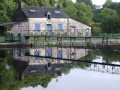
(4) At the end, turn left, then take the first left and follow the Blavet. Then turn right onto Rue des Moulins and continue to Rue Porlorino.
(5) First turn right then left, then keep left twice and immediately turn right onto Rue du Chêne, which you should follow to the end.
(6) Turn right, then take the stairs on the left. At the bottom, keep left and continue straight on until you reach Chemin de la Haute Folie.
(7) First turn left then right, and walk alongside the Blavet to the roundabout. Take the bridge on the left and join Rue Joseph Le Goff.
(8) First turn left then right, then right again, then take the first left and continue to the Church of Saint-Joseph. Then turn right onto Rue Nationale.
(9) First turn right then left, then left again. Then turn right and head for the car park (S/E).
 Visorando Member


 Moderate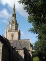
 Tourist office
 Difficult