Towards the Lower Vallonnet Glacier

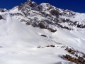
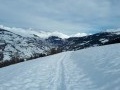
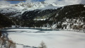
One of my most beautiful snowshoe hikes in 20 years! At least, as far as the final destination is concerned. This route takes you into a majestic landscape where the Lower Vallonnet Glacier at an altitude of 2,400 m (with its cave and tunnel) and, higher up, the Upper Glacier and the Albaron massif (alt. 3,637 m), which seems to oversee it all, immerse you in a world where time stands still. But for this glacier, time is sadly running out! This route presents no difficulties, apart from the slope to climb from the Balme ski lift. There are no hazardous slopes. However, you must remain cautious at the entrance to the glacier’s vault, where stalactites or blocks of ice could break loose during a thaw.

Details

71698772
Creation:
Last update:
Last review:
  • Snowshoeing
    Activity: Snowshoeing
  • ↔
    Distance: 6.32 mi
  • ◔
    Duration according to the author: 4 hrs 
  • ▲
    Difficulty: Moderate

  • ⚐
    Back to start: Yes
  • ↗
    Ascent: + 2,021 ft
  • ↘
    Descent: - 2,011 ft

  • ▲
    Highest point: 7,982 ft
  • ▼
    Lowest point: 5,968 ft

Description of the walk

Take the D902 to reach the village of Bonneval-sur-Arc. There is a large car park at the end of the Route du Tralenta. A smaller car park is also available near the Vallonnet chairlift, on the Route de l’Écot.

The route starts at the foot of the Vallonnet chairlift. 

(S/E) Cross the Blue run “Polo” and start climbing it on the left-hand side. Between the3rd and4th pylons, turn left onto the Green run “Alouette”. There may be signs prohibiting pedestrians. However, tolerance is the order of the day as this is the only possible route, which is also used by the ESF for snowshoe excursions. This is why you are asked to keep to the left of the run and not to walk side-by-side if you are in a group.

(1) Head back up the Green run. In one of its bends, admire the ice waterfall. Continue to the next junction with the Blue “Polo” run.

(2) Ignore the right-hand side of the Blue run “Polo”, which descends back to the village, and continue climbing to the left, following the Blue run “Accenteur” towards the nearby ski lifts. If you wish, stop by the ski patrollers at the Barme T-bar lift (Balme on IGN maps) to get some information.

(3) Cross the Green run, then the Red “Épervier” run, and head towards the Blue “Accenteur” run. Climb this steep slope on the left-hand side until you reach the red safety nets (empty).

(4) Follow the nets, heading left onto the “Chardonneret” run, and you’ll soon reach the Y-junction formed by the Circaète and Chardonneret runs. 

(5) Take the trail on the right and leave it very quickly on your right, continuing off-piste. Follow the Vallonnet stream up its right bank, following the ski touring or snowshoe tracks. If recent snowfall has covered all traces, head towards the cirque at the very back, keeping the Glacier Supérieur in your sights, as its summit is visible from a distance. Reach the slight incline marking the proximity of the glacier.

(6) Continue straight on for a few dozen metres until you reach the glacier. The cave is situated in the middle of the vault. Be wary of falling stalactites or blocks of ice that might break loose.

(7) Retrace your steps to the start of the arch. Go round the glacier to the right (on your right-hand side after turning round at the arch = on the left-hand side of the glacier when viewed from the front). Continue the climb for a few dozen metres until you reach the clearly visible opening of a tunnel which you can pass through . The view is magnificent. Also take a moment to admire the Upper Glacier at the summit.

(8) From the glacier tunnel, retrace your steps to the entrance to the vault. Head towards the slight incline you took on the way there.

(6) Do not follow the track from the outward journey, but cross over to the left bank of the Ruisseau du Vallonnet. As it is buried under the snow and therefore invisible, head slightly towards the left-hand walls without getting too close to them. Further on, if there are no tracks, aim for a green and yellow snow-level marker post. Reach the safety nets from the outward journey.

(4) Descend the run towards the Refuge du Criou. Continue along the Green run, which curves slightly to the right a little further on.

(2) At the junction with the Blue run “Polo Village”, follow the green arrow for “Alouette Village”. After several hairpin bends, rejoin the Blue run.

(1) Head to the foot of the chairlift (S/E).
Waypoints

  1. S/E : mi 0 - alt. 5,968 ft - Base of the Vallonnet chairlift - Arc (rivière) - Affluent de l'Isère
  2. 1 : mi 0.17 - alt. 6,079 ft - Junction for the Alouette green trail
  3. 2 : mi 1.09 - alt. 6,654 ft - Junction of the green and blue trails
  4. 3 : mi 1.23 - alt. 6,722 ft - La Balme ski lift and Refuge du Criou
  5. 4 : mi 1.53 - alt. 7,067 ft - Safety nets
  6. 5 : mi 1.78 - alt. 7,215 ft - Y-junction
  7. 6 : mi 2.56 - alt. 7,628 ft - A slight incline before the glacier
  8. 7 : mi 2.76 - alt. 7,667 ft - Glacier Cave
  9. 8 : mi 3.15 - alt. 7,769 ft - Glacier Tunnel
  10. S/E : mi 6.32 - alt. 5,971 ft - Base of the Vallonnet chairlift - Arc (rivière) - Affluent de l'Isère

Notes

Hike completed solo on 27 March 2025 in just under 4 hours, plus 1 hour for a break and to admire the glacier.

The track is the one recorded in real time.

Depending on snow conditions, and provided the Green run is well groomed, it is possible to ascend as far as (3) without putting on snowshoes.

Bar and restaurant along the route: the Refuge du Criou, at the top of the Vallonnet chairlift, near the Barme and Moulinet ski lifts (3).

Toilets at the Refuge du Criou, near the (3), if you buy a drink.

You can take the Vallonnet chairlift up to (3) with a pedestrian pass (€12.50 in 2025); this saves you 45 minutes of walking uphill. 

Hiking is possible in summer. For the names of the trails – the signposts for which are removed in summer – you can consult “OpenStreetMap Hiking (World)”. 

Worth a visit

In the same area, another of my walks: the hamlets of Vincendières and l’Avérole from the hamlet of Villaron (no.71531031).

From the foot of the Vallonnet chairlift, another (easy) walk is possible to the hamlet of l’Écot, where scenes from the modern film “Belle and Sébastien” were filmed.

The “Le Glacier des Évettes” hotel, bar, tobacconist and restaurant in Bonneval-sur-Arc, where a delicious mulled wine awaits you, along with their blueberry tart (or crêpes, if you prefer).

A visit to the old village of Bonneval-sur-Arc, notably including “La Ferme d’Angélina”, where you’ll find farmhouse cheeses, artisanal charcuterie, honey, biscuits, beers, wines and other local produce.

Reviews and comments

4.4 / 5
Based on 3 reviews

Reliability of the description
4 / 5
Ease of following the route
4.3 / 5
Route interest
5 / 5
Pounet Rando
Pounet Rando
• Edited:

I'm glad you enjoyed the hike. My description corresponds to my snowshoe hike in March 2025. With the snow cover, there is no lake, no moraine, no trail. It's a completely white world. I'm going back in March 2026, so I'll be able to compare the evolution of the glacier, which is certainly receding considerably and unfortunately destined to disappear. All the best.

Machine-translated

jipeverando
jipeverando

Overall rating : 4.7 / 5

Date of your route : Aug 25, 2025
Reliability of the description : ★★★★☆ Good
Ease of following the route : ★★★★★ Very good
Route interest : ★★★★★ Very good
Very busy route : No

From Bonneval, the climb is not very pleasant
150 m on the right after the toll for the Ecot.
You climb up a track under the chairlifts
But the rest is very pleasant.
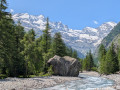
Stay at the bottom of the valley until you reach a moraine, which you can climb at your leisure.
This is a great opportunity to get close to a glacier, or what remains of it, without too much elevation gain.
What's more, it's very quiet.

Machine-translated

Pounet Rando
Pounet Rando

I'm glad you enjoyed the hike. Thank you for your details. My description corresponds to my snowshoe hike in March 2025. With the snow cover, there is no lake, no moraine, and no trail. It's a completely white world. As you mentioned, in summer, with the snow melt, the risks are greater. I'm going back in March 2026, so I'll be able to compare how the glacier has changed, as it's definitely suffering from the heat. Unfortunately, it's destined to disappear. All the best.

Machine-translated

User 7473555

Overall rating : 4.3 / 5

Date of your route : Aug 06, 2025
Reliability of the description : ★★★★☆ Good
Ease of following the route : ★★★★☆ Good
Route interest : ★★★★★ Very good
Very busy route : No

Done on 6/08/25, a very beautiful and fairly easy hike. The end of the glacier has receded considerably and is now more or less at point 8. Don't get too close or you risk being hit on the head by rocks or even ice, as the glacier is melting very quickly and falling continuously! It is possible to go around the "lake" on the right and return on the left. Venturing further along the moraine towards a tunnel seemed dangerous due to the melting. The place was very beautiful and unusual, almost black and white but dotted with tufts of flowers! There was a single edelweiss flower at the top of the ski slope!

Machine-translated

la baujue
la baujue

According to the person who accompanied me, it has receded considerably and he thinks that the cave will soon disappear...

Machine-translated

Pounet Rando
Pounet Rando

I'm glad you enjoyed the hike. I did it on snowshoes in March. The glacier must be suffering from the heat...

Machine-translated

la baujue
la baujue

Overall rating : 4.3 / 5

Date of your route : Jul 09, 2025
Reliability of the description : ★★★★☆ Good
Ease of following the route : ★★★★☆ Good
Route interest : ★★★★★ Very good
Very busy route : No

A lovely walk; the route depends largely on the walker’s ability to find their way: the path is poorly marked or even non-existent, and there were several fords today.

Machine-translated

Other walks in the area

For more walks, use our search engine .

The GPS track and description are the property of this route's author. Please do not copy them without permission.