Country:

 City:


As the route is not a complete circular route, it is advisable to arrange for transport to be waiting at the end of the walk, for example at the car park near the ‘Maison d’Aussois’, at the foot of the ski lifts.
To start the walk, park in the small car park on the side of the D125, just above the village of Le Bourget.
(S) Walk down for about a hundred metres, then head straight up the slope to find a well-marked path leading north-east. Reach an altitude of 1,420 m.
(1) Take the path on the left and head for the pass at an altitude of 1,481 m, near the Chatalamia barns.
(2) Climb straight up the slope to 1,570 m. Turn right and follow the contour line for about 100 m, then continue the ascent north-westwards to the 1,650 m mark.
Continue the ascent westwards. Once you reach the 1,700-metre mark, take a path facing the slope which winds north-westwards before turning west and joining a track coming up from the valley.
(3) Ignore this and continue the ascent through the woods heading north, then north-west, until you join theGR®5.
(4) Follow it to the right and continue the ascent north-eastwards. The path emerges from the forest and becomes a ridge path, which you follow north-eastwards then eastwards to reach the Barbier (2,330 m).
(5) Continue north-east for 600 m, then head due east to reach the Col du Barbier.
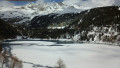
(6) From the pass, take the path on the right, heading north-east, which descends to the Plan d’Aval. Join the path that runs along the right bank of the lake and follow it to the dam wall.
(7) Descend below the dam wall to reach Le Drozet (1,811 m), then the path leading across the Saint-Benoît stream (1,780 m). Join the ski runs and follow them for a few dozen metres.
(8) When you reach the 1,750-metre mark, turn right onto the ski touring and snowshoe trail which leads back to the foot of the Aussois ski lifts (E).

 Visorando Member
 Difficult
 Easy
 Moderate