Valnontey Valley

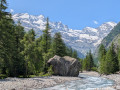
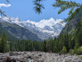
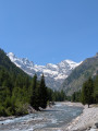
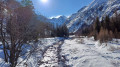
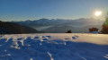
This pleasant route offers spectacular views of the Gran Paradiso massif. You’ll be able to see numerous ice waterfalls, which attract ice climbers from all over the world.

Details

n°44570055
Creation:
Last update:
Last review:
  • Snowshoeing
    Activity: Snowshoeing
  • ↔
    Distance: 4.18 mi
  • ◔
    Duration according to the author: 2 hrs 
  • ▲
    Difficulty: Easy

  • ⚐
    Back to start: Yes
  • ↗
    Ascent: + 348 ft
  • ↘
    Descent: - 348 ft

  • ▲
    Highest point: 5,791 ft
  • ▼
    Lowest point: 5,440 ft

Photos

Description of the walk

The start and finish of this walk are in the hamlet of Valnontey (3 km from Cogne).

  • Access by car from Cogne to Valnontey (car park).
  • Access by free shuttle bus from Cogne to Valnontey.

(S/E) From the car park, head south towards the first bridge near a pizzeria.

Signposted with “Pista per Pedoni” signs (yellow or orange)

(1) Follow the Valnontey stream to the next bridge.

(2) Continue along the footpath on the right bank of the stream until you reach a third bridge.

(3) Stay on this bank, heading south. Pass through the hamlet of Valmianiaz and carry on to the next bridge, which is broken. The track ends here.

(4) Retrace your steps back to the third bridge.

(3) Cross the bridge and continue along the opposite bank. You’ll reach a large junction with a cross-country ski trail.

(5) Cross the cross-country ski trail with care, following the ‘Pista per Pedoni’ signs closely.

(2) Stay on the footpath and head back to the second bridge.

(1) Cross the bridge and follow the same route as on the way out until you reach the first bridge. Return to the car park (S/E).


Waypoints

  1. S/E : mi 0 - alt. 5,443 ft - Valnontey car park
  2. 1 : mi 0.08 - alt. 5,469 ft - First bridge / Pizzeria
  3. 2 : mi 0.64 - alt. 5,531 ft - Second Bridge
  4. 3 : mi 1.21 - alt. 5,610 ft - Third Bridge
  5. 4 : mi 2.05 - alt. 5,791 ft - Fourth Bridge (broken) End of the trail.
  6. 5 : mi 3.18 - alt. 5,561 ft - Crossing the cross-country ski trail
  7. S/E : mi 4.18 - alt. 5,443 ft - Valnontey car park

Notes

  • Signposting: “Pista per Pedoni” signs
  • Cross-country ski trails and footpaths are clearly separated. It is essential to follow the signs and to cross the cross-country ski trails only at junctions where this is permitted.
  • If the snow is well-trodden, snowshoes are not necessary.
  • Trail opening dates: check with the Tourist Office.

Route completed by the author on 23 January 2024

Reviews and comments

4.2 / 5
Based on 2 reviews

Reliability of the description
4 / 5
Ease of following the route
4.5 / 5
Route interest
4 / 5
Alpages30
Alpages30

Overall rating : 4.7 / 5

Date of your route : Jun 19, 2025
Reliability of the description : ★★★★☆ Good
Ease of following the route : ★★★★★ Very good
Route interest : ★★★★★ Very good
Very busy route : No

The walk can be done via two different routes: the left bank or the right bank of the Valnontey stream. The path on the right is very well marked, relatively straightforward (just follow the stream) and doesn’t offer much shade. The path on the left, which initially runs alongside a campsite, is shadier, greener and tree-lined, but slightly less level (it’s not suitable for pushchairs...).

On arrival at the hamlet of Vermiana, things are a bit chaotic following the torrent’s flooding in late 2024. The houses and their surroundings are currently being cleared and repaired. In mid-June, it was very hot there and finding a cool spot for a picnic isn’t easy: you have to make your way down to the torrent to find a bit of coolness.

That said, the view of the peaks over 3,000 metres high, still snow-capped at the bottom of the valley, is magnificent. The valley floor is superb! You can also see the effects of the flood and the force of the torrent’s water...

Machine-translated

coraym
coraym

Overall rating : 3.7 / 5

Date of your route : Aug 20, 2024
Reliability of the description : ★★★★☆ Good
Ease of following the route : ★★★★☆ Good
Route interest : ★★★☆☆ Average
Very busy route : Yes

The hiking trail has been diverted due to landslides, but the municipality has put in place well-signposted alternative routes. However, the Italian difficulty rating system differs from that used in France and would benefit from an explanatory sign if you don’t have internet access to hand. The route, which is relatively wooded, presents no difficulties. In summer, a free bus service runs from Cogne to Valmontey. There are some lovely views of the glacier.

Machine-translated

Other walks in the area

For more walks, use our search engine .

The GPS track and description are the property of this route's author. Please do not copy them without permission.