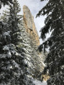
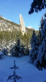
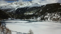
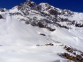
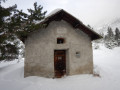
The Sardières Monolith at the start of the Croix d’Aussois trail

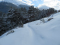
This route, known as ‘La Piste Blanche’, is clearly marked in purple. It is not groomed and more or less follows a summer path, though at times it also runs alongside cross-country ski tracks, which you should follow on the opposite side to the tracks reserved for cross-country skiers. We followed the trail left by previous walkers, which does not necessarily correspond to the summer path!

Details

1752777
Creation:
Last update:
Last review:
  • Snowshoeing
    Activity: Snowshoeing
  • ↔
    Distance: 4.53 mi
  • ◔
    Duration according to the author: 4 hrs 
  • ▲
    Difficulty: Moderate

  • ⚐
    Back to start: Yes
  • ↗
    Ascent: + 732 ft
  • ↘
    Descent: - 751 ft

  • ▲
    Highest point: 5,489 ft
  • ▼
    Lowest point: 4,760 ft

Photos

Description of the walk

Park in the Croix d’Aussois car park (photo).

(S/E) Start by following the cross-country ski trail (walking carefully along the edge so as not to damage it), which is fairly flat at first, then climbs gently after a left-hand bend. At the first hairpin bend on the right, leave the ski trail and take an ungroomed path that climbs into the forest.

(1) Cross a track and continue in the same north-easterly direction. After the highest point, you’ll reach the Carrefour du Milieu.

(2) Head straight on towards “Vallon de la Source and Monolith – 0h15”. The descent is a little steep but not very long and offers a beautiful view of the monolith. After the car park, head slightly uphill to reach the famous rock.

(3) The walk continues by veering to the right (south-east) to descend towards Sardières, sometimes following the ski trail. It may be necessary to take off your snowshoes for the last hundred metres before the county road and the tourist office, as the road may have been completely cleared of snow. Join the D83 and cross it to reach the picnic area.

(4) After your picnic (optional!), cross the D83 again and follow the cross-country ski trail south-west to the footbridge spanning the road.

(5) Turn right, then left, to follow the large ‘pedestrians’ sign whilst walking alongside the cross-country ski trail for 180 metres. Then leave the ski trail to begin a descent through the forest.

(6) Cross the D83 again and continue straight ahead. Underneath the high-voltage power line, take care as the path may be partially covered by snow due to the wind (photo). There is then a climb of around 60 metres to reach the car park where you started (S/E).

Waypoints

  1. S/E : mi 0 - alt. 5,000 ft - Aussois Cross
  2. 1 : mi 0.5 - alt. 5,131 ft - Crossing the track
  3. 2 : mi 1.43 - alt. 5,489 ft - Croisement du Milieu
  4. 3 : mi 1.58 - alt. 5,338 ft - Sardières Monolith
  5. 4 : mi 2.46 - alt. 4,925 ft - Picnic room in Sardières
  6. 5 : mi 2.95 - alt. 4,938 ft - Footbridge: turn right, then left
  7. 6 : mi 3.62 - alt. 4,856 ft - Crossing the D83
  8. S/E : mi 4.53 - alt. 5,000 ft - Aussois Cross

Notes

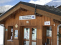
There is a picnic room available at the Tourist Office at the entrance to Sardières (photo).

As this walk follows a route that is largely through woodland, it is advisable to check that there is enough snow for snowshoeing.

Worth a visit

Reviews and comments

4.7 / 5
Based on 2 reviews

Reliability of the description
5 / 5
Ease of following the route
4.5 / 5
Route interest
4.5 / 5
phdorando
phdorando

Overall rating : 4.7 / 5

Date of your route : Dec 27, 2023
Reliability of the description : ★★★★★ Very good
Ease of following the route : ★★★★★ Very good
Route interest : ★★★★☆ Good
Very busy route : Yes

A lovely walk above Aussois. The signposting is perfect and clear. Highly recommended for the whole family.

Machine-translated

ADNET
ADNET

I’m glad you enjoyed this walk. But I suppose you weren’t able to do it on snowshoes at this time of year!

Machine-translated

vtersen
vtersen

Overall rating : 4.7 / 5

Date of your route : Apr 20, 2019
Reliability of the description : ★★★★★ Very good
Ease of following the route : ★★★★☆ Good
Route interest : ★★★★★ Very good

A lovely walk – enjoyable and with some lovely views.

Machine-translated

Other walks in the area

For more walks, use our search engine .

The GPS track and description are the property of this route's author. Please do not copy them without permission.