Les Coches – La Pierra – Les Esserts and back via Praz Salvard

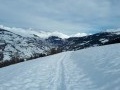
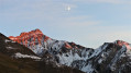
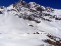
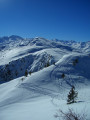
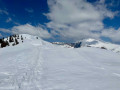
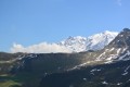
A lovely snowshoe walk through the woods, with beautiful scenery and stunning views of the mountain ranges and Mont Blanc, which can also be done on foot in summer.
No particular difficulty.

Details

958045
Creation:
Last update:
Last review:
  • Snowshoeing
    Activity: Snowshoeing
  • ↔
    Distance: 5.33 mi
  • ◔
    Duration according to the author: 4 hrs 
  • ▲
    Difficulty: Moderate

  • ⚐
    Back to start: Yes
  • ↗
    Ascent: + 1,519 ft
  • ↘
    Descent: - 1,519 ft

  • ▲
    Highest point: 4,911 ft
  • ▼
    Lowest point: 3,780 ft

Photos

Description of the walk

(S/E) Start from the car park at the western exit of Les Coches
Take the road that climbs up to the “Swiss” chalet.

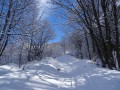
(1) Take the path that climbs alongside the chalet (flag) and winds its way along the meadow and then beneath the fir trees.

(2) At the first junction, keep right and continue straight on along the wide track.

(3) At the next fork, after a descent, turn right towards “Montchavin” and continue downhill.

(4) At the next fork, after crossing a stream, a sign points to “Montchavin” straight ahead and “Montchavin via La Pierra” to the left; take the left-hand route. The path descends steeply, winding down in a series of hairpin bends.

(5) Once at the bottom, turn left towards “la Pierra”.
At “la Pierra”, carry on straight ahead, cross the Ruisseau de Mazuet, and follow the tracks to the left until you reach the road, which you should take as it climbs.

(6) At the hamlet of Les Esserts, carry on a little way along the road (which isn’t cleared of snow in winter and, if you’re doing this walk in summer, is hardly ever used), without taking any of the paths you might come across.

(7) You’ll reach the hamlet of “Champs Drivet” and continue, still climbing, to Praz Salvard.

(8) There, turn left to head back towards Les Coches. Follow the path to Crevaillet, passing the sign for the Leat de Bellentre at the top of a large meadow.

(9) At Crevaillet, cross the road and head downhill opposite through the forest (wooden sign for Les Coches) rather than taking the road; it’s much prettier along these winding paths which lead back to the crossroads from the outward journey.

(2) Turn right onto the same path to return to the Orgère car park. (S/E)

Waypoints

  1. S/E : mi 0 - alt. 4,498 ft - L’Orgère car park, west exit of Coches
  2. 1 : mi 0.22 - alt. 4,596 ft - Swiss chalet
  3. 2 : mi 0.36 - alt. 4,560 ft - 1st junction – turn right
  4. 3 : mi 0.71 - alt. 4,423 ft - 2nd junction – take the sharp right turn
  5. 4 : mi 1.03 - alt. 4,183 ft - Head towards Montchavin via La Pierra
  6. 5 : mi 1.26 - alt. 3,937 ft - At the bottom of the descent, on the left
  7. 6 : mi 2.71 - alt. 4,032 ft - Les Esserts
  8. 7 : mi 3.81 - alt. 4,642 ft - Champs Drivet
  9. 8 : mi 4.25 - alt. 4,865 ft - Praz Salvard
  10. 9 : mi 4.71 - alt. 4,823 ft - Crevaillet
  11. S/E : mi 5.33 - alt. 4,491 ft - L’Orgère car park, west exit of Coches

Notes

A snowshoe hike in winter, which presents no particular difficulty
From Les Esserts, you’ll come across some tiny spring-fed fountains, which are likely to be there in summer too.

Worth a visit

Once you reach Praz Salvard, you can continue straight on towards “Les Thuiles”, a hamlet of three chalets about 15 minutes away.

Reviews and comments

4.4 / 5
Based on 3 reviews

Reliability of the description
4.7 / 5
Ease of following the route
5 / 5
Route interest
3.7 / 5
manissieux
manissieux

Of course, yes. We did it in winter, when the road was closed and it was snowing 🤗

Machine-translated

Xav B
Xav B

Overall rating : 4.3 / 5

Date of your route : Aug 08, 2026
Reliability of the description : ★★★★★ Very good
Ease of following the route : ★★★★★ Very good
Route interest : ★★★☆☆ Average
Very busy route : No

A lovely circular route, but too much walking along the road. We didn’t come across any cars, but the paths are more pleasant.

Machine-translated

manissieux
manissieux

Hello, Oh yes, I can confirm that it’s not recommended on ice.
We went back on 21 February – it had been snowing all night and it was brilliant (even in the snowstorm...)

Machine-translated

muse_88_
muse_88_

Overall rating : 4.3 / 5

Date of your route : Feb 27, 2022
Reliability of the description : ★★★★☆ Good
Ease of following the route : ★★★★★ Very good
Route interest : ★★★★☆ Good
Very busy route : No

Hello,
we tried this walk yesterday. It hasn’t snowed for a week and there’s black ice everywhere – as hard as concrete – which makes it very dangerous. Especially as there are lots of shaded sections. The start of the path is very narrow and icy; it’s dangerous even in snowshoes.
Wait until it’s snowed again before you set off – that’s my advice.
Have a lovely day

Machine-translated

tytytouch
tytytouch

Overall rating : 4.7 / 5

Date of your route : Jan 01, 2019
Reliability of the description : ★★★★★ Very good
Ease of following the route : ★★★★★ Very good
Route interest : ★★★★☆ Good

I went on this hike three days ago – there wasn’t enough snow, but there was quite a lot of black ice, so you’ll need snowshoes or suitable footwear before it snows again! Thanks for this route!

Machine-translated

Other walks in the area

For more walks, use our search engine .

The GPS track and description are the property of this route's author. Please do not copy them without permission.