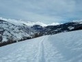
The hamlets of Les Vincendières and Avérole as seen from the hamlet of Le Villaron

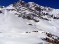
This walk will take you through the hamlets of La Goulaz, Les Vincendières and Avérole in turn, with their traditional stone and timber houses. Set in splendid surroundings, the route runs alongside the Torrent d’Avérole, overlooked by the Pointe de Charbonnel (3,752 m), the highest point in the Haute-Maurienne, from where you can even see the edge of the glacier of the same name. The Charbonnel, whose avalanches were feared by the inhabitants who, at the time, remained in the hamlet of Vincendières even in winter. In 1908, the schoolmistress was even buried in her bed. Fortunately, she was rescued. In Avérole, a short stroll around the ruins and the beautiful church will enhance your walk before you set off again along the same route.

Details

n°71531031
Creation:
Last update:
Last review:
  • Snowshoeing
    Activity: Snowshoeing
  • ↔
    Distance: 7.94 mi
  • ◔
    Duration according to the author: 4 hrs 
  • ▲
    Difficulty: Average

  • ⚐
    Back to start: Yes
  • ↗
    Ascent: + 906 ft
  • ↘
    Descent: - 906 ft

  • ▲
    Highest point: 6,591 ft
  • ▼
    Lowest point: 5,686 ft

Description of the walk

Between Bessans and Bonneval-sur-Arc, on the D902, head for the Villaron car park at the foot of the hamlet of the same name.

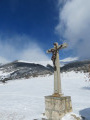
(S/E) From the car park, cross the road and take the path which starts to the left of the Notre-Dame des Grâces Chapel, by the cross.

(1) Follow the groomed track, signposted with mauve snowshoe symbols, towards the nearby hamlet of La Goulaz. 

(2) Leave the Route d’Avérole by turning left to enter the hamlet of La Goulaz. After a few chalets, turn right and leave the hamlet via the Chemin de la Goulaz. The route follows the summer road which runs along the right bank of the Torrent d’Avérole as far as the summer car park, where there is an information board with maps.

(3) From the car park, carry on straight ahead. The path continues to climb to the hamlet of Les Vincendières.

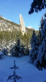
(4) Shortly after the hamlet, at the signpost for “Les Vincendières, alt 1860 m”, ignore the path signposted to the left towards “Hameau d’Avérole 0h35” (unless off-piste conditions allow it, depending on snow cover) and stay on the main path. After the hairpin bend, pass close to the old goods lift, which is still clearly visible with its cables.

(5) The path descends slightly before climbing again in a few bends to reach the entrance to the hamlet of Avérole.

(6) Continue towards the old houses. At the ruins, turn right to enter the heart of this old hamlet until you reach a promontory. Admire the panoramic views both upwards, towards the mountain ranges, and downwards towards the torrent and its small waterfalls.

(7) Turn back and head towards the church (and the picnic table at the back, where a well-deserved break awaits).
Then retrace your steps along the same path in the opposite direction to return to theVillaron car park (S/E).

Waypoints

  1. S/E : mi 0 - alt. 5,686 ft - Villaron car park
  2. 1 : mi 0.07 - alt. 5,689 ft - Notre-Dame des Grâces Chapel
  3. 2 : mi 0.75 - alt. 5,771 ft - The hamlet of La Goulaz
  4. 3 : mi 2.1 - alt. 5,968 ft - Vincendières car park (summer) – information board
  5. 4 : mi 2.35 - alt. 6,056 ft - The hamlet of Les Vincendières
  6. 5 : mi 3.08 - alt. 6,375 ft - Old goods lift
  7. 6 : mi 3.79 - alt. 6,535 ft - The hamlet of Avérole
  8. 7 : mi 3.95 - alt. 6,585 ft - Panorama
  9. S/E : mi 7.94 - alt. 5,686 ft - Villaron car park

Notes

There are no snowshoe walks listed for Bessans on Visorando, hence my suggestion for those searching on this site. On the Bessans website, several marked routes are available.

In summer, it is possible to cross to the other bank to return to the starting point.

Unless there has been recent heavy snowfall, snowshoes aren’t really necessary before (5) as the route is well-trodden. To continue beyond (5), it’s best to put them on to avoid sinking up to your knees.

Picnic table at Avérole church.

Worth a visit

(S/E) Near the car park, you can walk to the small hamlet of Le Villaron, which features the Chapel of Saint-Colomban. 

(1) The Chapel of Notre-Dame des Grâces, where votive offerings and even wedding wreaths have been left.

(4) You can stroll through the narrow streets of the hamlet of Les Vincendières and admire the Chapel of Mary Magdalene.

(7) Panoramic view.

You can continue the climb (1 hour one way) to the Refuge de l’Avérole.

A few kilometres away, via the D902, you can visit the old village of Bonneval-sur-Arc. Food and drink available.

From Bonneval-sur-Arc, you can walk to L’Ecot (in winter, the route is groomed). This is the hamlet where scenes from the modern film *Belle and Sébastien* were filmed. A pretty hamlet made up of old houses.

Reviews and comments

4.5 / 5
Based on 2 reviews

Reliability of the description
4.5 / 5
Ease of following the route
5 / 5
Route interest
4 / 5
Pounet Rando
Pounet Rando

I'm so glad you enjoyed the hike!

Machine-translated

User 11872818

Overall rating : 5 / 5

Date of your route : Dec 21, 2025
Reliability of the description : ★★★★★ Very good
Ease of following the route : ★★★★★ Very good
Route interest : ★★★★★ Very good
Very busy route : No

A pleasant hike. Snowshoes were not essential, as the snow was well compacted throughout the route (21/12/25). Beautiful scenery!

Machine-translated

Pounet Rando
Pounet Rando

Thank you for your interest in this hike. By ‘right bank’, do you mean to the right of the stream as you’re heading uphill? It is indeed a more hazardous area due to scree or avalanches (which is why I didn’t take that route, given the ‘marked’ avalanche risk), but when ascending, the right-hand side of the stream is actually its left bank.

Machine-translated

SAHI33
SAHI33

Overall rating : 4 / 5

Date of your route : Apr 07, 2025
Reliability of the description : ★★★★☆ Good
Ease of following the route : ★★★★★ Very good
Route interest : ★★★☆☆ Average
Very busy route : Yes

The path that climbs along the right bank of the torrent is a little more challenging as it crosses scree slopes from the Charbonnel Glacier, but it is much more interesting, even though it does not lead directly to the village of Avérole – which can be seen in the distance, perched high above the torrent.

Machine-translated

Other walks in the area

For more walks, use our search engine .

The GPS track and description are the property of this route's author. Please do not copy them without permission.