


Pounet Rando

 Visorando Member
 Premium user
 - Gender: man
Sign up:
Published route(s)
 Circular route via Étang de Machais, Rainkopf and Lac de Blanchemer
 8.41 mi
 +2,306 ft
 -2,306 ft
 5h 50
5h 50
 Moderate
 Departure from La Bresse (Vosges)
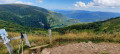
In the La Bresse region, a circular route allowing you to cross the Machais peat bog, then climb three summits, ending at Lac de Blanchemer. Breathtaking views of the Vosges and Alsace.
Loop through the woods and countryside north of Biesme (part of Mettet)
 7.04 mi
+469 ft
-440 ft
3h 40
Moderate
Departure from Mettet (Province de Namur)
7.04 mi
+469 ft
-440 ft
3h 40
Moderate
Departure from Mettet (Province de Namur)
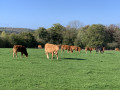
Enjoy this beautiful, peaceful hike with a few hills between countryside, woods and rivers. For those who would like a few extra kilometres, see my other hike in the same area (No. 6600390).
Capo Rosso via the new route with return via the coast
 5.50 mi
+1,952 ft
-1,955 ft
4h 15
Moderate
Departure from Piana (Corse-du-Sud)
5.50 mi
+1,952 ft
-1,955 ft
4h 15
Moderate
Departure from Piana (Corse-du-Sud)
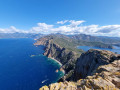
This hike to the Tour de Turghiu (Capo Rosso) offers one of the most beautiful views in Corsica from the summit. For several years now, improvements have been made to the route. A variant has been created to follow the coastline and its coves on the way back. The road you take by car from the village of Piana to the starting point offers a balcony view of the Gulf of Porto, the Calanques de Piana and the Corsican mountains. PLEASE NOTE: according to two comments received on 9 May and 1 June 2025, the "Littoral" section is not accessible. Please follow the directions.
Capu di U Vitullu starting from Piana
 9.06 mi
+3,156 ft
-3,150 ft
6h 55
9.06 mi
+3,156 ft
-3,150 ft
6h 55
 Difficult
Departure from Piana (Corse-du-Sud)
Difficult
Departure from Piana (Corse-du-Sud)
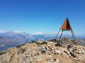
The summit of Vitullu is, wrongly, very little frequented compared to the nearby Capo D'Orto. Interesting if you want to be more alone.Vitullu (1,331 m) is slightly higher and offers a splendid view.At its summit is a pyramid, an IGN landmark.
In the Bois du Grand Fréchy in Biesme
 3.34 mi
+305 ft
-299 ft
1h 50
3.34 mi
+305 ft
-299 ft
1h 50
 Easy
Departure from Mettet (Province de Namur)
Easy
Departure from Mettet (Province de Namur)
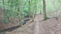
Whatever the season, this route will allow you to discover the splendours of the Bois du Grand Fréchy, all along the Ruisseau de l'Étang du Diable. A truly exotic route despite its short distance. I suggest another route in the same area: "Around the Bois du Grand Fréchy" (17 km). See hunting dates below
Le Hohneck - Sentier des Roches: alternative route with a circular figure-of-eight loop
 7.81 mi
+2,320 ft
-2,333 ft
5h 35
Difficult
Departure from La Bresse (Vosges)
7.81 mi
+2,320 ft
-2,333 ft
5h 35
Difficult
Departure from La Bresse (Vosges)
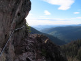
Starting from the summit of Hohneck, the route will take you to the Sentier des Roches, "the" hike to do in the region. Its route through the rocks offers splendid views towards Alsace.Please note! This hike is not accessible in winter (see practical information below)
Between passes and rocks around Lac des Corbeaux
 12.10 mi
+2,835 ft
-2,828 ft
8h 00
Difficult
Departure from La Bresse (Vosges)
12.10 mi
+2,835 ft
-2,828 ft
8h 00
Difficult
Departure from La Bresse (Vosges)
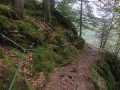
This magnificent circular hike starting from La Bresse will allow you to discover an infinite variety of landscapes: Lac des Corbeaux, Étang de Sèchemer, Col de la Vierge, the Roche du Lac viewpoint (after two mountain huts) to reach Col du Brabant and its ski area, and finally head back to La Bresse via a splendid route through the Planot-Paris Arboretum. Classified as difficult solely due to its length: 22 km.
Around the Bois du Grand Fréchy
 10.99 mi
+873 ft
-876 ft
5h 50
Moderate
Departure from Mettet (Province de Namur)
10.99 mi
+873 ft
-876 ft
5h 50
Moderate
Departure from Mettet (Province de Namur)
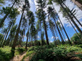
A beautiful hike (just over 3 hours), much appreciated, combining forests, streams, ponds and countryside. You will also be able to admire the castle of Sart-Eustache. There are a few short sections on tarmac, but these are necessary to reach other beautiful sections where the forest dominates. Hunting dates below
From Hohneck to three lakes via Sapin de Kolben
14.29 mi
+3,904 ft
-3,898 ft
8 hrs
 Very difficult
Departure from La Bresse (Vosges)
Very difficult
Departure from La Bresse (Vosges)
On the agenda: a full day of breathtaking views!
Starting from the summit of Hohneck, this hike will take you to a less frequented slope to the east of the Col du Rothenbach. This will lead you to the Sapin de Kolben and the chapel, before discovering the three lakes: Altenweiher, Fischboedle and Schiessrothried. Finally, return to the summit via the Col de Schaeferthal.
This hike is classified as very difficult: see the Practical Information section.
Hohneck - Three Lakes - Frankenthal - Col de Falimont - Le Hohneck
12.56 mi
+3,435 ft
-3,468 ft
8 hrs
Very difficult
Departure from La Bresse (Vosges)
This challenging route takes you through several typical areas, sometimes in the forest, sometimes across rocky terrain and sometimes across moorland. Each difficult section is followed by a section that allows you to recover.
This route is not accessible in winter. The route is closed between (14) and (18) from 1 November to 30 April 2022 (Prefectural Order of 18 May 2022).
 The hamlets of Les Vincendières and Avérole as seen from the hamlet of Le Villaron
7.94 mi
+906 ft
-906 ft
4 hrs
Moderate
Departure from Bessans (Savoie)
This walk will take you through the hamlets of La Goulaz, Les Vincendières and Avérole in turn, with their traditional stone and timber houses. Set in splendid surroundings, the route runs alongside the Torrent d’Avérole, overlooked by the Pointe de Charbonnel (3,752 m), the highest point in the Haute-Maurienne, from where you can even see the edge of the glacier of the same name. The Charbonnel, whose avalanches were feared by the inhabitants who, at the time, remained in the hamlet of Vincendières even in winter. In 1908, the schoolmistress was even buried in her bed. Fortunately, she was rescued. In Avérole, a short stroll around the ruins and the beautiful church will enhance your walk before you set off again along the same route.
Towards the Lower Vallonnet Glacier
6.32 mi
+2,021 ft
-2,011 ft
4 hrs
Moderate
Departure from Bonneval-sur-Arc (Savoie)
One of my most beautiful snowshoe hikes in 20 years! At least, as far as the final destination is concerned. This route takes you into a majestic landscape where the Lower Vallonnet Glacier at an altitude of 2,400 m (with its cave and tunnel) and, higher up, the Upper Glacier and the Albaron massif (alt. 3,637 m), which seems to oversee it all, immerse you in a world where time stands still. But for this glacier, time is sadly running out! This route presents no difficulties, apart from the slope to climb from the Balme ski lift. There are no hazardous slopes. However, you must remain cautious at the entrance to the glacier’s vault, where stalactites or blocks of ice could break loose during a thaw.
A circular route via Bocca di Guagnarola and Bocca di Cuccavera from Le Fer à Cheval
12.98 mi
+4,403 ft
-4,413 ft
9h 50
Very difficult
Departure from Albertacce (Haute-Corse)
A magnificent, physically demanding circular route passing by the Radule sheepfold (with its nearby waterfalls), heading towards the Cittulu Mountain Hut but branching off towards the Bocca di Guagnarola. A long descent to the Puscaghja Mountain Hut. Return via the Bocca Saltu and the Mare à Mare Nord, climbing back up to the Vergio Pass. It is possible to complete the route over two days, staying at the Puscaghja mountain hut.