Circular loop between Névache and Bardonnèche

A circular route along the border starting from the road linking Névache to Bardonnèche.

Details

43638
Creation:
Last update:
Last review:
  • Walking
    Activity: Walking
  • ↔
    Distance: 5.04 mi
  • ◔
    Average duration: 4h 40 
  • ▲
    Difficulty: Moderate

  • ⚐
    Back to start: Yes
  • ↗
    Ascent: + 2,651 ft
  • ↘
    Descent: - 2,631 ft

  • ▲
    Highest point: 7,415 ft
  • ▼
    Lowest point: 5,020 ft

Photos

Description of the walk

Park at the first hairpin bend on the descent towards Bardonecchia.

(S/E) Turn left onto the unmarked path that descends into the forest. Head towards the stream.

(1) Cross it and join a wide track. Follow a steep climb to reach the Chalet de Griau.

(2). Reach a crossroads and take the path on the right (signposted ‘La Sueur’).
The path then climbs steeply through the forest before reaching the mountain pasture. Continue along this path until you cross theGR®5B, marked RB (Red and White).

(3) Turn right onto it. Walk first on level ground, then downhill to a large meadow.

(4) Take a path on the right at the far end of this meadow, which climbs into the larch forest. Climb for about a hundred metres before beginning the descent back to the car park (S/E).

Waypoints

  1. S/E : mi 0 - alt. 5,659 ft - Car park at the hairpin bend
  2. 1 : mi 0.52 - alt. 5,052 ft
  3. 2 : mi 1.45 - alt. 6,050 ft - Griau
  4. 3 : mi 2.57 - alt. 7,287 ft - GR5b
  5. 4 : mi 4.47 - alt. 5,879 ft - Crossroads pre
  6. S/E : mi 5.04 - alt. 5,679 ft - Car park at the hairpin bend

Notes

Water points along the route, notably at the Chalet de Griau.
Shelter in the blockhouses on theGR®5B.

Worth a visit

Névache.
Bardoneccia.
The Vallée Étroite, which is a starting point for the Mont Thabor hike.

Always be cautious and plan ahead when you're outdoors. Visorando and the author of this route cannot be held responsible for any accidents occurring on this route.

The GR® and PR® markings are the intellectual property of the Fédération Française de Randonnée Pédestre.

Reviews and comments

3.9 / 5
Based on 5 reviews

Reliability of the description
3.4 / 5
Ease of following the route
3.8 / 5
Route interest
4.4 / 5
rachel marie
rachel marie

And indeed, at point 2, after the Guiau chalet, the sign for ‘La Sueur’ has changed to ‘Tour jaune de Barrabas’

Machine-translated

rachel marie
rachel marie

Overall rating : 4.3 / 5

Date of your route : Jul 31, 2024
Reliability of the description : ★★★☆☆ Average
Ease of following the route : ★★★★★ Very good
Route interest : ★★★★★ Very good
Very busy route : No

The signposting for the descent has been altered by the Italians since this guidebook was published:
on the steep descent through the woodland, about two-thirds of the way down, a sign for ‘Pian del Colle’ directs you off the GR, sharp right, onto a path that seems barely marked at first but becomes better signposted further on, and which leads straight to the hairpin bend where the car was left! No need to go all the way down to the ‘large meadow’ and then climb back up 100 m!! What a relief!

Machine-translated

ROLAND DE GENNARO
ROLAND DE GENNARO

Overall rating : 3.7 / 5

Date of your route : Jul 29, 2024
Reliability of the description : ★★★☆☆ Average
Ease of following the route : ★★★★☆ Good
Route interest : ★★★★☆ Good
Very busy route : Yes

I didn’t do the walk as described; my aim was to reach the Col de Acles.
Just at point N3, I’d suggest a short circular route to the caves in the Tour Jaune; access is easy.
There’s no historical information about this mountain range (the 1939–45 war, Italian fortifications).
And the beauty of the scenery doesn’t seem to have been mentioned.
A hike worth promoting

Machine-translated

jp11
jp11

Overall rating : 3 / 5

Date of your route : Aug 17, 2023
Reliability of the description : ★★★☆☆ Average
Ease of following the route : ★★☆☆☆ Disappointing
Route interest : ★★★★☆ Good
Very busy route : No

We’re not in the habit of giving out bad marks, but as far as this walk is concerned, there are a few things to be said – though we don’t mean any offence to anyone;
Coming from France (Névache), the most logical and easiest option is to park at the pass, just before the descent towards Italy.
You’ll see the sign for 1779m. 30m further up the GR, turn left towards a small military ruin. The climb is 250 to 300m, followed by 100m on level ground before beginning the descent towards the hairpin bend. The path is immediately on the right (a very stony path).
The tricky bit is crossing the stream.
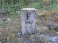
You cross after boundary marker 3, opposite a large erratic boulder (alt. 1572m, as shown on the IGN map – the quickest route)
Alternatively, you can descend to the 1507m contour line, where you’ll immediately find the track. (the longest route).
We cannot understand how the lowest point is 1,525m when the crossing is at 1,587m.
After that, it’s straightforward.
Fortunately, when you finish the hike, drive down to Mélezet, the first Italian village, and treat yourself to an ice cream (or several) and a crema di caffè at the ski lift bars.

Machine-translated

Pat05340
Pat05340

Overall rating : 4 / 5

Date of your route : Aug 22, 2017
Reliability of the description : ★★★★☆ Good
Ease of following the route : ★★★★☆ Good
Route interest : ★★★★☆ Good

We only measured 750m of elevation gain (not 865m). I think that at the bottom of the initial descent, whilst crossing the stream just after the ‘wave-breaking walls’, we must have taken a shortcut.

At point 2, the sign no longer says ‘Col de la Sueur’, but ‘Tour de Barabbas 710A’.

Otherwise, an original and interesting route.

Machine-translated

pasleb
pasleb

Overall rating : 4.3 / 5

Date of your route : Jul 02, 2016
Reliability of the description : ★★★★☆ Good
Ease of following the route : ★★★★☆ Good
Route interest : ★★★★★ Very good

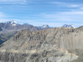
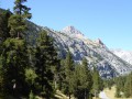
A steep descent at the start and end. Not easy for those who get nervous on descents. We missed the spot where we were supposed to cross the stream, but we managed to get back on track at the bottom of it. The climb is quite steep in places. That said, the scenery is magnificent. A very beautiful walk.

Machine-translated

Other walks in the area

For more walks, use our search engine .

The GPS track and description are the property of this route's author. Please do not copy them without permission.