Country:
 City:
City:


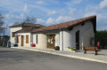
Car park at the community hall, Route de Bourg de Visa.
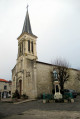
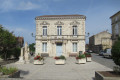
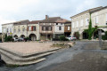
(S/E) From the community hall, head towards the village centre via Avenue Saint-Roch (D122). Enter via the Grand Rue, reach the square, turn right, pass the church entrance, then take the first street on the right, Rue Messager. At the end of the street, take Rue du Picadou, which descends to the left, marked with blue and green cross signs. Follow the stony track downhill until you reach a road.
(1) When you reach the D402, walk 20 metres to the right, then head down the stony path, which becomes grassy on the left. Continue until you rejoin the D402, then turn left until you reach the junction with the D215, which you should take to the right towards Roquecor.
(2) At the Noyers crossroads, turn left onto the road and carry on to the hamlet of Laborie. Pass the road leading to this hamlet on your left.
(3) Immediately after the bridge, take the track to the right between two hedges and follow it all the way to the end.
(4) At the end of the path, at the crossroads, leave the Chemin de Tacoune on your left and continue straight ahead for 100 metres, then turn right onto the path running alongside the hedge until you reach a road, which you should follow to the right. Cross the bridge and you will arrive at the Batanayre mill.
(5) Turn left onto the D215 towards Roquecor for 300 metres.
(6) Turn right onto the path to the left of the ditch running alongside the road towards La Coustelette and follow the steep path up towards the woods, then through the woodland until you reach a road; follow this to the right at a place called Lastuquettes.
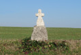
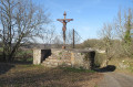
(7) Turn right onto the road towards the church and Marcoux Castle, following it as far as the cross. Ignore the road leading to the church ahead and continue along the path descending to the right of the cross, skirting the Marcoux hillock. Carry on until you reach a road, which you should cross to continue the descent along the path opposite until you reach the D402.
(8) Cross over to the opposite side towards Lamouline. In front of the house at Lamouline, turn onto the path leading uphill to the right. Pass the old house at Lavidalie, then Gueyrau, and continue along the road to Lacalquétie.
(9) At the house in Lacalquétie, shortly after the bend, turn right onto the path running along the edge of the woodland and then into the woodland.
(10) At the sign pointing towards Engayrac, follow this tree-lined path to the left to reach the D122, which you should take to the right to reach the car park at the community hall (S/E).

 Visorando Member

 Moderate