A short circular loop below Notre-Dame du Mai, the Cap Sicié massif near La Seyne

Here is a short, ideal route if you want to stretch your legs but are short on time. It consists of four distinct sections, each with its own character. The setting is the summit area of the Cap Sicié massif, between the Janas Forest and the Mediterranean Sea. A great deal of variety over a short distance, a bit of exercise and, as a bonus, splendid panoramic views.

Details

45716662
Creation:
Last update:
Last review:
  • Walking
    Activity: Walking
  • ↔
    Distance: 2.57 mi
  • ◔
    Average duration: 1h 50 
  • ▲
    Difficulty: Moderate

  • ⚐
    Back to start: Yes
  • ↗
    Ascent: + 791 ft
  • ↘
    Descent: - 801 ft

  • ▲
    Highest point: 1,161 ft
  • ▼
    Lowest point: 427 ft

Photos

Description of the walk

It is possible to reach the starting point from Six-Fours – Le Brusc, heading towards Notre-Dame du Mai, but the route is much safer if you come via La Seyne – Fabrégas.

If possible, park at the western end of the picnic area, near the entrance to the Macchi forest track. Otherwise, there are plenty of spaces available either directly opposite the entrance to the Amphitria sewage treatment works or at the side of the road heading towards La Seyne.

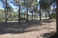
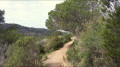
(S/E) With your back to the Macchi track, on the other side of the road, look for the entrance to a dirt track that climbs gently westwards. Stay on this track, which initially climbs gently beneath the pine trees, then crosses a clearing, passing a wayside shrine flanked by a bench on the right. Tackle a steep, much rockier ascent. This track, followed by a footpath, is known as the Chemin des Écoliers. At its highest point, it leads to a ruin with walls covered in multicoloured graffiti.

(1) Cross a track which, on the right, leads to the Notre-Dame du Mai Chapel; head straight ahead and then, immediately to the right (south), take a path that climbs steeply south-east.

(2) Leave the path on your right which heads west along the rocky ridge towards the Notre-Dame du Mai Chapel, and continue initially towards the ruins of military buildings (a semaphore station, barracks and a battery, which you can visit after a few descents and climbs). From the buildings below, a very rugged path allows the most daring (and we mean the very most daring!) to descend to Cap Sicié.

(3) Return to the start of the ridge path.

(2) Set off to the left, across the rocks, towards the Notre-Dame du Mai Chapel. The path isn’t always very well signposted, but you’ll always find your way.

(4) The Notre-Dame du Mai Chapel is an ideal spot to enjoy the scenery and/or have a picnic. Then, walk past the chapel,
- either by following the road,
- or by taking a shortcut on the right, which heads due north down towards the junction between the road and the track.

(5) Turn right onto the track and follow it for about a hundred metres until you reach the start of the downhill path on the left.

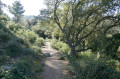
(6) You’ll first come to a descent, and 5 metres further along the track, a second descent. These two paths meet about 50 metres further down. We opted for the second path. The trail begins under the trees as a pleasant dirt track, then becomes rocky as it winds through scrubby heath.
After passing two or three rocky outcrops, the path comes out onto the road.

(7) Cross the road, veering to the left, and find a path leading down to the Belle Pierre trail. You’ll reach this trail at a bend where there’s a bench – a welcome spot for a short break. Take this path eastwards, running parallel to and below the road. Leave the path on your left which continues north along the Belle-Pierre route and carry on straight ahead, parallel to the road. Further on, you’ll reach the car park at the entrance to the Macchi track (S/E).

Waypoints

  1. S/E : mi 0 - alt. 436 ft - Car park at the entrance to the Macchi track
  2. 1 : mi 0.66 - alt. 988 ft - The graffiti-covered hut
  3. 2 : mi 0.76 - alt. 1,047 ft - Junction. Return to the buildings
  4. 3 : mi 0.82 - alt. 1,017 ft - Signal station, barracks and battery
  5. 4 : mi 1.39 - alt. 1,158 ft - Chapelle Notre-Dame du Mai
  6. 5 : mi 1.53 - alt. 1,024 ft - Ascent to
  7. 6 : mi 1.6 - alt. 1,007 ft - Descent route
  8. 7 : mi 2.01 - alt. 568 ft - Belle Pierre Trail
  9. S/E : mi 2.57 - alt. 436 ft - Car park at the entrance to the Macchi track

Notes

Walk completed in February 2024.
It is advisable to wear sturdy footwear for the rocky sections on both the ascent and descent, but particularly for the ridge path, and also to avoid slipping on a few slightly clayey sections of the descent.
Important note: we describe the ridge path after point (2) as we have walked it several times before; however, during our last visit in February, it was closed to the public due to rock stabilisation works on the cliff side, with reopening scheduled for late March.
If this is still the case when you are walking this route, head back down to point (1) and take the track heading west (a very pleasant walk); at the end of this track, at point (5), walk up to the Notre-Dame du Mai Chapel along the tarmac road, and after visiting the chapel, head back down to point (5) and continue on to point (6).

Worth a visit

Each of the four sections has its own charm and character:
- The Sentier des Écoliers starts off under the pine trees, crosses a cool clearing, then climbs steeply whilst remaining well shaded.
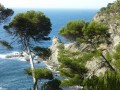
- The ridge path is exposed, challenging and rugged; it requires a strenuous hike, often involving the use of your hands, and offers, for three-quarters of its length, a superb 360° panorama of the Toulon mountains, Toulon and its harbour, the towns of Sanary, Six-Fours, Ollioules, Toulon and La Seyne, Toulon harbour, the coastline and its terrain as far as the Hyères Islands, the Cap Sicié massif and the Janas Forest, Cap Sicié itself, and the Notre-Dame de Mai Chapel in the line of sight. In short, a real feast for the eyes. Alternatively, the track below also offers some very beautiful scenery on the northern side.
- The path leading down after point (6) begins beneath a patch of scrub, then crosses heath and winds its way over a few rocky outcrops, with consistently beautiful views of the Janas massif.
- As for the Belle Pierre Trail, it is a pleasant, largely level forest path, very relaxing, and one that will make you regret having to return to your car so soon.

This walk allows you to see a number of military remains dating from the late 19th century (Peyras Fort, the semaphore station and photo-electric station at Cap Sicié, as well as Six-Fours Fort in the distance), some of which were partially destroyed by the Germans during the Second World War. As I’m by no means an expert on the region’s military history, I’d encourage you to read the fascinating overview written by a seasoned and highly knowledgeable walker (alias randojp, whose website is a treasure trove of discoveries).

From the semaphore station and, in particular, from the Notre-Dame de Mai Chapel, you can catch a glimpse of the rather strange sewage treatment plant – known as Amphitria – which treats the wastewater from the Toulon conurbation. You can visit it during Heritage Days; just the experience of descending through the very long tunnel that leads to it – with a drop of 140 metres over a distance of 1 kilometre – must be worth the trip!

The beautiful Notre-Dame de Mai Chapel (also known as Notre-Dame de Bonne Garde) was built in the early 17th century. The chapel itself is situated in the commune of Six-Fours, whilst the Feu de Garde tower, which stands in its forecourt, is actually in the commune of La Seyne! A local, Jean-Claude Autran (another fountain of local knowledge), will describe it far better than I can on his wonderfully comprehensive website.

And if you’re looking for a more comprehensive walk around the Notre-Dame de Mai Chapel, there’s no shortage of ideas on Visorando, but personally I’d recommend the one by rumax, where you can see and learn a great deal.

Reviews and comments

5 / 5
Based on 1 review

Reliability of the description
5 / 5
Ease of following the route
5 / 5
Route interest
5 / 5
LionelPKX64
LionelPKX64
• Edited:

Overall rating : 5 / 5

Date of your route : Apr 21, 2024
Reliability of the description : ★★★★★ Very good
Ease of following the route : ★★★★★ Very good
Route interest : ★★★★★ Very good
Very busy route : No

Stunning views over Toulon Bay, the Giens Peninsula, Porquerolles, and across to La Ciotat. Magnificent.

Machine-translated

Other walks in the area

For more walks, use our search engine .

The GPS track and description are the property of this route's author. Please do not copy them without permission.