Country:
 City:


Park on the D35 between Gréoux-les-Bains and Les Phélines, at the ‘Les Vignes’ signpost next to a small building opposite the vineyards.
(S/E) Cross the road and set off along the track towards Peicaï. At the first Y-junction, turn right and carry on straight ahead.
(1) At the junction with a track, go straight on towards Les Maurras and carry on through the hamlet.
On leaving the hamlet, at the junction with a track marked ‘Les Maurras’, take the road on the right and head down towards Les Phélines.
At the junction where the road meets two tracks, take the one on the left, which is a short cut to avoid the hairpin bends on the road. Join the road and turn left.
:2:: After the bridge, take the track on the left, then turn right and carry on straight ahead along this ascending track. You’ll reach a T-junction where two tracks meet just before La Bastide Neuve.
(3) Turn left and continue along this track towards La Bastide Neuve, passing some huts, and carry on until you reach the building; turn right, following the orange markings, and walk alongside the vineyard and the tennis court.
(4) At the signpost marked ‘La Bastide Neuve’, take the track on the left towards Gabianne and carry on straight ahead. Pass an old gate. You’ll come out onto a small clearing and stay on a narrow path. Walk past the houses at Les Puits Neufs before joining the road.
(5) Turn left, then take the first track on the right, the Chemin du Puits de Rouvière. Leave the orange signposting behind, walk past some houses and under a porch. Continue straight on. Walk past an old well and emerge onto a road at a Y-junction at the hamlet known as La Jardine.
(6) At a low wall, turn right, follow the white and orange markings on theGR®99and, further on, you’ll reach another road in the Les Rouvières neighbourhood.
(7) Turn left, walk past the church, then head right. Walk past a fountain and, at the next junction, turn right. Walk past a wayside cross and continue along the Chemin de Saint-Joseph. The road turns into a track; pass through the hamlet of La Mantuane, then turn left twice to reach the crossroads where there is a cross, a fountain and a well.
(8) Turn right, staying on theGR®, onto the small path climbing along the edge of the forest. Pay close attention to the signposts so as not to continue along the field. At the Y-junction, continue to the right. Join a track: turn right, then left, and continue straight on to join another track.
(9) Turn left and wind your way through the forest. Exit the forest to reach the road leading to the hamlet of Sainte-Anne.
(10) Leave theGR® and its red and white markings, then turn right and immediately left, following the orange markings. Cross the Beaucas stream and join the D35.
(11) Cross the road and take the path leading uphill opposite. At the junction with a small road, go straight on along a path leading uphill at the corner of a wall, until you reach a cobbled path with steps.
You’ll reach a car park; turn right. Join the D236, turn right and head up towards the village, leaving the signposted route.
Take the second alley on the right and go up the steps. At the top of the steps, turn left then right onto Traverse de l’Église, walk past the church and continue round it on the left. Reach a street and turn left, walk past the observatory (take the time to climb the tower to admire the view) and carry on straight ahead. At the end of the street, turn right and walk under the porch.
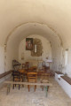
(12) Carry on straight ahead to visit the chapel and the two mills. Retrace your steps and, facing the porch, turn left. Pass between two rocks to join the Chemin de Croix and, at the next hairpin bend, turn left onto the Chemin de la Fontaine. After four hairpin bends, you’ll reach the hamlet of Sous la Fontaine.
Turn left onto the wide track and join the D69 at the hamlet of Frontel.
(13) Turn right and follow the road to the next junction. At the junction, turn left and continue along the small road called Chemin de la Plaine. At the next two junctions, keep going in this main direction. You’ll arrive next to the D35.
(14) Carry on along the Chemin de Tavet, pass the hamlet of Les Cheires and reach the hamlet of Le Pas de Colle.
(15) Before entering the forest, at fire marker 54, take the track leading down to the right through the grass. You’ll reach the hamlet of Clos du Loup. At the end of the track, carry on straight ahead along the road (Chemin de Mounéou). You’ll reach the houses at Les Phélines.
(16) At the right-hand bend, take a grassy track to the left after the wire fence and continue along the edge of a former field. At the end of the field, take a small path. You’ll reach a track in the Vallon du Ragel; turn right onto it, heading north. You’ll soon come to the D35; turn left onto it to reach the car park at the ‘Les Vignes’ signpost (S/E).

 Visorando Member
 Moderate


 Easy
 Association / Club / Walk leader