Country:
 City:
City:


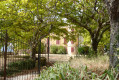
Park at the hiking information board, next to the Verdon, at the entrance to the fitness trail at the end of Rue des Eaux Chaudes.
(S/E) Set off towards the bridge, following the yellow markings. Go under the bridge and continue straight on along the Verdon, past the small dam, then past the two vehicle barriers and in front of the recycling centre. Reach the end of the road at the junction with Chemin l’Auro.
(1) Take this path on the right and carry on straight ahead, passing the municipal technical centre and the “Les Relarguiers” signpost. Join the D952.
(2) Turn right onto the small path running alongside the road. Cross the road at the first junction and turn left at the “Jas du Rocher” signpost. Continue straight on towards Chêne Vert de Rousset.
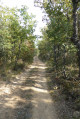
(3) At the end of the street, carry on straight ahead along a track, passing two yellow signposts with hats on top.
(4) At the three-way junction, take the track on the left that goes uphill and carry straight on.
At the top of the climb, you’ll reach the “Parabus” signpost.
(5) Carry on straight ahead along the track towards Les Abbées. Pass under two high-voltage power lines and past the Cavalerie house. Then carry on straight ahead, ignoring the turn-offs to the left. You’ll reach the T-junction at the ‘Les Abbées’ signpost.
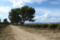
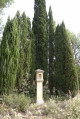
(6) Turn right and carry on straight ahead along this new track, passing under two high-voltage power lines. Walk alongside a wire fence, then a solar panel installation, and pass between the vineyards. Next to a wayside cross, you’ll find the “Chêne Vert de Rousset” signpost.
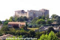
(7) Take the track on the left to catch a glimpse of Rousset Castle, then return to the signpost. Carry on straight ahead towards La Colle de Rousset; the track winds through the vineyards and reaches the end of them.
(8) Here, make a left-right zigzag to follow the track. Continue through the woods, passing once more under a high-voltage power line and past a red boundary marker. You will soon come to another crossroads.
(9) Take the track on the right, then, before a bend, take a small path on the left and head uphill through the woods, passing under a high-voltage power line. At the next junction, turn right and carry on straight ahead.
You’ll reach the signpost marked ‘La Colle de Rousset’.
(10) Turn left towards the Ancienne Drovers' Road of Arles to reach the junction with the RD 82 at the signpost of the same name.
(11) Turn left and follow the road for about a hundred metres. Cross the road to join a track on the right, pass the signpost marked “Les Plaines”, and carry on straight ahead towards La Colle.
You’ll reach the next junction, in front of a farm building, at the “La Colle” signpost.
(12) Take the track on the right towards Gréoux-les-Bains. Carry on straight ahead through the Ravin de la Goutette until you reach the cemetery next to the signpost marked “Chemin de Goutette”.
(13) Carry on straight ahead alongside the cemetery, cross the road and take the first street on the right towards “Château”. At the next junction, by the “Château” signpost, turn right and then immediately left to go round the castle.
Take the first flight of steps on the left, go through the gate and carry on straight ahead to take a narrow, stepped lane
At the end of the alleyway, turn right, walk past a fountain, carry on straight ahead and go down the steps on Rue du Cadran.
At the bottom of the steps, turn left onto Rue Grande, then carry on straight ahead to reach the central roundabout.
(14) Take the second road on the right towards Saint-Julien, then the first street on the left. Walk alongside the Thermes car park and continue straight on along Rue des Eaux Chaudes to return to the starting point (S/E).

 Visorando Member
 Difficult
 Association / Club / Walk leader
 Easy
Easy