Circular walk starting from Gréoux-les-Bains

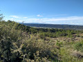
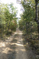
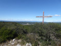
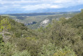
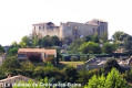
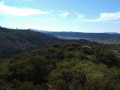
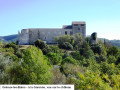
Circular route with some steep sections, thankfully in the shade, offering beautiful views as a reward.

Details

41938251
Creation:
Last update:
Last review:
  • Walking
    Activity: Walking
  • ↔
    Distance: 4.14 mi
  • ◔
    Average duration: 2h 35 
  • ▲
    Difficulty: Moderate

  • ⚐
    Back to start: Yes
  • ↗
    Ascent: + 751 ft
  • ↘
    Descent: - 741 ft

  • ▲
    Highest point: 1,690 ft
  • ▼
    Lowest point: 1,040 ft

Photos

Description of the walk

Easy parking at the side of the road called Chemin Gaspard de Besse, which branches off the D8 and leads to the campsites.

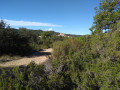
(S/E) Cross the D8 with care and take the track straight ahead until you reach the fork.

(1) Take the first path on the left and continue to the orchard.

(2) Turn right to follow the orchard and reach the path junction.

(3) Turn right onto this path and follow it to the track.

(4) Cross this and rejoin the path opposite. Follow it until it descends onto a track, which you take to the right until you reach a junction.

(5) Turn left. Continue in the same direction, ignoring the first path on the left.

(6) Take the next path on the left as it curves and climb to the highest point until you reach a track.

(7) Follow it to the right until you reach a junction with a wide track at a small, unnamed pass (elevation 471): a alternative route to the left goes round an old quarry.

(8) Turn right onto the wide track and follow it until you reach the original fork.

(1) Continue straight ahead. Cross the D8 with care and return to the car park (S/E).

Waypoints

  1. S/E : mi 0 - alt. 1,040 ft - Gaspard de Besse Path
  2. 1 : mi 0.14 - alt. 1,086 ft - Junction of the circular loop
  3. 2 : mi 0.46 - alt. 1,089 ft - Orchard
  4. 3 : mi 0.57 - alt. 1,099 ft - Path junction
  5. 4 : mi 0.85 - alt. 1,214 ft - Crossing a track suitable for vehicles
  6. 5 : mi 1.4 - alt. 1,417 ft - Junction
  7. 6 : mi 1.74 - alt. 1,430 ft - Bend
  8. 7 : mi 2.05 - alt. 1,686 ft - High point
  9. 8 : mi 2.29 - alt. 1,545 ft - Unnamed pass
  10. S/E : mi 4.14 - alt. 1,040 ft - Gaspard de Besse Path

Notes

There are no signposts.

Reviews and comments

3.9 / 5
Based on 4 reviews

Reliability of the description
4.5 / 5
Ease of following the route
4 / 5
Route interest
3.3 / 5
User 26143574

Overall rating : 4 / 5

Date of your route : Jun 24, 2025
Reliability of the description : ★★★★★ Very good
Ease of following the route : ★★★★☆ Good
Route interest : ★★★☆☆ Average
Very busy route : No

Easy hike with some difficulties

Machine-translated

Nanou31
Nanou31

Overall rating : 4.7 / 5

Date of your route : Jun 04, 2025
Reliability of the description : ★★★★★ Very good
Ease of following the route : ★★★★★ Very good
Route interest : ★★★★☆ Good
Very busy route : No

Climbing at the start but not too difficult

Machine-translated

a.chazal
a.chazal

Overall rating : 3.3 / 5

Date of your route : Feb 05, 2024
Reliability of the description : ★★★★☆ Good
Ease of following the route : ★★★★☆ Good
Route interest : ★★☆☆☆ Disappointing
Very busy route : No

A route through the forest, with no viewpoints; it’s more of a trail run route than a walking route. You may need a GPS to follow the route, as there are numerous paths.

Machine-translated

RANDOKAMM68
RANDOKAMM68

Overall rating : 3.7 / 5

Date of your route : Jan 29, 2024
Reliability of the description : ★★★★☆ Good
Ease of following the route : ★★★☆☆ Average
Route interest : ★★★★☆ Good
Very busy route : No

At point 6, I couldn’t find the path leading to point 7; otherwise, it was a lovely route!

Machine-translated

Other walks in the area

For more walks, use our search engine .

The GPS track and description are the property of this route's author. Please do not copy them without permission.