The Ourminière ravine

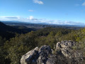
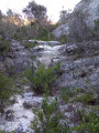
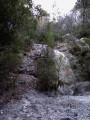
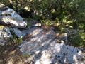
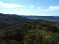
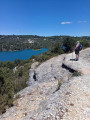
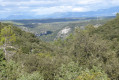
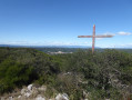
Once you’ve explored all the many signposted trails around Gréoux-les-Bains, set off on an adventure with your GPS. Easily climb two waterfalls – which are dry unless there’s torrential rain – then cross a mossy oak forest and walk through the shade of a pine forest. Finish with magnificent views of Mont Ventoux, La Lure, the Hautes-Alpes and Lake Esparron.

Details

n°19323351
Creation:
Last update:
Last review:
  • Walking
    Activity: Walking
  • ↔
    Distance: 3.76 mi
  • ◔
    Average duration: 2h 30 
  • ▲
    Difficulty: Moderate

  • ⚐
    Back to start: Yes
  • ↗
    Ascent: + 909 ft
  • ↘
    Descent: - 886 ft

  • ▲
    Highest point: 1,939 ft
  • ▼
    Lowest point: 1,079 ft

Photos

Description of the walk

Start from the car park at the Col du Défends, near the water tank by the side of the Lac d’Esparron road.

(S/E) Follow the road eastwards and negotiate the first bend.

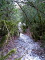
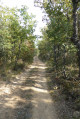
(1) Head down the forest track that starts on the left after ignoring the one leading up to the Notre-Dame des Œufs Chapel. Continue through the lichen-covered oak woodland until you reach a hairpin bend leading down to a stream bed.

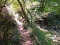
(2) Follow the stream upstream on the right. Climb over thefirst waterfall on the left, then the next one on the right. Follow thefirst tributary as it flows in on the left and, once you reach the path, take it to the right.

(3) It ends on a south-east-facing path that crosses a pine forest. At the crossroads, keep to the right and continue to the road.

(4) Cross the road and set off opposite onto a path that climbs through a clear-cut area, then, at the far end of the clearing, into an oak forest. Join a track that leads onto another, busier track, which you take to the right.

(5) Turn off onto thefirst track on the right, then follow the ridge whilst admiring the views of Mont Ventoux, La Lure and the Alps. Ignore the steep mountain-bike track heading down to the left and continue along the ridge until you reach a clearing, which you cross to join a path leading down to the left. You’ll come to a forest track.

(6) Follow this to the right until you come out onto the road at the Col du Défends. Turn left to return to the car park (S/E).


Waypoints

  1. S/E : mi 0 - alt. 1,549 ft - Car park near the water tank
  2. 1 : mi 0.08 - alt. 1,555 ft - Forest track
  3. 2 : mi 1.15 - alt. 1,096 ft - Torrent
  4. 3 : mi 1.28 - alt. 1,201 ft - Turn right at the fork
  5. 4 : mi 2.28 - alt. 1,617 ft - Crossing the road
  6. 5 : mi 2.97 - alt. 1,939 ft - Path to the right
  7. 6 : mi 3.49 - alt. 1,650 ft - Forest track
  8. S/E : mi 3.77 - alt. 1,562 ft - Car park near the water tank

Reviews and comments

3.4 / 5
Based on 3 reviews

Reliability of the description
3.7 / 5
Ease of following the route
3.7 / 5
Route interest
3 / 5
gougain
gougain

Overall rating : 3.3 / 5

Date of your route : Jun 25, 2024
Reliability of the description : ★★★★☆ Good
Ease of following the route : ★★★★☆ Good
Route interest : ★★☆☆☆ Disappointing
Very busy route : No

Of no interest, unless one wishes to undertake an orientation exercise to discover traces of a logical and obvious route taken by bipeds rather than by animals – a complicated route reserved for specialists…

Machine-translated

gougain
gougain
• Edited:

Not recommended for those who are not confident at reading maps; the route is very erratic. From the 50m-square viewpoint at Lake Esparon, it’s of no interest for a family walk, though an adventurer with a GPS constantly in hand and eyes fixed on it might find it worthwhile…

Machine-translated

Voyageur nature
Voyageur nature
• Edited:

This hike is impossible to do without a GPS. A challenging climb through old waterfalls, with some paths that have all but disappeared, as if nature had reclaimed its territory. Fortunately, there’s a beautiful forest filled with incredibly dense green lichens – a lovely surprise. Not recommended for beginners; it’s difficult overall.

Machine-translated

Guigues
Guigues

Overall rating : 3.7 / 5

Date of your route : Jul 04, 2023
Reliability of the description : ★★★★☆ Good
Ease of following the route : ★★★★☆ Good
Route interest : ★★★☆☆ Average
Very busy route : No

A short, pleasant walk through the boxwood and oak forests. Beautiful panoramic views from the ridge over Lake Esparon, the Lure Mountains and Mont Ventoux.

Machine-translated

Cfrachon
Cfrachon

Overall rating : 3.3 / 5

Date of your route : Jan 06, 2023
Reliability of the description : ★★★☆☆ Average
Ease of following the route : ★★★☆☆ Average
Route interest : ★★★★☆ Good
Very busy route : No

A peaceful and pleasant walk, but a GPS is essential, particularly between points 2 and 3 and then in some places afterwards, as it seems to me that the vegetation has been damaged and the paths are no longer very visible (look out for small piles of stones or arrangements of branches and stones that give some indication of the way, especially after point 4). That said, it’s fun for those who enjoy treasure hunts. Avoid this route on days when big game hunting is taking place, as there are a great many hidden hunting blinds.

Machine-translated

Other walks in the area

For more walks, use our search engine .

The GPS track and description are the property of this route's author. Please do not copy them without permission.