Country:
 City:
City:



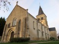
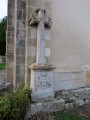
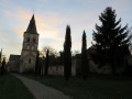
The route starts at Saint-Lactencin Town Hall, where there is plenty of parking. The church is 20 metres away and the FFRP route sign is nearby.
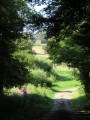
(S/E) Take Rue de la Mairie westwards and continue straight on, following the yellow markings. After the junction with Rue des Haies, take Rue de l’Âne Vert; the road turns into a grassy track.
(1) When you reach the Ferme des Jumeaux, take the grassy path on the left. In the distance, you can make out the Château de Bois Renault on the right.
You will then reach the rear of Château de la Brosse, where you can admire the grounds. Walk along a boundary wall until you reach a stony path near the Maruche farm.
(2) Turn left, continuing to follow the wall; cross an old tree-lined avenue leading to the château, then turn south-east at the corner of the wall. You will then see several farm buildings on your right before reaching the main entrance to the château (private).
Carry on straight ahead along a small road, passing the sheepfolds, until you reach the D64, which you follow to the left.
(3) After 200m, turn right onto a small side road, the D64d.
(4) After 400 metres, follow the yellow signpost, which directs you to head up to the left along a path across the field.
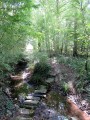
Head back down towards the Ruisseau de la Grosse Planche, which you can cross via a makeshift footbridge made from old concrete posts! Then head back up towards the Mée farm.
(5) Just before you reach it, turn left, staying on a path that winds its way through the vast expanses of farmland.
(6) Carry on straight ahead at the next crossroads and continue eastwards. You’ll reach the Carlauderie farm.
(7) Cross the D76 and carry on straight ahead towards Marécreux. At the large barn at the Basse-Cour farm, carry on straight ahead to reach Château Marécreux, which is actually more of a manor house. Then, continuing north-east, enter the Marécreux woods via a forest track.
(8) At the junction of the tracks, turn left towards the north-west and carry on straight ahead. You’ll reach the edge of the woodland and then come to a track suitable for vehicles as you leave the woods.
(9) Carry on straight ahead along the track which winds its way across the fields and joins the D64.
(10) Take this road on the right.
(11) 200 metres further on, turn left onto a track that runs alongside a woodland and takes you to Châteaufort Farm.
(12) Once past the farm, at the cross, take the grassy path on the left. It leads down towards the cemetery. The path then becomes a small road that takes you back to Saint-Lactencin.
(13) At the crossroads, take Rue du Stade north-west for 10 metres, then turn left onto a small gravel lane which leads to the rear of the church. Walk past the church, then take Rue de la Mairie to return to the car park (S/E).



 Visorando Member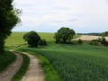


 Easy
Easy