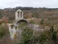
Serre de Mirabel from Citelles

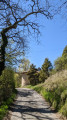
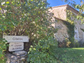
A lovely walk starting from the hamlet of Citelles, where the waterfall flows, and ending at the Serre de Mirabel. There are several viewpoints overlooking the Jabron valley as far as the foothills of the Vercors and the Mont Ventoux. The route is very varied, taking you through woodland, along tracks and paths, amidst forests of beech, oak and pine trees, and through fields of lavender.

Details

21081957
Creation:
Last update:
Last review:
  • Walking
    Activity: Walking
  • ↔
    Distance: 6.56 mi
  • ◔
    Average duration: 3h 45 
  • ▲
    Difficulty: Moderate

  • ⚐
    Back to start: Yes
  • ↗
    Ascent: + 837 ft
  • ↘
    Descent: - 840 ft

  • ▲
    Highest point: 1,486 ft
  • ▼
    Lowest point: 1,037 ft

Photos

Description of the walk

Park in the field on the left, before the ford at the hamlet of Citelles. If parked neatly, there is space for four to five cars.

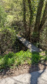
(S/E) Walk to the far end of the field below to cross the river via the small bridge, then head uphill towards the hamlet. After the first house, turn right, zigzag between the houses and leave the hamlet. Ignore the track leading uphill to the left and take the path that enters the woods. As soon as you emerge, you’ll see a field of lavender: follow the path as it bends to the left, head uphill until you reach the first yellow marker, leave the woods and turn left onto a clearing.

(1) At the second yellow marker, turn right onto the track, continue for about 400 metres, then turn left, following the MTB route 10/11 between fields on the left and woodland on the right. Ignore the first path branching off to the right and continue along the Serre de la Fougère track for about a hundred metres.

(2) Enter the pine woodland on the left, following the MTB route 10/11 as it descends. Zigzag between the pine trees, then between the beech trees.

(3) Before the stream, turn right onto the track which climbs and then descends again. Follow the Ruisseau de Lanson on your left.

(4) A track joins from the right: turn left, cross the stream, and carry on straight ahead, ignoring all the paths branching off to the left. Pass the house on your right at Lanson and continue for about 300 m.

(5) Head up the path on the left. At the top, turn right to reach the Serre de Mirabel and enjoy the view.

(6) Retrace your steps, leave the path you came up on to your left and head straight on. Further on, ignore the second path on the left and continue straight on until you reach a junction.

(7) Head down the path slightly to the left towards Serre Pointu. Further on, leave the path branching off to the right and head for a junction marked by a cairn at Masserot.

(8) Take the path on the right which climbs. Turn left onto the ridge, then carry on straight ahead. Emerge from the woodland, reach the track and carry on straight ahead. At the three-way junction, head off to the right.

(9) At the crossroads, carry on straight ahead between the lavender fields; stay on the main track of white pebbles, which veers to the right and then enters the woodland.

(10) Take the track that branches off to the left towards Terre Bodoin. You’ll reach a junction near Citelles.

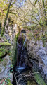
(11) Go straight on towards the bridge surrounded by barriers. You can climb down into the riverbed by descending the steep rocks to see the waterfall: be careful, the riverbed is slippery and there is a significant risk of falling.

Return to the junction, then head up the track on the right, passing between the wooden posts to reach the hamlet. Continue straight on to reach the car park in the field (S/E).

Waypoints

  1. S/E : mi 0 - alt. 1,106 ft - Field
  2. 1 : mi 1.27 - alt. 1,417 ft - Yellow marker, turn right onto the track
  3. 2 : mi 1.71 - alt. 1,430 ft - Turn left at the fork, mountain bike trail 10/11
  4. 3 : mi 2.19 - alt. 1,181 ft - Turn right before the stream
  5. 4 : mi 2.53 - alt. 1,083 ft - Track junction
  6. 5 : mi 3.1 - alt. 1,089 ft - Path on the left
  7. 6 : mi 3.59 - alt. 1,398 ft - Serre Mirabel
  8. 7 : mi 3.92 - alt. 1,447 ft - Crossroads, turn left diagonally
  9. 8 : mi 4.57 - alt. 1,411 ft - Masserot, cairn, on the right
  10. 9 : mi 5.27 - alt. 1,381 ft - Crossroads, go straight on
  11. 10 : mi 5.66 - alt. 1,385 ft - Track on the left
  12. 11 : mi 6.29 - alt. 1,102 ft - Citelles
  13. S/E : mi 6.56 - alt. 1,119 ft - Field

Reviews and comments

4.1 / 5
Based on 4 reviews

Reliability of the description
4 / 5
Ease of following the route
4 / 5
Route interest
4.3 / 5
Francoisroelens
Francoisroelens

Overall rating : 5 / 5

Date of your route : Apr 02, 2024
Reliability of the description : ★★★★★ Very good
Ease of following the route : ★★★★★ Very good
Route interest : ★★★★★ Very good
Very busy route : No

A truly lovely walk, following the entire ridge with our eyes fixed on Mont Ventoux.
We had the sun on our heads and our feet in the water. It was quite a fun experience...
Crossing the fords just before the hamlet of Citelles was impressive; March had been exceptionally wet...
The signposted car park is very small, so we stopped 500 metres earlier to find more spaces. As a result, on the way back after our 12 km walk, we had to walk back up the road. It kept us going for a good afternoon...

Machine-translated

morilles
morilles

Overall rating : 3.7 / 5

Date of your route : May 01, 2023
Reliability of the description : ★★★☆☆ Average
Ease of following the route : ★★★☆☆ Average
Route interest : ★★★★★ Very good
Very busy route : No

It is no longer possible to park in the field. In a sharp right-hand bend, there is space to park four or five cars on the left-hand side.
Between the start and point 1, don’t look for a lavender field – there aren’t any there any more – but this detail isn’t crucial.
It’s worth combining this walk with the Citelles stream route (in the opposite direction). The total distance is 17.1 km with 430 m of elevation gain.

Machine-translated

Frédéric Garlan
Frédéric Garlan

Overall rating : 3.7 / 5

Date of your route : Jun 04, 2022
Reliability of the description : ★★★★☆ Good
Ease of following the route : ★★★★☆ Good
Route interest : ★★★☆☆ Average
Very busy route : No

An easy walk, mostly along wide stony paths. The route runs mainly through woodland. There are few unobstructed views, apart from the stunning panorama over the Valdaine plain from the Serre de Mirabel.

Please note: if you wish to reach the start of the walk from La-Bégude-de-Mazenc, do not under any circumstances follow the route suggested by the app (via Waze). It is only passable by 4x4! You must therefore drive almost as far as Salles-sous-Bois and take the D24 towards Rochefort-en-Valdaine. Carry on to the wind turbines. A small signposted road then branches off to the right, leading to Citelles

Machine-translated

catherine-poullain
catherine-poullain

Overall rating : 4 / 5

Date of your route : May 04, 2022
Reliability of the description : ★★★★☆ Good
Ease of following the route : ★★★★☆ Good
Route interest : ★★★★☆ Good
Very busy route : No

A lovely, shaded, easy walk

Machine-translated

Other walks in the area

For more walks, use our search engine .

The GPS track and description are the property of this route's author. Please do not copy them without permission.