Country:

 City:


Park in the car park at the far end of the village, near the stream, opposite the Mital factory.
(S/E) First, walk alongside the river at the side of the road, heading westwards until you reach a Y-shaped junction.
(1) Turn right and you’ll soon reach another junction, where there’s a sign.
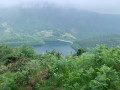
(2) Take the path on the left, following the signs for Goiko Iraga. Then turn right onto the track and follow the stream on your left. Cross the stream (Zalako Erreka) via a tiny bridge, then pass a small dam with a diversion channel. You’ll reach the pretty little lake of Olazaga.
(3) Walk round it on the left, crossing small streams by walking over stones (depending on the water level) and the remains of a bridge. You’ll reach a wider path.
(4) Turn right onto it, heading south-east, and reach a fork in the road at a hairpin bend.
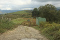
(5) Turn left onto the Okurunbeko Bidea path. You’ll reach a road and then the Otxoaren Borda farm.
(6) Turn left, continue uphill and you will then reach the junction with the NA-4000 road.
(7) Cross the road and continue left onto the Zalaburuko Bidea track. Carry on uphill to reach the Gardelko recreation area (with picnic tables and benches).
(8) Follow the signposted path through a small wood, then turn left to climb the short ridge leading to Agina (618 m).
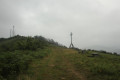
(9) Head down to cross the road, then climb back up to follow the ridge. You’ll reach the site dedicated to Padre Donosti.
(10) Continue due south to climb the small peak of Ikatzuluko Bizkarra (581 m), proceeding at a leisurely pace along the ridge.
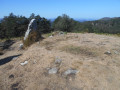
(11) Follow the ridge along its northern slope to a small plateau with the Ikatzulo recreation area, featuring picnic tables and benches, and a fountain.
(12) Turn right to descend to the charming Lake Domiko, the third lake.
(13) Return to the previous junction.
(12) Continue straight ahead along the Mikelgorriko Bidea path, carry on along the road and reach the junction marked by the Goiko Iraga sign, which you passed on the way out.
(2) Turn right and, heading in the opposite direction, follow the route taken on the way there to return to the Lesaka car park (S/E).
 Visorando Member

 Easy
 Association / Club / Walk leader