Country:

 City:
City:


The starting point for the walk is the car park on Bittiria kallea in the town of Lesaka.
To get there, see the ‘Practical information’ section below.
(S/E) Take the exit from the car park leading onto Bittiria Kalea, then turn left onto Aritxulegi Street (or the NA-4000). Carry on straight ahead. Pass Plaza Zaharra whilst continuing to follow the road. You will then reach Arretxea Kalea and cross over the stream.
(1) At the Stop sign, take the road straight ahead which goes uphill, following the sign for “Irain, eskola publikoa”.
A few metres further on, you’ll pass the public school (eskola publikoa) called Irain (you’re now on Irainbide). Once you reach the electricity substation, turn right onto the concrete track. A red and white mark indicates this change of direction, as you’re now on theGR®11-GR®12Lesaka-Buttitza route.
(2) At the junction, take the left-hand path and follow the various directions indicated by ‘LML’ signs: we have observed on the ground that there are numerous paths not shown on the maps.
(3) Carry on straight ahead.
(4) Take the path on the right.
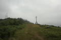
(5) Leave the path briefly and head right towards a bench to enjoy a lovely view. Retrace your steps and rejoin the route to reach the Frain cross. There are also plenty of picnic tables and benches here.
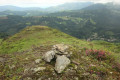
(6) Carry on straight ahead to the summit of Frain (498 m), which is dotted with numerous antennae. There is also an orientation board helping you to identify the various peaks.
(7) Then begin the descent.
(8) As you go, don’t miss the bicycle sculpture on the left. Further down the descent, you’ll reach a junction; turn right until you come to a sharp bend to the left.
(9) Go straight on, facing ahead. At the next junction, near Egimendia, there are several paths: take the one on the left signposted “LML”. At the next junction, take the path on the right signposted “LML”.
(10) Turn onto the small path on the left, then follow the signposted direction “LML”
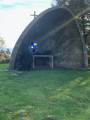
(11) Turn right and head towards the road. On the way, you’ll come across a pillar (which may once have supported a cross) and a boundary stone marked ‘est 9’. Follow the road and you’ll pass an old lime kiln. Continue until you reach the Ermita de Nuestra Señora de la Piedad.
(12) As you go down the steps, cross the road with great care, as visibility is poor. Take the road opposite and continue to the left.
(13) Turn onto the track on the right, this time following the signs marked ‘cycle’.
(14) At the building, keep to the left, following the “cycle” sign. You will then be on a dirt track. At the junction, turn right, continue for a few dozen metres, then take the track on the left marked “cycle”
(15) Leave the track and turn right, following the fence.
(16) At the house, turn left onto a path marked in green and white. Turn right about fifty metres further on, then carry on straight ahead at the next junction, making sure to keep heading in the same direction.
(17) Take care at this change of direction, where you must take the small path on the right. You will then cross the River Larrondoko several times: by fording, over a log, then over a bridge. Follow the river from there; this part of the walk is very pleasant. Further on, join the tarmac road.
(18) Continue in the same direction to return to the car park where you started (S/E).


 Visorando Member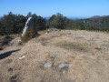

 Easy
Easy 
 Association / Club / Walk leader