Country:

 City:




Start from the car park at the edge of the village, near the stream, opposite the Mital factory.
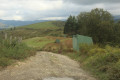
(S/E) First, follow the river alongside the road and head west until you reach a concrete track that starts on the left.
(1) Start this ascent on the left and head for the small ridge of Zima de Apitxea.
(2) Follow it along its northern slope to a small plateau with a recreational area (Ikatzulo, picnic tables and benches, and a fountain)
(3) Take a round trip down to the charming Lake Domiko. Walk along the dam.You can stop for a while to savour the unique atmosphere of this peaceful spot.
(4) Head back up to the crossroads.
(3) Carry on to the left, along the track leading towards Agina.
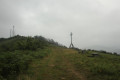
(5) On the way, climb the small peak of Ikatzuluko Bizkarra (581 m), making your way gently along the ridge. Then continue towards the site dedicated to Padre Donosti, marked by a sculpture by Jorge Oteiza, plaques engraved with inscriptions in Basque and a simple chapel. A place steeped in symbolism: it was here that the ashes of the Basque musician Mikel Laboa, composer of the famous song “Hegoak”, were scattered.
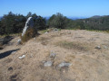
(6) Continue the ascent of Agina, crossing the tarmac road. The path is clearly marked. Reach the summit (618 m). This viewpoint offers a remarkable panorama of Lake San Antón (Embalse de Endara), part of the Basque coast and, in the distance, the Pyrenees mountain range.
(7) Begin the gentle descent for about two hundred metres.
(8) Turn right into a woodland and follow this path, which heads east. Cross the road and pass through the picnic area (Gardelko, with picnic tables and benches).
(9) A short climb leads to the summit of Illasmendi (or Irasmendi, depending on the map, 512 m). Beautiful view over Vera de Bidassoa.
(10) Continue downhill to a junction of paths and roads.
(11) Follow the red and white markings, ignoring the paths to the right or left, to return to the starting point (S/E).
 Visorando Member

 Easy
 Association / Club / Walk leader