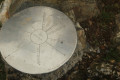
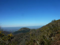
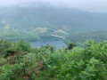
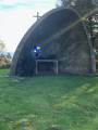
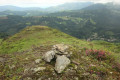
The ridges of the pidgeon hunting huts and the four peaks from Lesaka

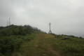
All types of paths: concrete tracks, dirt tracks and paths, and footpaths. There are several peaks to choose from, as well as forests and pastures. There are several 360° views and fountains along the route. You’ll want to choose a fine day to enjoy the views. This hike covers a considerable distance with a significant elevation gain, but the route isn’t complicated. Furthermore, some peaks can be bypassed by walking below them, which shortens the distance and elevation gain slightly. The vast majority of the ridges are dotted with ground-based and tree-based wood pigeon hunting posts. Hiking is prohibited during the wood pigeon hunting season (October). Menhirs and cromlechs can be found on certain peaks and passes.

Details

104493155
Creation:
Last update:
Last review:
  • Walking
    Activity: Walking
  • ↔
    Distance: 11.61 mi
  • ◔
    Average duration: 8h 00 
  • ▲
    Difficulty: Moderate

  • ⚐
    Back to start: Yes
  • ↗
    Ascent: + 3,031 ft
  • ↘
    Descent: - 3,022 ft

  • ▲
    Highest point: 2,539 ft
  • ▼
    Lowest point: 217 ft

Photos

Description of the walk

From the border at Irun, take the N 121 A road towards Pamplona. After about 15 minutes, take the Lesaka exit and head to the car park where the walk starts.

(S) From the car park, walk past the care home and cross the road, then continue following the GPS track until you reach the village boundary.

(1) On leaving the village, continue for about 3 km along the concrete track.

(2) At this junction, which marks the end of the concrete track, continue straight up the dirt track.

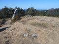
(3) Summit 1: Bidango Gaña, menhirs and cromlech. Retrace your steps for about 300 metres and take the path down to the right (south)

(4) Peak 2 – Almendruitz. This peak can be bypassed by taking the path along its western flank.

(5) Peak 3 – Pagolleta Gaña, menhir/cromlech. This peak can be bypassed by taking the track along its northern flank.

(6) Isaszelaleta Spring. A lovely spring with fresh, drinkable water.

(7) Unanu summit, featuring a cromlech. Stunning panoramic views. For the descent, retrace your steps for about 250m and take the small N-N/E ridge, which is not very pronounced at the start, marked by a yellow trail marker on a stone on the ground. A slightly steep path leads down to a junction with the track; continue along the path. There is a Yellow Circle marker on a tree at the start of the path. This summit can be bypassed by taking the path along its northern flank.

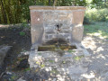
(8) Sastrene Pass and Fountain. On the right, behind an enclosure protecting a large table and benches, there is a wooden post with a tap attached to it. Continue the descent with your GPS to hand so as not to get lost amongst the many tracks you will encounter.

(E) Return to the car park after passing through the most picturesque part of this magnificent village.

Waypoints

  1. S/E : mi 0 - alt. 217 ft - Car park (start and finish)
  2. 1 : mi 0.77 - alt. 266 ft - Exit the village.
  3. 2 : mi 2.8 - alt. 1,243 ft - End of the concrete track
  4. 3 : mi 4.91 - alt. 2,536 ft - Summit 1 – Bidango Ganã, Menhir and Cromlech.
  5. 4 : mi 6.02 - alt. 2,287 ft - Peak 2 – Almendruitz 
  6. 5 : mi 6.94 - alt. 2,218 ft - Peak 3 – Pagolleta Gaña Peak, Menhir/Cromlech
  7. 6 : mi 7.69 - alt. 1,670 ft - Isaszelaleta Fountain 
  8. 7 : mi 8.62 - alt. 2,087 ft - Unanu summit, Cromlech.
  9. 8 : mi 9.24 - alt. 1,440 ft - Sastrene Fountain.
  10. S/E : mi 11.61 - alt. 217 ft - Car park (start and finish)

Notes

Car park, bars, restaurants – everything you need for a great day out.

Hiking is prohibited during the wood pigeon hunting season (October).

Worth a visit

A visit to the village is not to be missed.

Other walks in the area

For more walks, use our search engine .

The GPS track and description are the property of this route's author. Please do not copy them without permission.