Pollarded trees and Puisaye cedars

Another way to explore Colette’s homeland: follow the paths shaped by agriculture, the work of the hedges (landmarkers) and the local heritage.

Details

85320
Creation:
Last update:
Last review:
  • Walking
    Activity: Walking
  • ↔
    Distance: 6.40 mi
  • ◔
    Average duration: 3h 20 
  • ▲
    Difficulty: Moderate

  • ⚐
    Back to start: Yes
  • ↗
    Ascent: + 459 ft
  • ↘
    Descent: - 472 ft

  • ▲
    Highest point: 948 ft
  • ▼
    Lowest point: 722 ft

Photos

Description of the walk

The route starts from the car park near the Colette Museum (also known as the Maison de Santé car park).

(S/E) In front of the Mauris column, head up the street passing between the two sandstone blocks, walk past the Colette Museum (on your left), follow the avenue lined with lime trees and go through the gate. Turn right, passing the Gandrille residence (retirement home). Go down the first street on the right (Rue derrière le Parc), skirting the park to reach Rue des Renards.
Turn right and walk up this street, then head down Rue des Vignes on the left. The church without a bell tower will be on your left; follow it down to the left to reach the road and the level crossing.

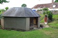
(1) Just after crossing the tracks, you can take a short detour to see the Petit Saint-Jean washhouse with its catchment basin. Then, follow the railway line along the Chemin du Petit Moulin, which is gravelled at the start.

(2) Pass the pumping station, cross the bridge over the Loing and follow this path – dotted in places with iron-rich stones – up to a road. On the left are the old iron-rich sandstone quarries used in the village’s construction.

(3) Cross this road and carry on straight ahead (a few dozen metres) to admire the Croix Saint-Pierre. Retrace your steps and head right for 150 metres. Turn right onto a dirt track. Ignore the next path on the right and continue to an old farm. Carry on to the next road.

(4) Follow it to the right to reach the hamlet of Les Cagnats. Enter the hamlet via the first street on the right to see the old horizontal oven, then take the first left to rejoin the main road.

(5) Turn right and follow this road to reach the village of Moutiers.

(6) On arriving in the village, take Rue de l’Église and continue, turning slightly left onto Rue de la Forge until you reach a ‘Stop’ sign.
Head to the right, cross the bridge over the Loing and join the main road (D85).

(7) Turn right without crossing the road, go past the railway tracks, let the main road continue to the left and, after crossing the D85, take the dirt track on the left which leads up towards the woods.
This track, ignoring the side paths, will take you to a small hamlet of a few houses (Les Michauts).

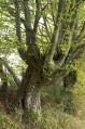
(8) At the junction, carry on straight ahead along the path, which is stony in places, grassy in others, and damp in certain sections, but magnificent for anyone who loves these pollarded trees.

(9) The dream of these strange creatures is over; a tarmacked road lies ahead, leading to a junction.

(10) At the ‘Stop’ sign, turn right, then at the second ‘Stop’ sign, turn right again. Cross at the pedestrian crossing, follow the pavement on the right for a few metres and go down the steps on the left leading to the Gerbaude washhouse.
Walk back up the alleyway and cross Rue de la Gerbaude. Head right towards the town centre. Turn left onto Rue Derrière les Murs and pass under the archway to reach Place du Marché.

(11) Opposite, take Rue de la Roche to return to the car park where you started (S/E).

Waypoints

  1. S/E : mi 0 - alt. 883 ft - Car park below the - Musée Colette
  2. 1 : mi 1.2 - alt. 804 ft - Lavoir de Saint-Jean
  3. 2 : mi 1.37 - alt. 748 ft - Pumping station - Loing (le)
  4. 3 : mi 1.97 - alt. 928 ft - The route joins a road
  5. 4 : mi 2.84 - alt. 886 ft - Cross-country route
  6. 5 : mi 3.19 - alt. 902 ft - Cross-country route
  7. 6 : mi 3.9 - alt. 745 ft - Entrance to the village - Eglise Saint-Pierre de Moutiers-en-Puisaye
  8. 7 : mi 4.38 - alt. 741 ft - The route leads onto the D85
  9. 8 : mi 5.16 - alt. 833 ft - Les Michauts
  10. 9 : mi 5.72 - alt. 823 ft - The route ends on a hard-packed track
  11. 10 : mi 5.94 - alt. 827 ft - Crossroads - Lavoir de la Gerbaude
  12. 11 : mi 6.27 - alt. 879 ft - Place du Marché
  13. S/E : mi 6.4 - alt. 883 ft - Car park at the start - Maison natale de Colette

Notes

On this route, please ignore the signposts; they are reserved for other specific routes described on Visorando.
Good walking boots are recommended in wet weather.

Worth a visit

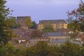
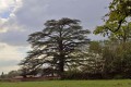
On this route, there are some very fine hedges. There are also some fine specimens of Lebanese cedar (including the one in the cemetery just before reaching the outskirts of Saint-Sauveur); a few metres before the ‘9 ’, from the edge of a field, there is a lovely view of the Colette Museum, the Saracen tower, and the buildings below with their slate roofs – these are the school Colette refers to in her works.
Places to visit in Saint-Sauveur, listed as one of the ‘Cités de caractères Bourgogne – Franche-Comté’ villages:

In Moutiers-en-Puisaye:

Reviews and comments

4.8 / 5
Based on 2 reviews

Reliability of the description
5 / 5
Ease of following the route
Non utilisé
Route interest
4.5 / 5
Tretouy
Tretouy
• Edited:

Overall rating : 5 / 5

Date of your route : Aug 02, 2021
Reliability of the description : ★★★★★ Very good
Ease of following the route : Not used / Not applicable
Route interest : ★★★★★ Very good
Very busy route : No

Route completed on 12 July by a group of 10 walkers aged between 66 and 78. It rained almost continuously for about an hour, then the weather improved enough for us to finish before further showers set in. No difficulties apart from a short wet and muddy stretch at the bottom of the valley. This is perhaps the only section that might be more difficult to navigate in winter. A very pleasant route; the group really enjoyed it.

Machine-translated

pitiflo
pitiflo

Overall rating : 4.5 / 5

Date of your route : Jun 29, 2018
Reliability of the description : ★★★★★ Very good
Ease of following the route : Not used / Not applicable
Route interest : ★★★★☆ Good

Easy-to-follow description,
a lovely, well-shaded walk to enjoy in summer

Machine-translated

Other walks in the area

For more walks, use our search engine .

The GPS track and description are the property of this route's author. Please do not copy them without permission.