Country:
 City:
City:


Red and white signposting
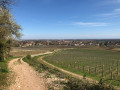
(S) East of Mellecey on the Route de la Vallée (D48), head up a wide stony track through the woodland heading south, then follow the vineyards.
(1) At the fork in the road, head left up a narrower path (signposted ‘La Garenne via GR® 7’). At another fork in the road, continue uphill straight ahead through the woodland. Turn right, then at a junction with a footpath, turn left onto the path. Continue through the woodland, turn right and reach a crossroads at a pass.
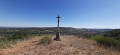
(2) Turn left onto the ridge and pass a cross. Ignore the paths branching off to the right and reach the top of the Chaume de Givry (information sign).
(3) Go through a gate, then head down due south.
(4) At the goat farm, go through a gate, then emerge onto a road in Russilly. At the crossroads, head downhill opposite along the Chemin des Ecoudres, above the hamlet.
(5) At the Croix de Chalut, head down to the left, then at the boundary marker, turn right onto a grassy path. Walk past the Château de Charnailles and come out onto a road.
(6) Turn right onto Rue de Charnailles, then at the Fork in the road, head downhill to the left.
(7) At the Jambles cemetery, turn left, then turn right onto Rue de la Côte Chalonnaise (shelter). At the cross (wash house), turn left, then left again. At the Fork in the road, leave the road and head up to the right along the path at the edge of the woodland. You’ll come out onto another path and turn left.
(8) At the crossroads of paths below Mont Avril, head uphill to the right, enter the forest, then go through a gate. After a bend to the right, pass under a high-voltage power line and head south-west.
(9) Near the summit of Mont Avril, go through a fence on the left and head down through the fields along a path. You’ll come out onto a road; follow it down to the left, pass a wash house, then reach a fountain at Cercot.
No signposting
(10) Turn right and, at the cross, head up to the left along Rue du Mont Cœur. Pass the Manufacture de Tapis de Bourgogne on your left, then the hamlet of Mortières (washhouse), and reach a Fork in the road (access to the restaurant in the hamlet of Le Désert, on the right 150 m away).
(11) Turn left, go under the dual carriageway and immediately climb up to the right along a footpath. You’ll come out onto a road; take it to the left, then walk alongside the grounds of Moroges Castle. First turn right then left, and you’ll come out into vineyards.
White and red markings
(12) Turn right between the vineyards onto Rue des Combennes. At the Fork in the road in Fissey, turn left and, after the square (fountain), turn left again. Pass the town hall and reach a crossroads (calvary).
(13) Turn right onto Route de Sainte-Hélène (D69), then emerge onto an ancient Roman road.
(14) Head uphill opposite along the stony track heading west, then pass under a high-voltage power line. Head south-west. You’ll come out onto a road; head uphill to the left and, 100 metres before Les Montots, you’ll reach a Fork in the road.
(15) Head down to the right along the grassy track. You’ll come out onto a road; head up to the left and you’ll reach a wayside cross and a wash house at Lys.
(16) Head down the road to the right. At the bottom of the valley, cross a bridge over the Guye and reach En Ballat.
(17) Take the stony path on the left, follow the Ruisseau du Moulin de Ronde and, at the Fork in the road, turn left. Follow the Guye, then at the T-junction, continue straight ahead and come out onto a road in Rivon.
No signposts
(18) Head down to the left, pass the farm, cross the Guye again, then head up to the right. Turn left and reach Sassangy (E).
 Visorando Member
 Tourist office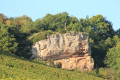
 Easy
Easy