Around Mercurey

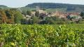
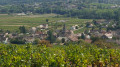
Discover the surroundings of Mercurey, between vineyards and woods with superb autumn landscapes.
20/07/2023 Moderator's message: The route is currently being modified because the passage to (8) in the Bois de l'Hallier is private.

Details

85551
Creation:
Last update:
Last review:
  • Walking
    Activity: Walking
  • ↔
    Distance: 6.48 mi
  • ◔
    Average duration: 3h 50 
  • ▲
    Difficulty: Moderate

  • ⚐
    Back to start: Yes
  • ↗
    Ascent: + 971 ft
  • ↘
    Descent: - 978 ft

  • ▲
    Highest point: 1,201 ft
  • ▼
    Lowest point: 745 ft
  • ⚐ Country: France
  • ⚐ City: Mercurey (71640)
  • ⚑
    Start/End: N 46.829205° / E 4.714718°
  • ❏
    IGN map(s): Ref. 3025SB
  • Hour-by-hour weather

Photos

Description of the walk

When you arrive in Mercurey, head towards Touches and park in the car park opposite the church.

(S/E) Walk past the church and turn right (rue de Caudroyes). Walk down this road to the cross, then turn right (rue de Maillonge). Turn left at the first road that leads to the D978.

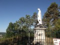
(1) Turn left, then take the first right (Rue des Byots). Follow this road until you reach the cross. At the cross, follow the signs for Vierge, which will take you to the top of the hill via a path through the woods. When you reach the Virgin Mary statue, follow the path. At the next crossroads, join theGR®76.

(2) Take the path on the left without going downhill. On your right, you will see an old mill. At the mill, head towards a white-painted metal post and go down the path to the left of this post. At the bottom of this path, walk along the wall and turn right until you reach the cross (des Montelons).

(3) Keep right on theGR®76(do not take the tarmac road to the right of this path). When you reach the edge of the forest, take the path on the left, then the path immediately opposite, and follow this path which runs alongside the forest.

(4) Enter the forest via this path. Please note: this path is not marked on the map but it does exist. It starts between the forest and the vineyard and then becomes a forest path, connecting to the dotted line on the map.
Follow this path through the forest. On the descent, you will come to a crossroads. Turn left onto the road, then turn right at the second path to reach the Croix de Bosebut crossroads.

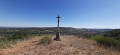
(5) Take the path in front of you with the cross behind you. Follow this path, which is aPR® (Yellow markings are almost non-existent, but you can see small metal plaques indicating an equestrian trail in the forest section). You will arrive at a rock with a gold plaque.

(6) Turn right and then left at the next junction. Follow this path, which descends and is paved in places. You will come to a junction with three large rocks.

(7) Turn right onto the path that goes uphill and you will come to a junction of three paths.

(8) Turn left and enter the woods. When you leave the woods, follow this path to the road. Turn left onto the road and follow it to the D978.

(9) Turn left onto it, then a few metres later turn right onto theGR®. Follow the path, turn left at the first crossroads and follow this path through the woods (when you turn left, there is a hunter's hut on your right). Follow this forest path to the Gravelles cross.

(10) Turn right to reach a metal chain between two rocks.

(11) Turn left and follow this path to the Château de Montaigu. At the château, follow the path through the woods that descends to a track alongside the vineyards (caution: very slippery path). Turn right onto this track, which becomes a tarmac road. Turn left at the first junction and follow this road uphill, which will take you back to the car park opposite Touches Church (S/E).

Waypoints

  1. S/E : mi 0 - alt. 961 ft - Car park opposite - Église Saint-Symphorien de Touches
  2. 1 : mi 0.58 - alt. 748 ft - D978
  3. 2 : mi 1.53 - alt. 1,076 ft - GR76
  4. 3 : mi 1.94 - alt. 1,096 ft - Croix des Montelons
  5. 4 : mi 2.31 - alt. 994 ft - Forest
  6. 5 : mi 3.06 - alt. 1,027 ft - Croix de Bosebut
  7. 6 : mi 3.26 - alt. 1,030 ft - Rock with a gold plaque
  8. 7 : mi 3.64 - alt. 925 ft - Crossroads with 3 large rocks
  9. 8 : mi 3.86 - alt. 1,073 ft - Three-way crossroads
  10. 9 : mi 4.6 - alt. 902 ft - D978
  11. 10 : mi 5.38 - alt. 1,070 ft - Croix des Gravelles
  12. 11 : mi 5.86 - alt. 1,047 ft - Former Château de Mointaigu
  13. S/E : mi 6.48 - alt. 961 ft - Car park opposite - Église Saint-Symphorien de Touches

Notes

(2) After the statue of the Virgin Mary, at the crossroads (marked on the map as elevation 329m and "les champs Martin"), the dotted line to the right ofthe GR®76is in fact theGR®76, marked as such on the ground.
(11) At the old Château de Montaigu, take care as the path through the woods is very slippery in wet weather. It is better to turn back and turn right (at the fork for the Château) and follow the path between the vineyard and the forest.

Worth a visit

Always be cautious and plan ahead when you're outdoors. Visorando and the author of this route cannot be held responsible for any accidents occurring on this route.

The GR® and PR® markings are the intellectual property of the Fédération Française de Randonnée Pédestre.

Reviews and comments

4.3 / 5
Based on 10 reviews

Reliability of the description
4 / 5
Ease of following the route
4.3 / 5
Route interest
4.5 / 5
alain B71
alain B71

Overall rating : 4.7 / 5

Date of your route : May 05, 2021
Reliability of the description : ★★★★★ Very good
Ease of following the route : ★★★★★ Very good
Route interest : ★★★★☆ Good
Very busy route : No

a lovely walk to explore the village

Machine-translated

merlin patrick
merlin patrick

Overall rating : 4.7 / 5

Date of your route : Jul 02, 2020
Reliability of the description : ★★★★☆ Good
Ease of following the route : ★★★★★ Very good
Route interest : ★★★★★ Very good
Very busy route : No

Good description, route best done in spring or autumn.
Hike through the vineyards, introducing us to the different Burgundy wines.

Machine-translated

onclepicsou
onclepicsou

Overall rating : 5 / 5

Date of your route : May 24, 2020
Reliability of the description : ★★★★★ Very good
Ease of following the route : ★★★★★ Very good
Route interest : ★★★★★ Very good
Very busy route : No

A lovely walk in the hills around Mercurey and its vineyards, with the village of Aluze as a focal point for part of the route; with a good map and by following the directions, there should be no issues.

Machine-translated

la commanderie
la commanderie

Overall rating : 4 / 5

Date of your route : May 13, 2019
Reliability of the description : ★★★★☆ Good
Ease of following the route : ★★★★☆ Good
Route interest : ★★★★☆ Good

Just one small criticism about the signage, which is not very visible.

Machine-translated

patronjpr
patronjpr

Overall rating : 2.7 / 5

Date of your route : Apr 08, 2019
Reliability of the description : ★★☆☆☆ Disappointing
Ease of following the route : ★★☆☆☆ Disappointing
Route interest : ★★★★☆ Good

Correct up to the Montelons cross, despite a rather poorly detailed start (you eventually figure it out). From the Croix des Montelons, we made it to the edge of the forest, but after that it was more than uncertain, until we got lost and ended up finding a road that took us back to Mercurey, but the walk was ruined. We'll have to review the route. Apparently, there has been a reorganisation and work at the entrance to the forest, and we don't know which path to take.

Machine-translated

henri57
henri57 ★
• Edited:

Hello,

A very beautiful hike with superb scenery, but the description lacks precision. In particular, before number 1, when you mention: "...when you reach the edge of the forest, take the path on the left...", we turned too early, at the previous intersection, which also runs alongside the forest. Also, after number 5, at the exit of the woods, the directions are rather confusing...

Finding your way in the forest is not easy.

Be sure to follow two rules:

1. Follow the description
2. Compare the description with the Visorando map (IGN 1:25,000).

But only use the map you provide, accompanied by the description.

That's already a very good reflex.

We will definitely do this superb walk again another time, using a phone screen to help us, as it is well worth the detour

You're on the right track.

A third optional rule:

3. If possible, check your position using the VIsorando GPS app or your GPS.

See you soon!

Machine-translated

SOIZICGOU
SOIZICGOU

Overall rating : 3.7 / 5

Date of your route : Sep 03, 2018
Reliability of the description : ★★★☆☆ Average
Ease of following the route : ★★★☆☆ Average
Route interest : ★★★★★ Very good

A very beautiful hike with superb scenery, but the description lacks precision. In particular, before number 1, when you mention: "...when you reach the edge of the forest, take the path on the left...", we turned too early, at the previous intersection, which also runs alongside the forest. Also, after number 5, at the exit of the woods, the directions are rather confusing...
It should be noted, however, that we did not have a phone with GPS to help us, only the map you provided, accompanied by the description.
Nevertheless, we will definitely do this superb walk again another time, with the help of a phone screen, because it is well worth the detour.

Machine-translated

Disney71
Disney71

Overall rating : 4.7 / 5

Date of your route : Aug 25, 2018
Reliability of the description : ★★★★☆ Good
Ease of following the route : ★★★★★ Very good
Route interest : ★★★★★ Very good

I did this hike this morning, which was very pleasant as there was little walking on the road. However, I took a few wrong turns, which meant I had to use the map to find my way back to the route (and ended up walking 13.7 km instead of 10 km).
But overall, there were some lovely views of Mercurey and even the Château de Rully at the start of the route.
I recommend it.

Machine-translated

NATFRE
NATFRE

Overall rating : 5 / 5

Date of your route : Jun 03, 2017
Reliability of the description : ★★★★★ Very good
Ease of following the route : ★★★★★ Very good
Route interest : ★★★★★ Very good

A very beautiful hike.
The little village of Touches is superb and we wanted to come back and explore the area after the St Vincent Tournante festival in January.
At the old Montaigu castle, we couldn't find the path through the woods; the grass must have grown over it.
The best thing to do is to turn back.

Machine-translated

jeannette vallet
jeannette vallet

Overall rating : 4.3 / 5

Date of your route : Sep 07, 2016
Reliability of the description : ★★★★☆ Good
Ease of following the route : ★★★★★ Very good
Route interest : ★★★★☆ Good

Thanks to the author of this hike, it was easy, enjoyable and allowed us to taste a few grapes on this beautiful sunny September day!

Machine-translated

Other walks in the area

For more walks, use our search engine .

The GPS track and description are the property of this route's author. Please do not copy them without permission.