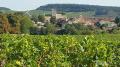
The Vallée des Vaux and its vineyards around Montabon

Saint-Mard-de-Vaux: A picturesque village whose houses are terraced on the eastern slope of the Vallée des Vaux, 9 km from Givry. Saint-Mard-de-Vaux is dominated by Montabon, a hill wooded with chestnut trees, oaks, hornbeams and black locusts (a variety of acacia).

Details

n°7516178
Creation:
Last update:
Last review:
  • Walking
    Activity: Walking
  • ↔
    Distance: 6.47 mi
  • ◔
    Average duration: 3h 45 
  • ▲
    Difficulty: Moderate

  • ⚐
    Back to start: Yes
  • ↗
    Ascent: + 925 ft
  • ↘
    Descent: - 928 ft

  • ▲
    Highest point: 1,575 ft
  • ▼
    Lowest point: 823 ft

Photos

Description of the walk

Start from the crossroads in front of the church.

Yellow signposts

(S/E) From the signpost, go round the church on the left and quickly take the signposted path to the right. Continue straight on until you reach the hamlet. At the fork, turn left then right onto Chemin du Charlet. Walk a few metres.

(1) Turn right opposite the car park, towards ‘Four Bassot’, to reach Rue des Fougères.

(2) Follow the road to the left for 100 m, then turn right at a 90° angle onto the grassy track leading into the woods, Montée de Pommier. Walk along the edge of the woods to reach the hamlet of the same name.
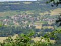
At the top, enjoy the view over Saint-Denis-de-Vaux.
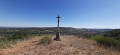
At the wayside cross, turn left, then immediately at the fire hydrant, turn left again (path closed to all vehicles), heading towards ‘Bois de Saint-Martin’. At the three-way junction, turn right and continue until you reach the sign for the ‘Paquier de prés’ washhouse, indicated by a green arrow.

(3) Turn right at the bottom of the valley, then turn left to follow the first valley floor. At the end of this, turn left and continue uphill to the summit.
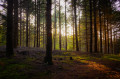
The route follows a forest track for 4.2 km: chestnut trees, oaks, hornbeams, black locusts (acacias) and a few firs.

(4) At the summit, take in the view over the Couchois. Continue to the right, crossing the fir forest and then another deciduous woodland.

(5) Once you reach the road, watch out for traffic. Continue to the right, downhill for 450 m.

(6) At the bend to the right, turn left twice and walk alongside the fields belonging to the Ferme de la Forêt.

(7) About a hundred metres before the farm, turn right towards Blaisy, pass by the small ponds and carry on straight ahead.
Follow the green signposts to join the Charrecey route.
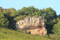
At the end of the forest trail, after the long descent, you’ll come across Blaisy Castle and a view of the Château Beau cliff top above the vineyards (a prehistoric site).

(8) Turn left and follow the road, Rue du Blaisy, for 350 m until you reach the crossroads with the wayside cross and the chestnut tree.

(9) Take the first path on the right; this route is shared with Saint-Martin-sous-Montaigu and then with Saint-Jean-de-Vaux.

(10) First turn left then right to cross the road between Saint-Mard-de-Vaux and Saint-Martin-sous-Montaigu. After 150 m along the road, follow the path to the right. At the wayside cross, continue straight on.
View towards the east over Saint-Jean-de-Vaux and Saint-Denis-de-Vaux in the distance.

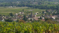
(11) Cross the road (D124) with care. Pass the chicanes opposite, then take the first path on the right. Continue through vineyards and meadows with a beautiful view of Saint-Mard-de-Vaux and, to the west, Barizey and Châtel-Moron.
At the lowest point (250m), turn right and rejoin the route taken on the way out.

(1) Carry on straight ahead to retrace your steps and return to Saint-Mard-de-Vaux (S/E).

Waypoints

  1. S/E : mi 0 - alt. 1,053 ft - Église Saint-Médard (Saint-Mard-de-Vaux)
  2. 1 : mi 0.32 - alt. 886 ft - Junction of the circular loop
  3. 2 : mi 0.65 - alt. 932 ft - Rue des Fougères
  4. 3 : mi 1.26 - alt. 1,076 ft - Paquier Washhouse
  5. 4 : mi 2.03 - alt. 1,558 ft - Summit
  6. 5 : mi 2.64 - alt. 1,394 ft - Head back down to the road
  7. 6 : mi 2.91 - alt. 1,319 ft - Crops grown at the forest farm
  8. 7 : mi 3.21 - alt. 1,368 ft - The Farm
  9. 8 : mi 4.53 - alt. 1,089 ft - Rue du Blaisy
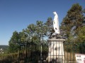
  10. 9 : mi 4.74 - alt. 1,056 ft - Calvary - Château de Blaisy
  11. 10 : mi 4.97 - alt. 1,047 ft - Route Saint-Mard-de-Vaux
  12. 11 : mi 5.45 - alt. 958 ft - Crossing the D124
  13. S/E : mi 6.47 - alt. 1,056 ft - Église Saint-Médard (Saint-Mard-de-Vaux)

Notes

(3) You can visit the wash house, which is about thirty metres away.

Worth a visit

As well as wine-growing, the village has long relied on the forest, which covers two-thirds of the area.

This forestry tradition gave rise to the nickname for its inhabitants, the ‘Loups’ (Wolves). Over the centuries, the parish changed its name several times: Saint-Médard, Saint-Marc, Montabon during the Revolution, and finally Saint-Mard-de-Vaux in the 19th century, with ‘Mard’ being a contraction of ‘Médard’, the 6th-century Bishop of Noyon.

Reviews and comments

4.3 / 5
Based on 2 reviews

Reliability of the description
5 / 5
Ease of following the route
5 / 5
Route interest
3 / 5
Vachon fernand
Vachon fernand

Overall rating : 4.3 / 5

Date of your route : Mar 31, 2026
Reliability of the description : ★★★★★ Very good
Ease of following the route : ★★★★★ Very good
Route interest : ★★★☆☆ Average
Very busy route : No

We did this route after a bit of a dry spell, but some of the paths were still muddy.
However, the starting point needs reviewing, as a car park for walkers has been built just outside St Marc de Vaux, and the route itself needs adjusting too, as on the way back you pass just a few metres from the car park where you started.
I also think it would be worth doing this walk during warmer weather, as there are plenty of forests

Machine-translated

AVF Mellecey
AVF Mellecey

Overall rating : 4.3 / 5

Date of your route : Feb 29, 2024
Reliability of the description : ★★★★★ Very good
Ease of following the route : ★★★★★ Very good
Route interest : ★★★☆☆ Average
Very busy route : No

lots of undergrowth
Best done in dry weather, otherwise watch out for the mud!

Machine-translated

Other walks in the area

For more walks, use our search engine .

The GPS track and description are the property of this route's author. Please do not copy them without permission.