Mercurey's little loop

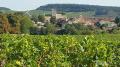
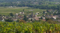
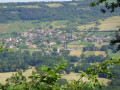
Discover Mercurey's surroundings: the vineyards, of course, but also the different viewpoints over the village and the beautiful 12th-century churches.

Details

870673
Creation:
Last update:
Last review:
  • Walking
    Activity: Walking
  • ↔
    Distance: 4.80 mi
  • ◔
    Average duration: 2h 45 
  • ▲
    Difficulty: Easy

  • ⚐
    Back to start: Yes
  • ↗
    Ascent: + 607 ft
  • ↘
    Descent: - 620 ft

  • ▲
    Highest point: 1,089 ft
  • ▼
    Lowest point: 745 ft
  • ⚐ Country: France
  • ⚐ City: Mercurey (71640)
  • ⚑
    Start/End: N 46.836216° / E 4.717469°
  • ❏
    IGN map(s): Ref. 3025SB
  • Hour-by-hour weather

Photos

Description of the walk

Start: Start at the junction of the D978 and the road to Touches (Bourgneuf).

(S/E) Go up the street towards Touches (GR®76): a good little climb to get there, but if you turn around, the view is worth it. When you reach Touches, take the second street on the right.

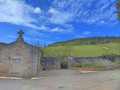
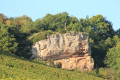
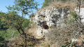
(1) Admire the 12th-century church. Continue straight ahead on Rue du Clos du Roy to the first junction, then turn right at an acute angle onto the road that leads to the winery at "les Bacs" (le Meix Foulot). The tarmac road becomes a grassy path (sentier des Montaigus), which you follow to the junction below what remains of the château (castle) on your left. Turn right and continue along this pleasant path through the undergrowth to the fork.

(2) Keep right, cross the road coming from Touche and continue downhill.

(3) As you go downhill, admire the decorative water reservoir on your right, then continue to enter Bourgneuf. Turn right, then left on the 3rd street to reach the main road (D978).

(4) At the junction with the main road, turn left towards the pond; be careful , there's a lot of traffic. Take the first street on the right to drive alongside the pond (where you could have parked if you hadn't found a space in town). Admire the scenery and the many ducks. Continue to the right, almost all the way around the pond to the houses. On your left, you'll see a rainwater collector and decanting hopper.

(5) Fork right into Rue du Pont Latin and go straight through the village (another 12th-century church). Take the fifth street on the left, just before a fork in the road, and climb towards La Vierge on a path through the vines, concreted over to protect it from erosion. If you stop to catch your breath, look behind you - the view is magnificent. Continue straight ahead.

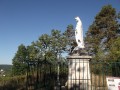
(6) Find a path on the right which continues up through the undergrowth, climbing a small embankment. At a junction on the path, keep to the right and head back downhill towards 'La Vierge' (Virgin Mary statue).

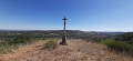
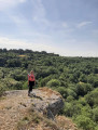
(7) Enjoy the view. be careful if it's humid, the stones are slippery. Continue on to the calvary.

(8) Continue straight ahead to reach Rue de Jamproye (street). Turn right, then left after a few metres into Rue des Byots. When you reach the main street, turn right and go straight ahead to reach the starting point(S/E).

Waypoints

  1. S/E : mi 0 - alt. 778 ft - Intersection D978 - Rue vers Touches
  2. 1 : mi 0.5 - alt. 965 ft - 12th century church
  3. 2 : mi 1.43 - alt. 1,089 ft - Fork, right
  4. 3 : mi 1.74 - alt. 1,060 ft - Water tower
  5. 4 : mi 2.3 - alt. 787 ft - Left on the main street
  6. 5 : mi 2.63 - alt. 810 ft - Fork, right
  7. 6 : mi 3.4 - alt. 1,030 ft - Embankment + path
  8. 7 : mi 3.58 - alt. 1,014 ft - Virgin
  9. 8 : mi 3.9 - alt. 830 ft - Calvary
  10. S/E : mi 4.8 - alt. 778 ft - Intersection D978 - Rue de Touche

Notes

Start: Start at the junction of the D978 and the road to Touches (Bourgneuf).

Parking: Start from the village centre if you can find parking. Parking is also available around the pond. Good shoes necessary, especially for the descent from the Virgin Mary statue. In the second part, you can see where you've been before reaching the pond.

Worth a visit

Don't forget to try the 'jambon persillé' (Burgundy speciality) and fine wines (in moderation!).

Always be cautious and plan ahead when you're outdoors. Visorando and the author of this route cannot be held responsible for any accidents occurring on this route.

The GR® and PR® markings are the intellectual property of the Fédération Française de Randonnée Pédestre.

Reviews and comments

4.4 / 5
Based on 15 reviews

Reliability of the description
4.3 / 5
Ease of following the route
4.5 / 5
Route interest
4.5 / 5
Mumu10
Mumu10

Overall rating : 4.3 / 5

Date of your route : May 02, 2025
Reliability of the description : ★★★★★ Very good
Ease of following the route : ★★★★☆ Good
Route interest : ★★★★☆ Good
Very busy route : No

Lovely, fairly shady walk, apart from the steep climb up to the Virgin Mary.

Machine-translated

emmanuel.pointurier
emmanuel.pointurier

Overall rating : 4 / 5

Date of your route : May 20, 2024
Reliability of the description : ★★★★☆ Good
Ease of following the route : ★★★★☆ Good
Route interest : ★★★★☆ Good
Very busy route : Yes

Very nice walk around mercurey not very hard except the climb to the virgin

Machine-translated

Val7112
Val7112

Overall rating : 4 / 5

Date of your route : May 13, 2024
Reliability of the description : ★★★★☆ Good
Ease of following the route : ★★★★☆ Good
Route interest : ★★★★☆ Good
Very busy route : Yes

Pleasant little walk, lots of paths, few footpaths ... so can be done in all seasons

Machine-translated

cece.b
cece.b

Overall rating : 4.3 / 5

Date of your route : Oct 02, 2023
Reliability of the description : ★★★★☆ Good
Ease of following the route : ★★★★☆ Good
Route interest : ★★★★★ Very good
Very busy route : No

A very pleasant walk, easy to do, with many beautiful views.

Machine-translated

BRELAUD
BRELAUD

Overall rating : 4.7 / 5

Date of your route : Aug 18, 2023
Reliability of the description : ★★★★★ Very good
Ease of following the route : ★★★★☆ Good
Route interest : ★★★★★ Very good
Very busy route : No

Lovely walk through the vineyards. Some passages in the woods. Beautiful 12th-century church. Beautiful views over Mercurey and Touches.
Large parts of the route are unshaded... so best done early in the morning in summer.
It can be difficult to park near the starting point: there are some nice shady spots near the pond (between points 4 and 5 of the route).

Machine-translated

Lechad
Lechad

I couldn't agree more! At marker 8, simply take one of the paths on your right, which will take you back to the church and the car park.

Machine-translated

Alain et Hélène
Alain et Hélène

Overall rating : 4.7 / 5

Date of your route : Oct 11, 2021
Reliability of the description : ★★★★★ Very good
Ease of following the route : ★★★★★ Very good
Route interest : ★★★★☆ Good
Very busy route : No

A pleasant little tour in fine weather.

It's always a pleasure to walk through or along the vineyards.

Perhaps something to see: at the very end of the route, the return to the starting point is on the pavement of the main street. There are lots of cars whizzing past us because the pavement is so narrow. Wouldn't it be possible to do the same end of the route along the bottom of the vineyards? I haven't checked whether it would be possible to cross the small stream again further on (towards the start).

Machine-translated

Elisa!!!
Elisa!!!

Overall rating : 4.7 / 5

Date of your route : Jun 10, 2020
Reliability of the description : ★★★★★ Very good
Ease of following the route : ★★★★★ Very good
Route interest : ★★★★☆ Good
Very busy route : No

A beautiful walk with varied scenery.

Machine-translated

Lechad
Lechad

Overall rating : 4.3 / 5

Date of your route : May 17, 2020
Reliability of the description : ★★★★☆ Good
Ease of following the route : ★★★★★ Very good
Route interest : ★★★★☆ Good
Very busy route : Yes

Knowing the area well, I didn't have to read all the explanations on this route,
This "Petite boucle..." trail is almost the same as the "Autour de Mercurey" trail, only a little shorter.
To leave the cars more easily, I would advise starting the tour at Touches, where there is a large new car park.

Machine-translated

nuitsblanches
nuitsblanches

Overall rating : 5 / 5

Date of your route : May 14, 2020
Reliability of the description : ★★★★★ Very good
Ease of following the route : ★★★★★ Very good
Route interest : ★★★★★ Very good

We had a great time today as a family! The big climbs were a little less popular with the children, but we had a great time!

Machine-translated

Bourgogne
Bourgogne

Overall rating : 5 / 5

Date of your route : Feb 17, 2020
Reliability of the description : ★★★★★ Very good
Ease of following the route : ★★★★★ Very good
Route interest : ★★★★★ Very good

It's perfect for a team of senior hikers...

Machine-translated

ambroise paré
ambroise paré

Overall rating : 4 / 5

Date of your route : Jun 03, 2019
Reliability of the description : ★★★★☆ Good
Ease of following the route : ★★★★☆ Good
Route interest : ★★★★☆ Good

Nice route, nice view in some places, signposting to be seen, otherwise good.

Machine-translated

la commanderie
la commanderie

not used

Machine-translated

Aurélie M.
Aurélie M.

Overall rating : 4.7 / 5

Date of your route : Mar 16, 2019
Reliability of the description : ★★★★☆ Good
Ease of following the route : ★★★★★ Very good
Route interest : ★★★★★ Very good

A great way to discover Mercurey from both sides.
I was even lucky enough to see the Mont Blanc chain at point 7 above Chalon sur Saône.
And I stopped for a long time at the old chateau de Montaigu. You have to go up the path to find the entrance.
The description at the Touches exit wasn't very clear to me.

Machine-translated

renéanita
renéanita

Overall rating : 5 / 5

Date of your route : Sep 10, 2018
Reliability of the description : ★★★★★ Very good
Ease of following the route : ★★★★★ Very good
Route interest : ★★★★★ Very good

Hello;

If you follow the route on the map live, you can't go wrong.
The scenery is magnificent.
But be careful, if it rains, the route is slippery and a bit dangerous (stones, steep gradients, etc.).

And for those with a sweet tooth, the route is strewn with walnuts, walls and, at this time of year, grapes.

All in all, a very nice walk,

Machine-translated

Other walks in the area

For more walks, use our search engine .

The GPS track and description are the property of this route's author. Please do not copy them without permission.