Country:

 City:


From Sisteron, head towards Laragne-Montéglin, pass through Serres via the D1075, then a few kilometres further on, follow the D994, before turning off onto the small D49 local road. Pass through the village of Chabestan, then through Le Saix. Park in the small car park just before the gorge, near a sign stating ‘it is not advisable to continue along this road’.
(S/E) From the car park, take the small tarmac road towards the Défilé du Gouravour. Walk through the gorge, which climbs steeply along a concrete section before becoming a lovely track with a gentler gradient, whilst following the Torrent de Maraize.
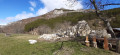
(1) At the second hairpin bend, leave the track and climb up a path on the right, rejoining the track further on. Along the path, you’ll spot wooden figures and animals. Pass in front of the Centre le Faï ( an international, tourist and social centre), then the Trompes du Faï. Continue along the track until you reach the level of the Old Abbey of Clausonne.
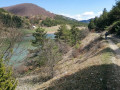
(2) Ignore the path leading down to the right here; carry on straight ahead to the 1133-metre altitude, where you’ll join the GR® 94 and the GRP® “Tour du Buech”. Continue straight on to the 1272-metre altitude atthe foot of the Lac de Peyssier reservoir. Follow the GR® as it runs along the right-hand bank of this magnificent lake to its southern end.
(3) At an altitude of 1284, turn right, still following the GR® through beautiful pastures. Below on the left are the ruins of the “Jas des Aigues”.
(4) At the edge of a mixed coniferous and deciduous woodland, leave the GR® and turn right onto a path that climbs steadily through the woods. The yellow markings have all but disappeared. Keep a close eye on the trail. You are now beginning the ascent of the Montagne d’Aujour.
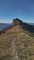
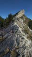
(5) After this steep section through the forest, you’ll reach a more rocky and open stretch. Follow the cairns and some old yellow markings. Keep the summit and a beautiful cliff face in sight. Continue through this maze of rocks until you reach a flatter, grassy section. Directly in front of you is a rock face facing due east. Follow it along to its northern end, where you’ll find the “Faille d’Aujour” on your left. Do feel free to take a round trip there. It is possible to reach the fault via the southern slope. The fault continues as a sort of tunnel on the northern slope. Once you have retraced your steps, follow the rocky ridge, skirting it to the right, heading due north. Take particular care on this slightly overhanging section.
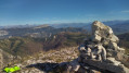
(6) At the end of this rocky ridge, there is a section with a handrail (rope) to help you negotiate this short climbing section. You are now on the northern slope of the Montagne d’Aujour. Continue the ascent, which is quite steep, keeping to the left and following the fault; take care not to get too close, as there is a risk of falling rocks. Continue up the grassy slope to the summit, where there is a small antenna.
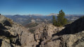
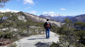
From there, a 360° panorama allows you to take in: the Dévoluy, the Champsaur, the Écrins; to the south, the Ubaye and the Mercantour; and Mont Ventoux.
The traverse across the Montagne d’Aujour follows thewest-facingridge, featuring exposed sections, grassy patches, a maze of rocks, and slabs mainly along the ridge (slippery area). Do not hesitate to use your hands on the few technical climbing sections.
(7) After a lovely descent through dense vegetation, you’ll reach a flat area – a sort of pass – with a grassy section. A few metres before the altitude of 1656, leave the ridge and descend the southern slope, following a well-marked path. Pass a small ledge without difficulty beneath the rocky outcrop to emerge onto a wide track.
(8) Follow it straight ahead to reach the Col de L’Armande at an altitude of 1535 metres. Continue straight on, down the northern slope, along the wide forest track which descends through the Bois de l’Ubac. Follow this until you reach a junction with a path that continues straight ahead, after an altitude of 1252 metres.
(9) Carry on along the track to the left until you reach another junction at a right-hand bend.
(10) Leave the main track and take the path on the left. Pass a path leading down to the right, then a second one on the left.
(11) Cross the valley floor and the Torrent de la Peguiére and carry on straight ahead until you reach another junction with a path at a very tight bend.
(12) At this bend, take the (barely visible) path on the right across the pastures.
(13) Turn right onto a barely visible path that descends through the pastures towards the Old Abbey of Clausonne. Take the time to visit this historic site.
(14) Cross the site and head left onto a path that descends towards the Torrent de Maraize. Cross the river to rejoin the wide track you took on the way there.
(2) Turn left and follow the track back in the opposite direction, passing ‘Le Faï’ and then the Gouravour Gorge to reach the car park (S/E).

 Visorando Member
 Moderate


 Association / Club / Walk leader
 Easy
 Very difficult