La Tête des Quarante

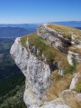
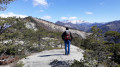
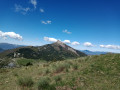
The route alternates between woodland and ridges covered in beautiful wildflowers. Lovely views of the Montagne d’Aujour, the Montagne de Rochefort, Ceüze and Bure, as well as much further afield (Ecrins, Ubaye, Buech). See (a) in the practical information section.

Details

n°2161902
Creation:
Last update:
Last review:
  • Walking
    Activity: Walking
  • ↔
    Distance: 4.53 mi
  • ◔
    Average duration: 3h 35 
  • ▲
    Difficulty: Difficult

  • ⚐
    Back to start: Yes
  • ↗
    Ascent: + 1,736 ft
  • ↘
    Descent: - 1,745 ft

  • ▲
    Highest point: 5,197 ft
  • ▼
    Lowest point: 3,724 ft

Photos

Description of the walk

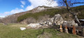
Starting point: The hamlet of Espréaux, between Veynes and Esparron.
Parking is not easy. Park at the side of the road, taking care not to park on private property. Coming from Veynes, just after the hamlet there is a picnic area on the right, then immediately after that, still on the right, a fairly wide field entrance where you can park a car at the edge without damaging the crops.

(S/E) From the main road (D20), head due west up the road leading into the heart of the hamlet. Walk to the fountain.

(1) Turn right for a few metres, then immediately left. Traces of pale yellow markings remain.
First, follow a very wide track. When it ends, head up to the right to reach a crossroads.

(2) Be careful not to be tempted by the path that descends to the left towards a reservoir; the trail continues to the right, with a circular route that starts north-east and then goes west. Carry on without too much difficulty. You’ll reach a point where a number of fallen trees make progress more difficult. You’ll come to another junction of paths.

(3) Leave the pale yellow-marked route here and head south-east. Further on, head up to the right (west) towards the Serre de la Baraffe.
Note: Don’t hesitate to stay right on the edge of the ravine to avoid the trees and vegetation.
Then follow the ridge north-west to reach the Tête des Quarante.

(4) Continue due north, skirting the rocky outcrop of the Grosses Pierres. Keep this outcrop on your right. At the end of it, climb up to rejoin the ridge. Continue along it to the summit of Boutelenq.
Note: In the wooded section, always stay as high up as possible; the route is easier this way.

(5) Head north to reach the summit of Côte Belle (altitude 1,589 m).
Turn 90° to the right to reach the Ourettes stream further down. Stay in the non-wooded area for as long as possible. Ignore thefirst horizontal path you come across. Continue your descent a little further. Atthe second path you cross, follow it to the right. Enter the forest and look for a tree marked with a red dot near the stream.

(6) Walk down alongside the dry stream for about 350 metres, more or less following this red dot marking.
Continue on a gentle descent, leaving the stream behind, and head right into a beautiful beech forest (marked with a red line).
On leaving the forest, you’ll come to a cairn with a large white dot (see photo).

(7) Continue south-west to reach the hamlet of Les Isnards.

(8) To avoid crossing the fields, go past the easternmost house and follow the path leading towards Espréaux. After crossing the small stream, turn left immediately to reach the first crossroads directly.

(1) Turn left onto the wide track that leads back to the hamlet of Espréaux (S/E).

Waypoints

  1. S/E : mi 0 - alt. 3,760 ft - The village of Espréaux
  2. 1 : mi 0.16 - alt. 3,789 ft - Crossroads marking the end of the circular loop
  3. 2 : mi 0.52 - alt. 4,009 ft - Misleading junction
  4. 3 : mi 0.95 - alt. 4,534 ft - End of the PR
  5. 4 : mi 1.62 - alt. 5,059 ft - Tête des Quarante
  6. 5 : mi 2.47 - alt. 5,197 ft - Summit of Boutelenq
  7. 6 : mi 3.03 - alt. 4,551 ft - On reaching the stream, look for the red dot markings
  8. 7 : mi 3.69 - alt. 4,190 ft - Cairn with a white marker
  9. 8 : mi 4.1 - alt. 3,763 ft - Les Isnards
  10. S/E : mi 4.53 - alt. 3,757 ft - The village of Espréaux

Notes

On my way back from the walk, I bump into a local from the hamlet who had wished me a good walk that morning. I tell him where I’ve been and mention that there are fallen trees blocking thePR® path. He replies that the path leading from Espréaux to the Col de Villauret hasn’t been maintained for years, ever since he and his son stopped using it. Yet another path doomed to disappear.

Water source: The fountain in the hamlet of Espréaux.
Picnic tables at the entrance to the hamlet of Espréaux (marked on the TOP 25 map)

(a) This walk requires a good sense of direction and a good command of the necessary tools: map and compass or GPS, as there is virtually no signposting.

Before reaching the (6), there is a slightly steep descent off the path.

Always be cautious and plan ahead when you're outdoors. Visorando and the author of this route cannot be held responsible for any accidents occurring on this route.

The GR® and PR® markings are the intellectual property of the Fédération Française de Randonnée Pédestre.

Reviews and comments

2.6 / 5
Based on 6 reviews

Reliability of the description
2.2 / 5
Ease of following the route
2.5 / 5
Route interest
3.2 / 5
User 28329492
• Edited:

Overall rating : 2 / 5

Date of your route : Oct 25, 2026
Reliability of the description : ★☆☆☆☆ Very disappointing
Ease of following the route : ★☆☆☆☆ Very disappointing
Route interest : ★★★★☆ Good
Very busy route : No

Went for a walk this afternoon – it was a right nightmare: no signposts and trees lying across the path.
It’s a real shame because it’s a lovely walk.
But without the IGN trail map, it’s impossible to follow.

Machine-translated

User 11570293

Overall rating : 1.3 / 5

Date of your route : Dec 29, 2025
Reliability of the description : ★★☆☆☆ Disappointing
Ease of following the route : ★☆☆☆☆ Very disappointing
Route interest : ★☆☆☆☆ Very disappointing
Very busy route : No

The hike started off well, but once we entered the forest of badly damaged trees, there were no paths left. It was impossible to continue; we were getting branches in our eyes and scratching ourselves... Great! So we turned back!

Machine-translated

Chemins de Monteglin

Overall rating : 4 / 5

Date of your route : Mar 26, 2024
Reliability of the description : ★★★☆☆ Average
Ease of following the route : ★★★★☆ Good
Route interest : ★★★★★ Very good
Very busy route : No

The elevation gain is incorrect. It is not 508 m but 640 m.

Machine-translated

Victoria B
Victoria B

Hello,

Thank you for your feedback and these details. It is indeed clearly stated in the description that the path isn’t very accessible (my mistake – we hadn’t read it before setting off on the walk). And it’s a real shame that this path, particularly the downhill section, isn’t maintained, as this walk has real potential!

Machine-translated

mapigap
mapigap
• Edited:

Hello
I completely agree with you regarding the issue with the estimated time. Unfortunately, I’m not in a position to correct it. It’s the software that calculates this based on the elevation gain and distance. As for the rest, you’re simply confirming what’s stated at the end of the description (practical information). So the situation hasn’t improved, which is a shame. So it’s still a ‘wild boar’ hike!

Machine-translated

Victoria B
Victoria B
• Edited:

Overall rating : 3 / 5

Date of your route : Nov 14, 2021
Reliability of the description : ★★☆☆☆ Disappointing
Ease of following the route : ★★★★☆ Good
Route interest : ★★★☆☆ Average
Very busy route : No

Unfortunately, there are a lot of problems with this walk.
In fact, the route follows unmarked paths that are barely visible and, for the section between stages 5–6 and 7–8, don’t even exist! You therefore absolutely must have the app and be using geolocation to find the route; otherwise, it’s almost impossible!
What’s more, the descent towards the end is very steep and very long. It’s either over a carpet of slippery dead leaves (especially in autumn) or through thickets of shrubs and young trees. So make sure you wear protective clothing to avoid getting scratched!
Finally, the walking time is underestimated! It took us 4 hours 30 minutes, even though we hardly stopped and walked at a brisk pace. The walk remains very interesting up to stage 5 at the summit of Côté Belle, but as for the rest of the route, I agree with a previous comment: it’s best to turn back if you’re worried about steep descents or if you don’t have mobile coverage to track your location!

Machine-translated

DanielANDRE
DanielANDRE
• Edited:

Overall rating : 4 / 5

Date of your route : Jan 09, 2020
Reliability of the description : ★★★☆☆ Average
Ease of following the route : ★★★★☆ Good
Route interest : ★★★★★ Very good

Very few paths, and they haven’t been maintained for a long time
Mostly off-trail and not always easy, with vegetation (broom, etc.) and a bit of snow.
The descent after Grosses Pierres isn’t very easy, nor is the one from Côte Belle down to the stream; you need to be very careful to find the path that cuts across (barely marked).
It took us 5 hours with a group.
Magnificent scenery

Machine-translated

JPC07
JPC07
• Edited:

Overall rating : 1.3 / 5

Date of your route : Jul 15, 2019
Reliability of the description : ★★☆☆☆ Disappointing
Ease of following the route : ★☆☆☆☆ Very disappointing
Route interest : ★☆☆☆☆ Very disappointing

Avoid at all costs: all the paths are blocked by vegetation. A dizzying descent after point 4, followed by a “real slog” right through to the finish. Thank goodness the mobile signal came back after point 4, as we would have been completely unable to find our way back to the starting point. What’s more, there’s a lot of undergrowth, which is of no interest whatsoever. At a pinch, you could do a round trip up to the ridge, which is worth a look. Allow at least six hours, including a snack break – that is, if you don’t get lost, which remains a more than likely scenario.

Machine-translated

Other walks in the area

For more walks, use our search engine .

The GPS track and description are the property of this route's author. Please do not copy them without permission.