Traverse from Grand Parra to the Pointe des Arlicots

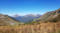
A magnificent traverse along a narrow ridge linking two peaks in the Bauges range, both over 2,000 m high.

Details

23155401
Creation:
Last update:
Last review:
  • Walking
    Activity: Walking
  • ↔
    Distance: 9.79 mi
  • ◔
    Duration according to the author: 7 hrs 
  • ▲
    Difficulty: Extremely difficult

  • ⚐
    Back to start: Yes
  • ↗
    Ascent: + 4,022 ft
  • ↘
    Descent: - 4,003 ft

  • ▲
    Highest point: 6,752 ft
  • ▼
    Lowest point: 3,196 ft

Photos

Description of the walk

Access is from the lower or upper car park at Les Aroles (1,000 m) in École. From Saint-Pierre d’Albigny, head up to the Col du Frêne, towards Le Châtelard. In École, turn right in the village centre – a chamois will watch you go by – and turn right again 200 m further on. Head up the tarmac road, which turns into a dusty track a little further up.

(S/E) From the car park, take the wide, gently sloping track marked as part of theGRP® access route towards the Chalets du Praz.

(1) Look out for the return path on the left and continue straight on along the track until you reach the junction just past the Chalets du Praz.

(2) Turn left towards the Chalets du Lauzarin and, after 150 m, turn right onto the grassy track leading to a chalet and skirting a woodland.

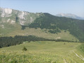
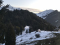
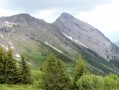
(3) At the entrance to the chalet, leave the track by turning left. From there, there is no longer a path or trail, and several routes are possible depending on how you interpret the terrain. As for me, I aimed for a gap between the fir trees (see photo) at the foot of the north-west ridge of the Grand Parra, through grass already knee-high, then climbed straight up the slope before traversing (photo) and following a couloir to its summit. The slope is very steep and there’s nothing to stop you if you fall, but provided it’s not wet, your boots grip very well.

(4) At the top of the couloir, continue straight up the slope, keeping to the left alongside the pines and dwarf pines, as this is safer than the grassy slope to the right.

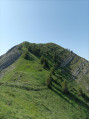
(5) At 1,900 m, start traversing towards a fir tree (photo) on the right and head for the pass between the Grand Parra and the Cha. Continue to the right to reach the summit.

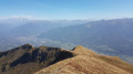
(6) Take in the view from the ridge running from the Grand Parra to the Pointe des Arces via the Arlicots, then descend back to the pass to climb the Grand Parra.

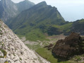
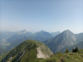
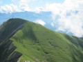
(7) From the summit, there is a magnificent view of all the peaks of the Bauges, but it is too misty elsewhere, and the perilous traverse begins here. The descent from the summit is very steep. There are several rocky outcrops that are somewhat difficult to negotiate either along the ridge line or on the eastern side of the ridge. Take care on the descents as there is a sheer drop on both sides.

(8) At this point, you can look down on the rocky faults above Fréterive, which are clearly visible from the valley: this marks the end of the difficult sections and the rocky terrain; the climb to the Pointe des Arlicots is along a slightly steep but safe grassy slope.

(9) From the summit, take the northern ridge of the Montagne de la Lanche, where a few chamois were crossing the valley, disturbed by a climber on the eastern ridge. At 1,950 m, the path turns left towards the west onto the Beau Mollard ridge, heading towards the water reservoirs.

(10) Pass between the first two reservoirs and head down the slope until you reach an old track; from there, cross to the left to position yourself directly below the Chalets du Lauzarin, which you reach via a steep slope.

(11) Pass between the two chalets, making sure to close the gates properly, and follow a well-shaded track back to the ascent route.

(1) Head back down the track to the right and return to the car park (S/E).

Waypoints

  1. S/E : mi 0 - alt. 3,199 ft - Les Aroles car park
  2. 1 : mi 2.77 - alt. 4,311 ft - Junction of the circular loop
  3. 2 : mi 3.4 - alt. 4,728 ft - Junction
  4. 3 : mi 3.59 - alt. 4,764 ft - Entrance to the chalet – Start of the off-trail section
  5. 4 : mi 4.02 - alt. 5,909 ft - Top of the couloir
  6. 5 : mi 4.12 - alt. 6,263 ft - Traverse towards the pine tree
  7. 6 : mi 4.31 - alt. 6,473 ft - La Cha
  8. 7 : mi 4.57 - alt. 6,516 ft - Le Grand Parra
  9. 8 : mi 4.96 - alt. 6,627 ft - Fault
  10. 9 : mi 5.05 - alt. 6,713 ft - Pointe des Arlicots
  11. 10 : mi 5.9 - alt. 5,200 ft - Leave the track, turning left
  12. 11 : mi 6.32 - alt. 4,695 ft - Le Lauzarin
  13. S/E : mi 9.79 - alt. 3,196 ft - Les Aroles car park

Notes

There is little water along the route; an ice axe can provide significant reassurance on steep, wet slopes, and a rope may also be useful on the ridge for those less comfortable with exposed sections. Please note that the route can start from the convent car park, but this adds 100 to 150 metres of elevation gain.

This route passes through a protected area, which may be subject to special regulations:

Reviews and comments

4.8 / 5
Based on 2 reviews

Reliability of the description
5 / 5
Ease of following the route
4.5 / 5
Route interest
5 / 5
VCANET
VCANET

Overall rating : 4.7 / 5

Date of your route : Jun 10, 2025
Reliability of the description : ★★★★★ Very good
Ease of following the route : ★★★★☆ Good
Route interest : ★★★★★ Very good
Very busy route : No

A very beautiful hike with some real challenges.
The description clearly indicates the steepness of the grassy slope at points "3" to "5" and mentions the use of an ice axe. (I would not want to descend this grassy slope at all).
After this experience, I think that, provided everything goes well, an ice axe is an optional extra, making the climb easier. However, it is best to consider it essential in case of a fall in the grass. It would then prevent you from sliding, as it would on a snowfield. (This would be impossible with walking poles).
If I were to return to this terrain, I would insist that everyone have an ice axe.
The traverse of the ridge between points "7" and "9" seemed less risky to us than the climb up this grassy slope.

Machine-translated

meskiangasher
meskiangasher
• Edited:

Overall rating : 5 / 5

Date of your route : Jun 12, 2025
Reliability of the description : ★★★★★ Very good
Ease of following the route : ★★★★★ Very good
Route interest : ★★★★★ Very good
Very busy route : No

Did it alone on a beautiful day in 6.5 hours, after several days of dry weather.
The climb up through the grassy scree is very steep and should only be attempted in dry weather. I hesitated between going up and down through the grass and returning via the ridge, but the steepness of the slopes convinced me to return via the ridge!
The ridge isn't that exposed, but it's still very challenging in places, and the rock isn't very good, so you have to check every handhold and foothold. A hold broke off under my hand, about ten kilos of rock! However, it was better than on the ridge between the Pointe des Arces and the Pointe des Arlicots, at least there are holds.
The view is superb, a very beautiful outing. Less exposed and difficult than the ridges of the Néron, but with poor rock. A good T5!

Machine-translated

Other walks in the area

For more walks, use our search engine .

The GPS track and description are the property of this route's author. Please do not copy them without permission.