Tour of Arclusaz

The currently signposted routes mean you have to choose between the Col and the Dent d’Arclusaz, each of which is accessible via a different side. This hike avoids this dilemma by offering a circular route that takes in both summits.

See the ‘Practical Information’ section for details on the difficulty levels.

Details

3296699
Creation:
Last update:
Last review:
  • Walking
    Activity: Walking
  • ↔
    Distance: 11.11 mi
  • ◔
    Duration according to the author: 8 hrs 
  • ▲
    Difficulty: Very difficult

  • ⚐
    Back to start: Yes
  • ↗
    Ascent: + 3,911 ft
  • ↘
    Descent: - 3,914 ft

  • ▲
    Highest point: 6,673 ft
  • ▼
    Lowest point: 3,071 ft

Photos

Description of the walk

From the village of École, take the small road leading up to the Col de l’Arclusaz and park when it becomes a track closed to motorised vehicles. There is a car park at this point (altitude 1,000 m, coordinates 45.63936, 6.177138).

(S/E) From the car park, take the track on the left (there is another track, currently not shown on IGN or OpenStreetMap maps, which branches off to the right). Stay on this track (signposted towards the Col d’Arclusaz) until you reach the Chalet des Arbets below the pass.

(1) At the chalet, the track becomes a footpath. Continue straight on along this footpath to the junction for the Col d’Arclusaz.

(2) Turn left towards the Col d’Arclusaz.

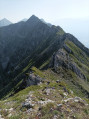
(3) At the pass, you can see the route to follow to the Dent d’Arclusaz. This is a path that is only visible in places: you can see a north-west-facing section at the bottom of the slope, which climbs gently through the meadow; then another west-facing section that climbs straight up the slope to the base of the rocky section; finally, a last section facing north-west which climbs above a rocky outcrop halfway up the slope. The end of the path is not visible from the pass.

Descend from the pass by following the signposted path. Just after a bend to the right, as you emerge from a rockier section, leave this path to join the one leading up to the Dent d’Arclusaz.

(2) The start of the Dent d’Arclusaz path is not clearly marked; you’ll need to cut across the meadow to reach a more visible section (which is why it’s worth having spotted it from the pass). The path passes beneath a copse on the left, then above another on the right. It fades in places, but simply continue up the grassy slope heading north-west until you come to a steep track climbing due west.

(4) Follow this track straight up the slope. When you reach the bottom of the rocky section, the path veers north-west again and passes over a rocky outcrop. From there, the path remains fairly clearly visible. Follow it to the Dent d’Arclusaz.

(5) At the Dent d’Arclusaz, follow a path heading north beneath the ridge. A few cables have been installed to aid passage through the rocky sections, but it is often easier to keep closer to the ridge, slightly above the cables.

(6) At the Col de Cochette, a passage allows you to cross over to the western slope (you’ll need to use your hands for the first few metres). A signposted path then takes you back down to Pierre Besse.

(7) Then on to the Col du Potat.

(8) At the Col du Potat, leave the signposted path and head towards the barn visible 100 metres away. Turn right just before the barn, onto a track that descends through the meadow and then into the forest.

(9) After a wide circular track, you’ll reach a junction: turn right onto a track that remains almost flat along the mountainside. Continue straight on until you reach a meadow with two barns.

(10) Take the track that runs between the two barns. It turns right immediately afterwards, climbing up into a meadow above the first barn. At the edge of the meadow, the track turns left (north-east), but it becomes hard to follow. Cross the meadow, keeping to the same level, alongside a row of trees.

(11) When you reach the edge of the forest, a small gate allows you to leave the meadow and rejoin a more visible path. This path heads left, crosses a ravine and then climbs to the right to join a forest track (do not take the branch that descends to the left towards Gratteloup).

(12) Follow the track straight on, along the mountainside, until you reach a road.

(13) This is the road leading to the starting car park. Turn right onto it and you’ll reach the car park (S/E) after two hairpin bends.


Waypoints

  1. S/E : mi 0 - alt. 3,261 ft - Car park
  2. 1 : mi 4.15 - alt. 5,036 ft - Chalet des Arbets
  3. 2 : mi 4.77 - alt. 5,640 ft - Junction for a return trip to the pass
  4. 3 : mi 4.94 - alt. 5,807 ft - Col d'Arclusaz
  5. 4 : mi 5.3 - alt. 5,738 ft - Ascent
  6. 5 : mi 5.61 - alt. 6,670 ft - Due north beneath the ridge - Dent d'Arclusaz
  7. 6 : mi 5.77 - alt. 6,398 ft - Cross over to the western slope - Col de Cochette
  8. 7 : mi 6.12 - alt. 5,768 ft - Pierre Besse
  9. 8 : mi 7.5 - alt. 4,432 ft - Col du Potat – Leave the marked trail
  10. 9 : mi 8.54 - alt. 3,255 ft - Junction
  11. 10 : mi 9.06 - alt. 3,071 ft - Crossroads (barns)
  12. 11 : mi 9.26 - alt. 3,143 ft - Portillon
  13. 12 : mi 9.34 - alt. 3,136 ft - Junction (track)
  14. 13 : mi 10.83 - alt. 3,114 ft - Junction (road)
  15. S/E : mi 11.11 - alt. 3,255 ft - Car park

Notes

The path between the pass and the Dent d’Arclusaz (5) is very steep and quite slippery. It is only suitable for experienced walkers with good footwear, and should be avoided in wet weather.
I recommend following the route in the direction described here, so that you tackle this section on the ascent: on the one hand, this allows you to get a clear view of the route from the pass; on the other hand, it is safer than descending, given the terrain.

This route passes through multiple protected areas, which may be subject to special regulations:

Worth a visit

View of Miolans Castle just below the Col de l’Arclusaz!

Reviews and comments

4.3 / 5
Based on 3 reviews

Reliability of the description
4.3 / 5
Ease of following the route
4 / 5
Route interest
4.7 / 5
JMZAHN
JMZAHN

Overall rating : 3.7 / 5

Date of your route : Sep 23, 2024
Reliability of the description : ★★★★☆ Good
Ease of following the route : ★★★☆☆ Average
Route interest : ★★★★☆ Good
Very busy route : No

A very easy route, mainly on tracks, up to the last ‘farm’ in this valley.
It’s then a ‘classic’ route up to the Col de l’Arclusaz.
That’s when things get a bit trickier.
A traverse on a slope, generally quite steep, where it’s best to avoid falling and/or slipping.
If you manage to find the exact spot where the path begins that climbs more steeply and directly towards the Dent d’Arclusaz, your progress should be smoother.
It’s steep, but I only found this path once I was close to the ridge (you’ll surely do better if you manage to follow the best track meticulously, keeping closely to the description and the GPS track).
Next, you need to find the passage – the only one that appears ‘feasible’ – to cross over to the other side of the mountain and continue your circular route.
There are several handrails in this section, but in my view they’re not particularly useful, as the major risks aren’t where this safety ‘equipment’ has been installed.
The main risk on this route lies in the “passage” at the “Col de Cochette” (one of the most perilous and narrow passes I have ever had to cross).
You have to descend by free-climbing down several metres along an almost vertical face, with few secure holds for your feet and hands.
Some basic climbing skills may help with this section, if you feel confident enough to attempt it, as a fall here could be fatal, and unfortunately there is no safety equipment at this point (in my opinion, this is the only place where the installation of a few rungs, in the style of a ‘via ferrata’, could prevent accidents that could have tragic consequences).
If you manage to get past this ‘Col’ unscathed, you’ll breathe a huge sigh of relief and, after a steep start to the descent – where you need to proceed cautiously, though without major risk in good weather conditions – the rest of the circular route is pure pleasure.
If, like me, you want to give this ‘adventure’ a go, bear in mind that once you’ve reached the point above the ‘critical’ section, and if you decide not to tackle those few metres of high risk, you’ll have to turn back and, in theory, descend more or less via the same route as on the way up.
Enjoy your exploration and stay safe.

Machine-translated

Noiroux
Noiroux

Overall rating : 4.3 / 5

Date of your route : Jul 10, 2024
Reliability of the description : ★★★★☆ Good
Ease of following the route : ★★★★☆ Good
Route interest : ★★★★★ Very good
Very busy route : Yes

Generally speaking (not in this case, but based on hikes I did last year in another region), your route descriptions do not always match the reality on the ground: there are far too few landmarks, such as coloured markings at regular intervals; some paths are overgrown with grass, whilst others have simply disappeared or been removed by farmers, and they are very poorly maintained…

Machine-translated

Charlie 38
Charlie 38

Overall rating : 5 / 5

Date of your route : Apr 06, 2024
Reliability of the description : ★★★★★ Very good
Ease of following the route : ★★★★★ Very good
Route interest : ★★★★★ Very good
Very busy route : No

A really lovely hike in the heart of the Bauges.
A superb mountain range with plenty of interesting peaks.

The route starts off gently, which is quite pleasant all the way up to the chalets.
Once past the chalets, the going starts to get steeper as you head up to the Col de L’Arclusaz. There’s quite a lot of snow at this time of year, which really slows you down.

Lots of people stop here and head back down…
A few head off to Chapeau de Napoléon on the left, which is just nearby.

For the brave souls who want to carry on from the pass in snowy conditions, this is where things get tricky.

It’s very tricky to find the path leading up to the peak, so we cut straight across, facing the peak.
From there, it really starts to climb; I think that in winter the difficulty is much greater and requires even more energy.

You can barely see where you’re walking, and you have to tackle several grade 3 climbing sections.
Up to the breach, the route is tiring and demanding.

The descent is also very dangerous, with a lot of snow and several tricky sections all the way to the Pierre de Besse.

I’d say the difficulty level is:
May to November: very difficult
December to April: extremely difficult

Machine-translated

Other walks in the area

For more walks, use our search engine .

The GPS track and description are the property of this route's author. Please do not copy them without permission.