Buffère Mountain Hut

You’ll gradually discover the Clarée valley. As you gain altitude, your view will widen. It’ll soon become truly extraordinary!

This walk is part of a multi-day hike: Col et Refuge de Buffère

Details

2969571
Creation:
Last update:
Last review:
  • Snowshoeing
    Activity: Snowshoeing
  • ↔
    Distance: 2.98 mi
  • ◔
    Duration according to the author: 3 hrs 
  • ▲
    Difficulty: Moderate

  • ⚐
    Back to start: No
  • ↗
    Ascent: + 1,627 ft
  • ↘
    Descent: - 98 ft

  • ▲
    Highest point: 6,762 ft
  • ▼
    Lowest point: 5,226 ft

Description of the walk

(S) From the car park, head to the Tourist Office (information) then walk past the roundabout.

(1) Take the snow-covered road (closed to traffic) that skirts round the village. It is completely covered in snow and very easy to walk on. The exit from the upper town will be on your left; continue uphill.
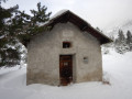
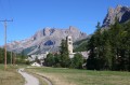
Pass the Oratoire Saint-Benoît, on your right as you climb, and follow the S-bends in the road to reach the Notre-Dame de Bon Secours Chapel. Enjoy the view of both the Cerces massif and the valley.

(2) Carry on along the snow-covered road, pass the Sainte-Barbe Chapel and continue to the junction for the Buffère refuge, which is very well signposted.

(3) The yellow signs indicate the summer route, a path running perpendicular to the road which leads to the car park and follows the Clarée upstream to the Rately Bridge. In winter, the tracks lead you safely to the Rately Bridge.

(4) Follow the signposts and head west, turning right onto a gentle climb. After about 300 m, leave the path on your right which follows the Clarée and climbs up to Fontcouverte. Continue for 150 m and, after a lovely bend, begin the ascent: a lovely climb of about 500 m, fairly straight, where the route through the snow is much easier than the summer path.
After two sweeping bends, you’ll emerge into a clearing (known as Le Serre), where there are two chalets and a ruin.
Just a little more effort and you’ll reach a cluster of chalets and a cross. You’re just below the Buffère refuge.

You’re at the Buffère chalets – take a moment to enjoy the surroundings, the chapel and the refuge (E).

Waypoints

  1. S : mi 0 - alt. 5,226 ft - Névache Haut car park. - Office de tourisme de Névache
  2. 1 : mi 0.05 - alt. 5,233 ft - Road closed
  3. 2 : mi 1.34 - alt. 5,745 ft - Notre-Dame de Bon Secours
  4. 3 : mi 1.65 - alt. 5,804 ft - Junction for the Refuge Buffère
  5. 4 : mi 1.89 - alt. 5,722 ft - Rately Bridge - Clarée (rivière)
  6. E : mi 2.97 - alt. 6,762 ft - Buffère Mountain Hut - Refuge de Buffère

Notes

There are clean public toilets behind the Tourist Office, next to the car park.

Worth a visit

There are several chapels and shrines along the route, providing opportunities to stop and admire the scenery and take photos.
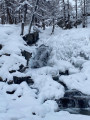
The banks of the Clarée are ideal for taking photos of snow, ice, waterfalls and so on.
A few chalets, some in ruins and others restored, dot the route.

Reviews and comments

5 / 5
Based on 2 reviews

Reliability of the description
5 / 5
Ease of following the route
5 / 5
Route interest
5 / 5
damasa47
damasa47

Overall rating : 5 / 5

Date of your route : Feb 03, 2025
Reliability of the description : ★★★★★ Very good
Ease of following the route : ★★★★★ Very good
Route interest : ★★★★★ Very good
Very busy route : Yes

a lovely walk

Machine-translated

regis.rollin
regis.rollin

Hello,
We made our way up to the refuge on 19 February. The first section of the climb, which was quite steep, was icy due to ski tourers skidding down the slope. It was a bit daunting, but by planting our snowshoes firmly, we managed to get through it (the same went for the descent).

Machine-translated

Malyse56
Malyse56
• Edited:

Overall rating : 5 / 5

Date of your route : Jun 19, 2020
Reliability of the description : ★★★★★ Very good
Ease of following the route : ★★★★★ Very good
Route interest : ★★★★★ Very good
Very busy route : No

A fine run.

Machine-translated

Other walks in the area

For more walks, use our search engine .

The GPS track and description are the property of this route's author. Please do not copy them without permission.