Country:
 City:


Park in the hikers’ car park at Rührberg.
(S/E) Head towards the road linking Inzlingen and Whylen. Turn right towards the village of Rührberg, keeping to the right-hand side of the road. At the end of the pavement, cross the road and take the small path on the left, marked by a blue ‘pedestrians’ sign. Continue straight on along Blauenstrasse, which is cobbled, and follow it to the end. Then turn right onto Belchenstrasse, cross it to reach the pavement on the other side, and join Inzlinger Strasse, passing under some high-voltage power lines. You will arrive at the road leading to Rührberg. It is signposted with a red diamond (Westweg, östliche Variante) and a white and blue diamond on a yellow background (Hochrhein Höhenweg).
(1) Cross the road and head left, towards the village centre, staying on the pavement on the right-hand side of the road. Follow Inzlingerstrasse straight on until you reach a small square with a fountain (drinking water). Turn left and cross the square. Please note that there is no pavement on this section of the road. Go round the restaurant on the left and you’ll reach Feldbergstrasse.
(2) Follow the signs for “Eigenturm” to the left, following the Red Diamond markings, until you reach the next signpost.
(3) Turn right towards “Eigenturm”, following the Red Diamond markings. Enter the forest and arrive at a crossroads.
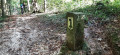
(4) Turn left, whilst continuing to follow the Red Diamond markings. There will be no further signposts until you reach the tower. Join the Schwanderskreuzweg path.
(5) Follow it to the left, still marked with Red Diamonds.
(6) Leave the Schwanderskreuzweg and continue along the Hirschenleckweg, still marked with Red Diamonds; keep left. Carry on straight ahead, following the Red Diamond markings.
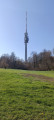
(7) Carry on straight ahead. The tower is about 100 m away.
(8) Retrace your steps, following the same path as on the way there, but in the opposite direction, back to the car park (S/E).
 Visorando Member

 Moderate