Country:

 City:


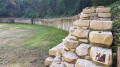
The starting point is at the “P2” car park, right next to the “Römerhof” restaurant.
(S/E) Leave the car park and turn right. Walk past the restaurant. Keep Merkurstrasse and Thermenstrasse on your left. At the junction with Curiastrasse, there is an information board about the forum. Carry on straight ahead and turn right into the next street, Basilikaweg. On your right, just before the first building, you can catch a glimpse of the “Forumtempel”. Carry on straight ahead. Walk past a wooden building with panels summarising the history of the town of Augst through the ages. Just after this, in the covered part of the building, there are educational displays on the lives and trades of the townspeople in Roman times. At the Y-junction, turn right towards the curia. Walk past the picnic tables. Walk past the curia (the seat of the town council in Roman times). Immediately afterwards, go down the steps on the left. Halfway down, you can visit the “Mosaikenaustellung” in the curia’s cellar.
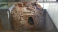
(1) At the bottom of the stairs, turn left towards the hypocaust. The path leads through a grassy area before rejoining a dirt track. Walk past the hypocaust, which displays a cross-section of a building featuring underfloor heating technology. Continue straight ahead. When you reach a gate, information boards explain the presence of the foundations of public baths (Badeanlage), their rules and functions. Turn left and cross a metal footbridge. At the end of it, go down a few steps. Here, you can venture down a few more steps into the underground chamber of a well (Unterdisches Brunnenhaus). Turn back. Climb back up the few steps, cross the footbridge again, and pass the baths and the hypocaust once more. Leave the grassy path you took on the way there and continue diagonally to the right. The path turns right and goes uphill. Walk past the foundations of the curia, which you can explore. Back at the Y-junction, carry on straight ahead to the end of the street. Turn right.
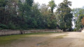
(2) At the “Taberna” (Tavern), which you can also enter by going down a few steps, cross the road carefully. On the other side of the road, go down a few stone steps and enter the theatre at the top. Make your way all the way down. Once you reach the stage floor, turn left until you exit the theatre. Facing a wall with an information board, turn right and take a path cutting across the grass to reach the road. Turn left into the street, then immediately right onto a curved path that leads uphill. At the top, there is a picnic table on the left. Turn right to walk round the Schönbuhl monument, an ancient sanctuary. At the steps leading up to the monument, there are benches from which you can admire the theatre and, thanks to the information boards, learn a little more about it. Continue round the monument until you return to the previous picnic table. Turn right. Here you’ll find more picnic tables and a flight of steps. Go down them. At the bottom, carry on straight ahead and walk past the “Backstube” (bakery), which is built against the wall. Continue until you reach the road.
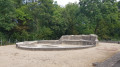
(3) Carefully cross the tarmac road and head towards the left-hand side of the theatre. Continue straight ahead to go down a few steps. Follow the path along the metal walkway to explore the theatre’s foundations and find out more about it. At the end, go back up a few steps and leave the theatre via a small open-air shop. Just past the shop’s premises, turn right. There you’ll find a square with a model of the site and information boards detailing all the points of interest to visit. Carry on straight ahead and carefully cross the road at the pedestrian crossing to reach the museum entrance. The museum invites you to discover the history of the archaeological excavations at the site and to visit a reconstruction of a Roman villa. Opposite the museum, turn left. Walk alongside the Lapidarium, which displays a collection of remarkable stone monuments. Carry on along this pavement. Ignore a flight of steps on your left and, at the end of the pavement, cross the road carefully then turn right. Walk past a school and take Schulstrasse, the first road on the left. Walk past a beach volleyball court and a car park. At the T-junction, turn right, towards the amphitheatre.
(4) At the Y-junction, continue diagonally to the left, towards the amphitheatre. After a few hundred metres, walk past the ruins of the Grienmatt Sanctuary, which you can see more closely by cutting across the fields. At the next four-way junction, near the Tempelhof lodge, carry on straight ahead. About 200 metres further on, before passing under the motorway bridge, turn left onto a path marked by barriers. Climb a few steps. The path turns left.
(5) At the end of the path, turn right. Walk past some picnic tables and information boards, then cross the amphitheatre from one end to the other. On the other side, the path turns right and climbs. The path then turns right to run alongside the motorway. Here too, there are information boards explaining the presence of the foundations of a defensive wall. At a four-way junction, ignore the bridge over the motorway on your right and carry straight on. Along the path is a timeline detailing events that took place in the region, particularly during ancient times. Walk past a car park, then under a bridge towards the Tierpark. When the dirt track gives way to a tarmac road, the road turns left. Pass the Sammlungzentrum car park on your left and a private entrance to the park on your right.
(6) If the gate is open, enter the wildlife park on your right. Inside, you’ll find information on how the Romans used the animals in the park, the foundations of a city gate, a building offering a lovely panoramic view and housing an exhibition of a few ancient artefacts, and finally, the ruins of a remarkable mausoleum. Leave the park. Turn right. At the T-junction, turn right. Cross the road carefully and turn left into Schwarzackerstrasse, heading towards the Zigelei (tile kiln). The Zigelei is on the left-hand side of the street, housed in a circular, fully glazed building. Once you’ve walked round it, don’t miss the Stadtmauer on your right, in the middle of a grassy area. Once again, there are plenty of information boards. Retrace your steps. At the T-junction, turn right. Ignore a cycle path on your right and carry on straight ahead.
(7) Ignore the road on the left leading to the wildlife park you’ve just come from and carry on straight ahead towards P1, P2 and P3. The road curves slightly to the right. Carry on for a few hundred metres, skirting a garden, until you reach a four-way junction. Turn right towards P1. On the other side of the road is an information board indicating the former site of a Roman villa. Take the first dirt track on the right towards the Cloaque & Keller. It is located a little further along the track. You can walk down to it. If you decide to walk through it (be careful, as the path is very narrow in places), you’ll come out on the other side. You’ll then simply need to climb a few steps and turn back. Once back on the road, turn right. 100 metres further on, you’ll find the entrance to the car park where you started. (S/E)

 Visorando Member
 Moderate