Country:
 City:


Start from the Town Hall, Place Sylvain Darlas.
(S/E) Walk behind the church, then take Rue des Payroules
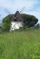
(1) After Rue Belle Paule, take Chemin du Moulin on the left and continue until you reach Rue du Village. Carry on straight ahead, cross Voie le Village and follow the footpath to the roundabout.
(2) Take the path on the right which runs alongside a green space and leads to the Clos de la Plaine.
(3) Turn left, then left again at the first street. At the bend, take the small path leading onto Rue du 8 Mai 1945. Follow it to the left towards the village. 70 metres past Energym, take the cul-de-sac on the right and, at the end, turn right onto the footpath which leads you into the “Le Clos des Mélodies” housing estate. Turn right, then take the lane “Le Clos des Chants” until you reach Route de Launagret
(4) Walk along the left-hand side of Route de Laugranet until you reach the roundabout at the Christian Jumel sports ground and cross with care – there is no pedestrian crossing. Turn onto the path that runs alongside the tennis courts and the earth mound
(5) Once you’ve entered the Magnolias housing estate, turn right onto Place des Frênes and, at the end of the square, take the footpath. Turn right onto “Clos des Alisiers”. At the roundabout, take the small path on the right for about a hundred metres. Turn left onto Rue des Micocouliers. Stay on the left-hand pavement and, at the end of the street, veer right and continue for 500 metres, then turn right and carry on straight ahead for 400 metres.
(6) Take the path on the left leading to the lake. At the lake, turn right onto the dirt track that runs alongside the houses. Cross the access road to the housing estates.
(5) Head towards the roundabout and cross via the tunnel leading to Avenue Berdot. Continue along the cycle path to Jean de La Fontaine Primary School. Shortly after Impasse des Écoles, cross Avenue du 19 Mars 1962 at the pedestrian crossing and pass under the archway of L’Espace Marcel Clermont to reach the “Clos de Larcan”. Turn left, then cross the park. Cross the Aussonnelle via the small wooden bridge and walk alongside the children’s playground.
(7) Cross the RD37, then enter the woods via the entrance marked by two wooden posts; follow the gravel path. In spring you’ll find magnificent daffodils here; out of respect for nature, please do not pick them, as this will ensure they flourish abundantly next summer.
At the end of the path, turn left and then left again onto Chemin de Poumayre to reach the town hall.

 Visorando Member



 Moderate