The lakes of the Domaine de Banayre

A circular route starting from the town hall, taking the footpath to the secondary school, then passing through the Banayre park to see the lakes, and returning past the castle and along the Chemin des Starguets.

Details

n°3809298
Creation:
Last update:
Last review:
  • Walking
    Activity: Walking
  • ↔
    Distance: 5.48 mi
  • ◔
    Average duration: 2h 35 
  • ▲
    Difficulty: Easy

  • ⚐
    Back to start: Yes
  • ↗
    Ascent: + 39 ft
  • ↘
    Descent: - 39 ft

  • ▲
    Highest point: 686 ft
  • ▼
    Lowest point: 623 ft

Photos

Description of the walk

(S/E) Start from the church forecourt; with your back to the church, walk to the road junction. Turn left onto Rue du 11 Novembre and follow the footpath on the left-hand side of the road. Continue along Route de Saint-Lys, passing two roundabouts. Be sure to use the pedestrian crossings when crossing the various roads.

(1) At thethird roundabout, turn slightly left, staying on the footpath, until you reach a road and head towards the Collège Irène Joliot-Curie.
Walk past the school and continue along the footpath between the sports hall and the playground to reach the Domaine du Banayre.

(2) Turn left onto Avenue des Romarins and carry on until you reach the architect’s house on the corner of the next street on the right.

(3) Turn right. The road ends and continues as a path opposite; carry on towards the Le Vidaillon stream. Then follow this path, which runs alongside the stream and crosses the housing estate, feeding the three ponds along the way, which are used as water reservoirs. Pass the first pond, then carry on to go round thesecond on the right and thethird on the left, until you reach the road. Carry on straight ahead and leave the housing estate.

(4) At the roundabout, turn left and take the footpath. After passing a cross, veer left and, at the end of the footpath, turn right onto the path leading to Chemin de Soulery. Carry on straight ahead until you reach the junction with the D68a.

(5) Turn left onto Route de Cantalauze until you reach the Bouygues tower at the next junction.

(6) Turn right onto the Chemin du Château and carry on straight ahead until the next junction. As you pass, on the right, you can see Cammartin Castle, headquarters of the “Les Chaussures du Château” chain of shops and home to the first retail outlet.

(7) Turn left onto the Chemin des Starguets and continue straight on until you reach Fontenilles Church. Walk round the church to reach the churchyard (S/E).


Waypoints

  1. S/E : mi 0 - alt. 663 ft - Place Sylvain d’Arlas. Cross the - Aussonnelle (rivière)
  2. 1 : mi 0.98 - alt. 679 ft - Third roundabout
  3. 2 : mi 1.63 - alt. 686 ft - Avenue des Romarins
  4. 3 : mi 1.8 - alt. 679 ft - Architect-designed house
  5. 4 : mi 2.91 - alt. 666 ft - Roundabout, Route de Fontenilles
  6. 5 : mi 3.6 - alt. 673 ft - Junction with the D68a
  7. 6 : mi 3.85 - alt. 669 ft - Chemin du Château
  8. 7 : mi 4.48 - alt. 659 ft - Starguets path towards the village centre
  9. S/E : mi 5.48 - alt. 663 ft - Place Sylvain d’Arlas - Église Saint-Martin (Fontenilles)

Notes

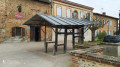
On the square, opposite the church, the café “Chez Lulu” is a great place to quench your thirst after your walk, with a lovely terrace and a home-style lunch.
There are no particular difficulties on the route, which is mostly flat.

Worth a visit

(S/E) On Saturday mornings, the forge is open and in operation thanks to its volunteers, which makes for a pleasant way to round off the walk.

Just before the secondary school, you arrive at Genibrat, where “Radio St Lys” was once based, enabling communication with sailors all over the world. It was from here that the final message was sent to Alain Colas, who went missing at sea aboard the Manureva. The facilities are open to visitors during Heritage Days.

The secondary school is home to two horses with therapeutic properties; their presence has a calming effect on the pupils.
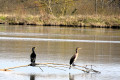
With a bit of luck, you might spot herons on the lakes.
Thesecond lake has a peninsula, and thethird is the largest, with its shoreline overgrown with vegetation.

Camartin Castle is privately owned, but you can admire it by taking the path leading to the shop, which sells shoes at a 5 per cent discount compared to other shops.

The church has been fully restored.

Reviews and comments

3.3 / 5
Based on 3 reviews

Reliability of the description
4 / 5
Ease of following the route
3.7 / 5
Route interest
2.3 / 5
Isabellev
Isabellev

Overall rating : 3.3 / 5

Date of your route : Oct 07, 2024
Reliability of the description : ★★★★☆ Good
Ease of following the route : ★★★★☆ Good
Route interest : ★★☆☆☆ Disappointing
Very busy route : No

Far too much tarmac… I think it might be possible to take more of the smaller paths
Only the stretch along the lakes is worth a go. (1 km)

Machine-translated

AJT-31
AJT-31

Thank you for your feedback.
We did the route on the same day with the Pujaudran group.
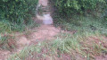
Despite a few muddy patches between the first two lakes, the group really enjoyed the peace and tranquillity of the Banayre estate

Machine-translated

Denat Patrick
Denat Patrick

Overall rating : 4 / 5

Date of your route : Feb 22, 2024
Reliability of the description : ★★★★★ Very good
Ease of following the route : ★★★★☆ Good
Route interest : ★★★☆☆ Average
Very busy route : No

An interesting route for local residents, but otherwise of very limited interest. Almost 9 km long, mostly tarmac, with sheltered stretches between housing estates.

Machine-translated

AJT-31
AJT-31

Hello,
It’s true, this isn’t the best time of year to explore this route. At the moment, we’re focusing on routes that are mainly on tarmac.
If you’d like to find out more, please visit our Facebook page ‘Marche à Fontenilles’.
You’re also welcome to join us for a trial run

Machine-translated

JOADIE
JOADIE

Overall rating : 2.7 / 5

Date of your route : Dec 19, 2020
Reliability of the description : ★★★☆☆ Average
Ease of following the route : ★★★☆☆ Average
Route interest : ★★☆☆☆ Disappointing
Very busy route : No

I set off along a very busy and noisy country road, though there is a footpath. When I reached the lakes: what a dump! I managed to extricate myself from there and made my way to a residential area… fortunately full of friendly locals, so I turned back! That kept me occupied all afternoon.
This time, it wasn’t a success… I’ll wait for better weather and I reckon we can find somewhere better in the Fontenilles area.

Machine-translated

Other walks in the area

For more walks, use our search engine .

The GPS track and description are the property of this route's author. Please do not copy them without permission.