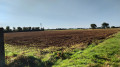
Circular route around the centre of Fontenilles

A short route, mostly on tarmac roads.

Details

n°4405030
Creation:
Last update:
Last review:
  • Walking
    Activity: Walking
  • ↔
    Distance: 3.40 mi
  • ◔
    Average duration: 1h 35 
  • ▲
    Difficulty: Easy

  • ⚐
    Back to start: Yes
  • ↗
    Ascent: + 49 ft
  • ↘
    Descent: - 49 ft

  • ▲
    Highest point: 673 ft
  • ▼
    Lowest point: 617 ft
  • ⚐ Country: France
  • ⚐ City: Fontenilles (31470)
  • ⚑
    Start/End: N 43.552678° / E 1.191718°
  • ❏
    IGN map(s): Ref. 2043ET, 2043O
  • Hour-by-hour weather

Photos

Description of the walk

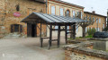
Start from the church forecourt. Park in the town hall car park (or, if full, on Boulevard de la République).

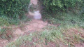
(S/E) Walk behind the church, then take Rue des Payroules to join the Chemin des Starguets and follow it. The path overlooks the Aussonnelle, then descends into a hollow where the Ruisseau de Fonbrennes flows, joining the Aussonnelle shortly afterwards. After a bend, head uphill and take the Chemin de Fonbrennes. Follow it almost to the end of the climb. Cross the Fombrennes stream and you’ll then come to the first junction.

(1) Turn left onto the Chemin des Hauts de Fonbrennes, which becomes a stony track after the first houses. Join the D65, the Route de La Salvetat. Then turn left towards Fontenilles. Pass in front of Carget Castle and its solar farm, and continue until you reach the entrances to the ‘Des Tilleuls’ and ‘De la Plaine’ housing estates on the left, just before the roundabout at the entrance to Fontenilles.

(2) Turn left onto the Clos de la Plaine and go to the end of the street. The street ends at a roundabout; take the dirt track opposite the street you have just followed. After a few metres, rejoin the road at the Impasse du Village. Follow it to the next junction.

(3) Turn into thefirst street on the right – this is the ‘Passage du Village’ – and continue to the D37, ‘Avenue du 8 mai 1945’. Pass Energym on your right and cross the junction carefully, then turn left towards the village centre. Next, take thefirst tarmac road on the right, the ‘Chemin de Lascrabères’. Continue to the footpath on the left leading to the schools.

(4) At the raised pedestrian crossing, turn left onto the footpath and cross the Crabères stream via the wooden bridge. At the end of the bridge, enter Lascrabères Park through the gate, which is open during the day only. Walk through the park and exit to the right onto Avenue du 8 mai 1945. Continue to the traffic lights, cross with care and turn left to return to the church forecourt (S/E).


Waypoints

  1. S/E : mi 0 - alt. 666 ft - Car park - Église Saint-Martin (Fontenilles)
  2. 1 : mi 1.42 - alt. 653 ft - Chemin des Hauts de Fonbrennes
  3. 2 : mi 2.38 - alt. 663 ft - Route de la Salvetat
  4. 3 : mi 2.61 - alt. 673 ft - Towards Energym
  5. 4 : mi 3.06 - alt. 656 ft - Bridge over the Crabères
  6. S/E : mi 3.4 - alt. 666 ft - Car park - Église Saint-Martin (Fontenilles)

Notes

It is advisable to bring high-visibility vests (yellow vests).
Drinking water and toilets are available in the post office building when it is open to the public.
Public toilets are available on the Place du Souvenir, outside the Maison des Loisirs.
On the square, opposite the church, the café ‘Chez Lulu’ is a great place to enjoy a drink after your ride, with a lovely terrace and, at lunchtime on weekdays, a home-style meal.
There are no particular difficulties on the route, which is mostly flat.

Worth a visit

(S/E) On Saturday mornings, the forge is open and in operation thanks to its volunteers, which makes for a pleasant way to round off the walk.
In Cazalères Park, there is a magnificent rain tree, built entirely by volunteers from the forge
The church has been fully restored.

Reviews and comments

4.3 / 5
Based on 2 reviews

Reliability of the description
5 / 5
Ease of following the route
5 / 5
Route interest
3 / 5
FatiMati
FatiMati

Overall rating : 4 / 5

Date of your route : Oct 15, 2023
Reliability of the description : ★★★★★ Very good
Ease of following the route : ★★★★★ Very good
Route interest : ★★☆☆☆ Disappointing
Very busy route : No

A Sunday afternoon stroll. It’s just as well I didn’t take the children – the section along the departmental road is actually quite dangerous.
Not much of a tourist attraction, but a good route for stretching your legs and getting some fresh air on a Sunday evening.
The route isn’t very busy.

Machine-translated

AJT-31
AJT-31

Hello,
Glad to hear you enjoyed the walk we organised
The Walking Section of the Courir à Fontenilles association organises walks on Saturday and Sunday mornings
If you’re interested, you’re welcome to join us for a trial walk
For more information, see our Facebook page ‘Marche à Fontenilles’ and our blog http://caf31.canalblog.com/
Kind regards

Machine-translated

Avis
Avis

Overall rating : 4.7 / 5

Date of your route : Jan 03, 2021
Reliability of the description : ★★★★★ Very good
Ease of following the route : ★★★★★ Very good
Route interest : ★★★★☆ Good
Very busy route : Yes

A lovely discovery in the village of Fontenilles; a pleasant route on the way there with lovely views of the castle, though the return journey along the road was less enjoyable (watch out for vehicles). Nevertheless, it was an enjoyable route, and I’m looking forward to exploring the other routes in the area.

Machine-translated

Other walks in the area

For more walks, use our search engine .

The GPS track and description are the property of this route's author. Please do not copy them without permission.