Country:
 City:
City:


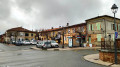
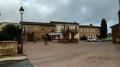
Start from the church forecourt. Park in the town hall car park (or, if that’s full, on Boulevard de la République).
(S/E) Walk behind the church, then take Rue des Payroules to join the Chemin des Starguets and follow it.
Ignore the road on the right leading to Les Chaussures du Château, which forms part of theGR® route, and continue along the Chemin des Starguets until you come to a dirt track on the right.
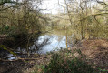
(1) Leave the Chemin des Starguets here and turn right onto this dirt track to head down towards L’Aussonnelle. Cross the river either via the footbridge or the beam, then turn left straight away and follow the river along the right bank. Enter the small woodland and, as you pass through, admire the bend in the river and its confluence with the Fonbrennes stream. You’ll emerge at Las Prières and rejoin the tarmac road on the Chemin de Saint-Flour. Walk through the whole of the Saint-Flour neighbourhood and continue to the departmental road, stopping briefly to admire the sculptures in our artist’s garden, almost opposite the fishing ponds.
(2) Turn left at the crossroads, walk past the Saint-Flour estate and follow the Route de Pascau down towards the bed of the Aussonnelle.
(3) At the bottom of the descent, before the bridge over the Aussonnelle, turn right onto the path marked GR®86 towards La Source and note, on the right, the earthen embankment used to retain the water of the Roch reservoir. Continue to the start of the climb.
(4) Continue along theGR® and join a small road. Follow this and leave theGR® markingsbehind. Pass close to Thière whilst following the road. After passing a few houses lining the road, turn right towards Roch.
(5) When the path makes a right-angle turn, leave it by turning left onto a small track. The path winds through the woods and emerges to the right into a clearing, then descends towards the stream that feeds the lake.
(6) Cross the stream, then continue to the right to rejoin the end of Impasse du Bois du Juge. Exit the cul-de-sac, cross the raised footbridge and turn right onto Route de Magnes until you reach the next junction.
(7) Turn left onto the Chemin du Rugas, which ends at the Chemin des Cavaliers. Turn left onto the path and rejoin the GR®86, marked in red and white, and follow it. Cross the château woods and arrive at a tarmac road.
Carry on straight ahead along the Chemin des Roitelets, which bends to the left and ends at the Route de Cantalauze (D68a).
(8) Turn right and walk alongside the departmental road, taking the path between the ditch and the houses. Keep right at the ‘Y’-shaped junction and continue on the D68h. The road descends towards the bed of a stream coming from La Pichette, then climbs back up to the first houses.
(9) Turn right onto Chemin Monicole, which changes from tarmac to a dirt track at the barrier at the bottom of the descent towards L’Aussonnelle.
Use the wooden footbridge to cross the river and continue to Chemin des Payroules.
Turn left onto the track and walk uphill to the church; walk round it and arrive at the forecourt of the church where you started (S/E).



 Visorando Member
 Moderate

 Difficult