A double circular loop in the shape of a figure of 8 starting from Purgerot

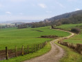
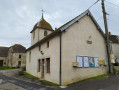
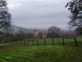
A varied walk through woods, meadows and farmland, passing through four villages rich in wayside shrines, superb wash houses, chapels and churches, some of which feature original architecture, such as the church in Chargey with its added Greco-Roman pediment, or the church in Gesincourt, which also serves as the town hall.
Special feature: the figure-of-eight route offers the flexibility to walk the entire circuit or just one of the two circular loops.

Details

2840735
Creation:
Last update:
Last review:
  • Walking
    Activity: Walking
  • ↔
    Distance: 12.96 mi
  • ◔
    Average duration: 7h 00 
  • ▲
    Difficulty: Difficult

  • ⚐
    Back to start: Yes
  • ↗
    Ascent: + 1,211 ft
  • ↘
    Descent: - 1,207 ft

  • ▲
    Highest point: 1,198 ft
  • ▼
    Lowest point: 741 ft
  • ⚐ Country: France
  • ⚐ City: Purgerot (70160)
  • ⚑
    Start/End: N 47.748832° / E 5.998492°
  • ❏
    IGN map(s): Ref. 3320SB, 3321SB
  • Hour-by-hour weather

Photos

Description of the walk

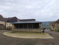
Park near the church or the town hall in Purgerot, in the centre of the village.

(S/E) From the town hall, head south up Rue des Bournaux. Just past the last farm, take the forest track straight ahead, which continues to climb southwards. Pass an abandoned cemetery on your left, along with the road that bends and turns into a track.

This track climbs to the ridge, then descends, running alongside what look like old quarries on your left. The main track turns left at a cross, then arrives at an elegant, well-maintained chapel, flanked by a few beautiful pollarded willows. A little further down, you’ll reach the church at Chargey-lès-Port.

(1) At the church, head down the Grande Rue (D197) opposite. Pass a beautiful wash house on the right. At the next junction, follow the D197 to the left, which becomes Rue de la Pennière (there’s a beautiful wash house at the junction).

(2) At the next junction, about 200m on, take Rue Voie des Côtes, which climbs to the right. Continue along this street, which turns into a track and passes a final large farm before entering the forest, still heading more or less south-south-west. Pass the “Tomb.” marked on the IGN map, which is an engraved gravestone set into a low stone wall at the foot of a large tree. About 1.5 km further on, you’ll come to a track leading up from the plain.

(3) Follow this forest track to the right for about 700 metres until you reach a crossroads. Turn right at a right angle to head north-west, continuing straight on for about 1,500 metres. The track then curves gently northwards, about 150 metres after leaving the woods, to cross some farmland. You’ll arrive at a bend in a very good farm track.

(4) Turn left onto this track, which joins another track 300 metres further on. Follow it to the right, heading north-north-east.

(5) About a hundred metres before reaching the D7, take the forest track which climbs to the right then turns left (beehives on the right) to continue climbing gently, more or less parallel to the D7.

(6) At the start of a right-hand bend, take a well-marked path that descends to the left up to the top of the village of Purgerot. The path disappears as you leave the forest, but simply head straight on along the low wall that leads down to Rue de la Chèvre. At the bottom of this very steep street, turn right to reach the town hall.

(S/E) From the town hall, cross the Grande Rue and head south down Rue du Vaux, which leads to the superb fountain and washhouse with its distinctive metal structure. Continue down Rue du Vaux, which becomes Rue des Vignes, then head north up the other side of the Vallon. Ignore the path that veers off to the left and continue up the tarmac road that runs alongside a small vineyard.

(7) Carry on straight ahead along the forest track at the isolated farm in the hamlet of Grande Vigne. The track makes a slight hairpin bend before crossing the ridge and descending the northern slope, quickly emerging from the forest, crossing farmland and climbing up to some large sheds (cattle sheds and haylofts).

(8) At the pass, by the wayside cross, leave the main path and turn left, then right onto the path leading down to Aboncourt. When you reach the D56, turn left. Near the church, note an interesting wayside cross featuring, on one side, Christ on the cross, and on the other, the Virgin Mary with her feet resting on an angel’s head. Continue along the D56 to the church-cum-town hall in Gesincourt. Don’t miss the opportunity, to the left of this building, to visit the interesting combination of well, drinking trough, fountain and washhouse situated slightly below.

(9) Just before leaving the village, take a path on the left, passing the last house on your right, then a large shed. The track climbs and reaches a ridge overlooking vast expanses of pasture and farmland. This south-westerly track then enters the forest whilst climbing, turns left and soon reaches farmland again, which it crosses in an easterly direction for about 1 km, before entering the forest once more. The track veers southwards, where it is joined by another forest track coming from the north.

(10) About 100 metres after this junction, leave the main track and turn left onto a less-travelled track which descends rapidly down the hillside. This track continues to the entrance to the village of Purgerot. From there, simply follow the departmental road to return to your starting point (S/E).


Waypoints

  1. S/E : mi 0 - alt. 846 ft - Purgerot Church
  2. 1 : mi 0.87 - alt. 915 ft - Church at Chargey-lès-Port
  3. 2 : mi 1.17 - alt. 889 ft - Leave the D197
  4. 3 : mi 2.69 - alt. 968 ft - Junction
  5. 4 : mi 5.1 - alt. 984 ft - Crossroads on a farm track
  6. 5 : mi 6.1 - alt. 1,043 ft - Start of the forest track
  7. 6 : mi 6.53 - alt. 1,158 ft - Trail start
  8. 7 : mi 7.81 - alt. 873 ft - Grande Vigne
  9. 8 : mi 8.76 - alt. 810 ft - Calvary
  10. 9 : mi 9.78 - alt. 801 ft - Leave the D56. Gésincourt exit
  11. 10 : mi 11.85 - alt. 1,010 ft - Bois des Bas junction
  12. S/E : mi 12.96 - alt. 846 ft - Purgerot Church

Notes

La Ludore Farm Inn in Aboncourt-Gesincourt 03 84 68 71 28

Reviews and comments

4.6 / 5
Based on 3 reviews

Reliability of the description
5 / 5
Ease of following the route
5 / 5
Route interest
3.7 / 5
danles
danles

Overall rating : 4.3 / 5

Date of your route : Aug 11, 2021
Reliability of the description : ★★★★★ Very good
Ease of following the route : ★★★★★ Very good
Route interest : ★★★☆☆ Average
Very busy route : No

This afternoon, in the sweltering heat, I walked the shaded southern circular route from 1 to 6, following the alternative route suggested in the 14 June 2021 review by Visorandonneur MM25, as it is less monotonous than the section from 4 to 6, which remains entirely in the woods. The route description is excellent, clear and precise, leaving no room for error. The final stretch of the route, from point 6 to the village of Purgerot, is very difficult. The path is poorly maintained and numerous trees block the way, requiring considerable agility to get under or over them; it is impossible to go round them as the area is overgrown with brambles. The walk through the village of Chargey-les-Port reveals a few points of interest, but the rest of the route is uninteresting.

Machine-translated

MM25
MM25

Overall rating : 4.7 / 5

Date of your route : Jun 13, 2021
Reliability of the description : ★★★★★ Very good
Ease of following the route : ★★★★★ Very good
Route interest : ★★★★☆ Good
Very busy route : No

Hello,
The route is very well signposted.
In my opinion, on very hot days such as 13 June, start with the northern circular route (Gésincourt and Aboncourt), which is much more open, and then continue in the shade via the southern circular route (Chargey-les-Port) and the forest.
PLEASE NOTE: At point 9, do not turn left straight away but head well to the right and turn left after 100 metres.
A recommended alternative route:
At point 4, bypass point 5 by turning right onto the white track, climb up to elevation point 329 and take the white track on the left leading up to elevation point 360, where you’ll find two tables with benches under the trees (in good condition) before continuing along this same path towards the two telecommunications pylons; then, when you reach the three-way junction, turn left and, after 250 m, you’ll reach point 6 and rejoin the original route, which will take you back to Purgerot. As you emerge from the woods, it may seem as though you are approaching private property, but, as indicated in the description, head down to the left, following the stone wall.
MM25

Machine-translated

randonanard
randonanard

Overall rating : 4.7 / 5

Date of your route : Jan 19, 2020
Reliability of the description : ★★★★★ Very good
Ease of following the route : ★★★★★ Very good
Route interest : ★★★★☆ Good

A lovely route – the first circular section is mainly through woodland and the second through meadows; the villages are very pretty, and there’s the chance to stop for a bite to eat in Purgerot after the first circular section. I was doing a recce so I could take a group there in April.

Machine-translated

Other walks in the area

For more walks, use our search engine .

The GPS track and description are the property of this route's author. Please do not copy them without permission.