Country:
 City:
City:


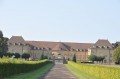
Starting point and car park: Place de l’Église, Purgerot.
(S/E) With your back to the church, set off along the Grande Rue or the D7.
Turn left onto Place du Four and head uphill again to the left along Rue de la Chèvre, which then becomes a grassy track (a steep climb to start the route).
(1) At the first crossroads, turn left and continue uphill, passing a pasture on your right.
(2) When you come out onto a small road, turn right and, at the first bend, carry on straight ahead to re-enter the forest via a woodland path.
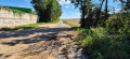
(3) You will then reach a stony path and pass close to a large pylon.
Turn onto the grassy path a little further on to the right (altitude 360m) to reach the D7 road via a lovely forest track.
(4) Carefully follow this departmental road to the left, then turn right onto a path through the woodland after the bend.
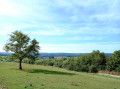
(5) Turn left at the Fork in the road and continue through fields and meadows.
(6) Turn right at the Fork in the road at the entrance to the woodland, which you cross. Continue across the fields for 1.5 km and head down to the right to come out onto the D56 at the entrance to Gesincourt.
(7) Follow the D56 to the right, crossing Gesincourt and then Aboncourt with care.
Cross a bridge near a cheese dairy.
(8) After the bridge over the Ruisseau d’Aboncourt, turn right onto a small road.
(9) At the cross, keep left onto a dirt track through the fields. Reach the top of the Bois du Petit Lien via an uphill track.
(10) Head back down towards the village of Purgerot. Turn right towards the wash house and head for the Place de l’Église (S/E).

 Visorando Member
 Difficult

 Easy
Easy