Tour of Lake Irati

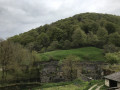
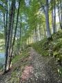
A lovely walk through the forest, circling Lake Irati.

Details

n°4368719
Creation:
Last update:
Last review:
  • Walking
    Activity: Walking
  • ↔
    Distance: 6.09 mi
  • ◔
    Average duration: 3h 20 
  • ▲
    Difficulty: Easy

  • ⚐
    Back to start: Yes
  • ↗
    Ascent: + 633 ft
  • ↘
    Descent: - 617 ft

  • ▲
    Highest point: 2,822 ft
  • ▼
    Lowest point: 2,641 ft

Photos

Description of the walk

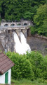
Head to Orbaizeta via the NA-2030 road, then turn right towards the Irati Forest. Pass the Mendilatz lodge and continue along this road to the dam. At the dam, there is a large car park just before a barrier blocking further access.

(S/E) Turn back until you reach the first road on the left.

(1) Take the hairpin bend to the left down to the dam and cross it.

(2) Take the first path on the left to walk along the lake shore.

(3) Cross the small bridge and continue northwards along the shore.

(4) At the house in the forest, head north-west then due north, ignoring the paths branching off to the right.

(5) Turn left and cross the bridge over the River Egurgi. Turn immediately left towards the south-west to continue along the lakeshore. The path is circular and returns to the starting point at the dam car park (S/E).

Waypoints

  1. S/E : mi 0 - alt. 2,723 ft - Irati Dam car park
  2. 1 : mi 0.14 - alt. 2,756 ft - Turn left towards the dam
  3. 2 : mi 0.39 - alt. 2,762 ft - Path on the left
  4. 3 : mi 1.81 - alt. 2,736 ft - Bridge over the River Irati
  5. 4 : mi 2.07 - alt. 2,720 ft - House in the forest
  6. 5 : mi 3.74 - alt. 2,667 ft - Bridge over the River Egurgi
  7. S/E : mi 6.09 - alt. 2,723 ft - Irati Dam car park

Notes

There are no water sources along the route.

Worth a visit

It is possible to launch your boat at the bridge over the River Egurgi.

Reviews and comments

3.7 / 5
Based on 2 reviews

Reliability of the description
4 / 5
Ease of following the route
4 / 5
Route interest
3 / 5
Stephane 40
Stephane 40

Overall rating : 3.7 / 5

Date of your route : May 13, 2024
Reliability of the description : ★★★★☆ Good
Ease of following the route : ★★★★☆ Good
Route interest : ★★★☆☆ Average
Very busy route : Yes

Hello
The stone bridge is indeed broken, so it’s impossible to complete the circuit via the marked route. There is a way through, but it involves walking at least 2 km upstream along the river. You’ll have to wade through the water!! Expect 20 to 30 cm of water!
You can reach the route by going round the other side of the bridge, cutting across at the top; on the other side, further down, there’s a fairly easy track to get back to the area.
A very pretty forest with a variety of trees.
However, there’s a €7 charge for car access on the Spanish side!!!
There’s access from the French side towards the Iraty chalets!
Enjoy your walk

Machine-translated

pascalou81
pascalou81

Overall rating : 3.7 / 5

Date of your route : May 24, 2022
Reliability of the description : ★★★★☆ Good
Ease of following the route : ★★★★☆ Good
Route interest : ★★★☆☆ Average
Very busy route : No

Warning: Bridge Destroyed ******
An easy route with the great advantage of being in the shade. The bridge is destroyed, so it’s not easy to find the path again; you have to head back up and then follow the river to find a place to cross it. It’s quite a struggle, but with the Visorando track you’ll find your way back. Take a break at point 5 by the river; after that, the route becomes less interesting.

Machine-translated

Other walks in the area

For more walks, use our search engine .

The GPS track and description are the property of this route's author. Please do not copy them without permission.