Country:
 City:
City:


The route starts from the large car park in the heart of the hamlet of Les Esterets du Lac.
Yellow markings.
(S/E) From the car park, head up Avenue des Esterets on the left.
Follow this road, which passes between the villas and then turns into a track. Go through the barrier and continue along this track, which descends gently through the woods.
(1) At the junction, continue to the left, following the yellow markings. After a short, ravine-like section, cross a footbridge over a stream.
Then ignore the track leading uphill to the right and follow the yellow markings along this track, which descends gently to a wide track near the River Reyran.
(2) Continue to the right along this wide track, which runs along the right bank of the Reyran.
A few hundred metres further on, a sign points to the Malpasset Dam via the Chemin des Crêtes on the left.
(3) Head down this small track to the left, and fords the Reyran (walk across the stones on the right if the water level is too high).
Continue along the yellow-marked track which climbs to the right. This steep, gullied climb requires you to push your bike in a few places.
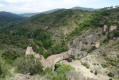
Once at the top, the Chemin des Crêtes branches off to the right. This wide, level and very rideable path offers a lovely panoramic view across the whole Reyran valley. Be careful, however, of a few flooded sections if it has rained in the previous days.
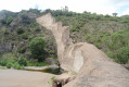
Follow this path, which turns into a track, to the dam for a beautiful view of the ruins of the disaster that claimed more than 400 lives in the town of Fréjus in December 1959.
Then continue along the track as it descends alongside the motorway, passing underneath it.
(4) Turn right to cross the ford and then immediately left to pass under the motorway again.
Carry on along the track which climbs towards the Malpasset dam.
(5) At the sign for “Site de Malpasset”, turn right onto the path leading down towards the Reyran. Ford the Reyran to reach the foot of the dam.
(6) You now have two options:
- carry your bikes over the dam (not easy) to reach the point directly (9)
- retrace your steps back to the point (5) to climb up to the viewpoint above the dam (description below).
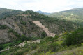
(5) Once you’ve retraced your steps, turn right onto the Ambon track. This track is very rideable and can be climbed easily if you take your time. Don’t miss the viewpoint above the dam (on the right-hand side of the track) at a left-hand bend at the top of the track.
Continue on to a small pass where there is a water tank.
No signposting.
(7) Head down to the right along a good, unmarked track to a wide junction where there is another water tank.
Yellow markings.
(8) Take the small path branching off to the right for a return trip to the foot of the dam (upstream side).
(9) Return to the previous junction.
(8) Turn right to head up the Route de Malpasset alongside the Reyran, rejoining the junction with the Chemin des Crêtes.
(3) Follow the same route as on the way out to the next junction.
(2) Carry on straight ahead along this wide track, cross the ford, and continue up to a gate.
Carry on to the left; the track turns into a road and you’ll reach the entrance to the hamlet.
(10) Turn left onto Avenue des Esterets to return to the starting point. (S/E)



 Visorando Member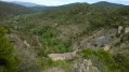
 Moderate