Circular waterfall loop starting from Tourrettes-sur-Loup

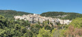
A lovely, fairly easy walk suitable for families or couples. You’ll mainly be following quiet paths, an old railway line and the famous Route des Gorges du Loup. Magnificent views of Tourrettes-sur-Loup, Bar-sur-Loup, Gourdon, the Gorges du Loup and a brief stop at the Château de l’Amiral de Grasse.

Details

2073890
Creation:
Last update:
Last review:
  • Mountain biking
    Activity: Mountain biking
  • ↔
    Distance: 17.22 mi
  • ◔
    Duration according to the author: 3 hrs 
  • ▲
    Difficulty: Moderate

  • ⚐
    Back to start: Yes
  • ↗
    Ascent: + 3,291 ft
  • ↘
    Descent: - 3,278 ft

  • ▲
    Highest point: 1,565 ft
  • ▼
    Lowest point: 499 ft

Photos

Description of the route

Park at Tour’Rent Bike.

(S/E) Join the D2210.

(1) Turn right onto it and head west until you reach the junction by the football ground.

(2) Turn left onto Rue de la Pauvetta and head downhill to the next stop sign.

(3) Turn right onto Route de Provence. At the Y-junction, keep left and cross the Vallon du Cassan. Further on, you’ll come to another Y-junction.

(4) Turn left onto Route de Plan Buisson and continue to the four-way junction.

(5) Keep right on Route de Plan Buisson until you reach a ford.

(6) Cross the ford or the bridge, then continue along the small track opposite. Join the Chemin de l’Île Croix.

(7) Begin a steep climb to the junction of the Chemin de la Baume and the Chemin du Moulin à Farine.

(8) Turn left onto the Chemin de la Baume. Then continue along the woodland path that follows on from it. Follow the Chemin des Chênes Verts as far as the Camassade campsite.

(9) Turn left onto the Route de Pie Lombard and continue to the junction marked with signpost 193.

(10) Carry on straight ahead, crossing an old railway bridge.

(11) At the end of the railway bridge, take the Piste des Valettes. (This is a very scenic track below the recently resurfaced Route de Grasse.) Stay on this track until you reach the junction with the Route de Grasse.

(12) Cross the Route de Grasse and take the Route des Valettes. Continue along this road; after a hairpin bend, you’ll reach the junction with the D2210, the Route de Grasse.

(13) Turn right onto it and follow it to the Pont du Loup junction.

(14) At the entrance to Pont du Loup, turn right onto the Route des Gorges and continue to the Courmes Waterfall.

(15) Continue north on the same road to reach the Saut du Loup.

(16) Set off again along the Route des Gorges, passing back under the tunnel to the junction of the Grasse–Pont du Loup road via a lovely descent through the gorges.

(14) Turn right towards Nice onto the Route de la Colle, following the River Loup once more until you reach the Route des Valettes Sud.

(17) Head up the Route des Valettes Sud to the left until you reach the Château des Valettes.

(18) Continue along the Route des Valettes Sud until you reach the junction with the D2210.

(12) Turn right onto the Piste des Valettes, which you have already taken, to reach the junction with the Route de Pie Lombard.

(10) Turn left onto the track to join the D2210 and head straight on towards Traverse de Quenières, heading in the direction of Mas des Cigales. You’ll reach another junction, at the Route des Quenières.

(19) Turn right onto this road, which overlooks Tourrettes-sur-Loup. Further on, you’ll reach the Route de Saint-Jean.

(20) Turn right onto this road, reach the Place du Village, go round it, and arrive at the church.

(21) Take the Route de la Bourgade as far as the junction with the D2210, which you passed on the way there.

(2) Ignore the Route de la Bauvetta on the right and stay on the Route de Vence. You’ll come back to the original junction a little further on.

(1) Turn left to follow the route you took on the way there and return to the Tour’Rent Bike car park (S/E).


Waypoints

  1. S/E : mi 0 - alt. 1,312 ft - Car park at Tour’Rent Bike
  2. 1 : mi 0.06 - alt. 1,309 ft - Stadium junction
  3. 2 : mi 0.54 - alt. 1,079 ft - Stop
  4. 3 : mi 1.09 - alt. 1,043 ft - Plan Buisson Road
  5. 4 : mi 1.55 - alt. 925 ft - Four-way junction
  6. 5 : mi 1.91 - alt. 869 ft - Ford
  7. 6 : mi 2.15 - alt. 961 ft - Chemin de la Baume
  8. 7 : mi 2.24 - alt. 1,010 ft - Chemin de la Baume
  9. 8 : mi 2.63 - alt. 1,056 ft - Camping de la Camassade
  10. 9 : mi 2.79 - alt. 1,066 ft - Waypoint 193
  11. 10 : mi 3.36 - alt. 1,099 ft - Railway bridge
  12. 11 : mi 4.51 - alt. 991 ft - Crossroads on the Route de Grasse
  13. 12 : mi 5.88 - alt. 764 ft - Return via the Grasse road
  14. 13 : mi 6.46 - alt. 640 ft - Pont du crossroads - Loup (fleuve)
  15. 14 : mi 8.36 - alt. 1,335 ft - Cascade de Courmes
  16. 15 : mi 8.91 - alt. 1,322 ft - Saut du - Loup (fleuve)
  17. 16 : mi 12.56 - alt. 499 ft - Route des Valettes Sud
  18. 17 : mi 12.65 - alt. 577 ft - Château des Valettes
  19. 18 : mi 15.82 - alt. 1,309 ft - Route des Quenières
  20. 19 : mi 16.57 - alt. 1,371 ft - Route de Saint-Jean
  21. 20 : mi 16.93 - alt. 1,329 ft - Church of Tourrette-sur-Loup
  22. S/E : mi 17.22 - alt. 1,325 ft - Car park at Tour’Rent Bike

Notes

Note: Looking at the diagram and considering the altitudes, the elevation gain seems excessive.

Worth a visit

(14) At Pont-du-Loup, you can stop off briefly in the village before heading up the Route des Gorges and sampling some sweets at Florian’s (a famous confectioner for several generations) – a very pleasant spot with a walk along the banks of the Loup.
(15) Visit the Saut de Loup and have lunch there if you wish.
(18) Stop off at the Château de l’Amiral de Grasse, with its beautiful garden and lovely Provençal mansion.
(20) Visit to Tourrettes-sur-Loup: a magnificent medieval village, the ‘capital of the violet’.

Reviews and comments

4.2 / 5
Based on 3 reviews

Reliability of the description
3.7 / 5
Ease of following the route
4.7 / 5
Route interest
4.3 / 5
Yangshuo
Yangshuo

Overall rating : 3 / 5

Date of your route : Sep 28, 2024
Reliability of the description : ★★☆☆☆ Disappointing
Ease of following the route : ★★★★☆ Good
Route interest : ★★★☆☆ Average
Very busy route : No

A disappointing route, as it’s advertised as a mountain bike route, yet only a very small section of the route is suitable for mountain biking. Most of the route is along the road, which is pleasant, but nothing more.

Machine-translated

ecby
ecby

Overall rating : 5 / 5

Date of your route : Sep 20, 2024
Reliability of the description : ★★★★★ Very good
Ease of following the route : ★★★★★ Very good
Route interest : ★★★★★ Very good
Very busy route : Yes

A route completed on a mountain bike by following the GPS track. No particular technical difficulties as noted (medium difficulty); however, on a mountain bike without electric assistance, some of the climbs are quite ‘tough’. Beautiful views along this route, including a stop at the ‘Saut du Loup’ (admission €1, well worth it). Conclusion: a lovely ride

Machine-translated

Dinet
Dinet

We never managed to find the signposted starting point, which leads to a dead end in a residential area. In the end, we drove to the Courmes waterfall.

Machine-translated

jpbaldou
jpbaldou

Overall rating : 4.7 / 5

Date of your route : Oct 18, 2021
Reliability of the description : ★★★★☆ Good
Ease of following the route : ★★★★★ Very good
Route interest : ★★★★★ Very good
Very busy route : Yes

We had a bit of a struggle finding the Domaine des Courmettes… it wasn’t explained very clearly on the listing… thanks

Machine-translated

Other walks in the area

For more walks, use our search engine .

The GPS track and description are the property of this route's author. Please do not copy them without permission.