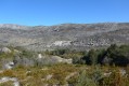
Circular route in the Estérel around Marsaou and Vinaigre

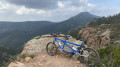
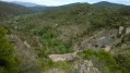
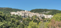
A route with no major technical difficulties, following wide tracks that offer numerous vantage points overlooking the Mediterranean, the mountains on the Italian border and the Var hinterland.

Details

31099514
Creation:
Last update:
Last review:
  • Mountain biking
    Activity: Mountain biking
  • ↔
    Distance: 21.04 mi
  • ◔
    Duration according to the author: 3 hrs 
  • ▲
    Difficulty: Moderate

  • ⚐
    Back to start: Yes
  • ↗
    Ascent: + 2,037 ft
  • ↘
    Descent: - 2,054 ft

  • ▲
    Highest point: 1,529 ft
  • ▼
    Lowest point: 36 ft
  • ⚐ Country: France
  • ⚐
    Area: Esterel
  • ⚐ City: Mandelieu-la-Napoule (06210)
  • ⚑
    Start/End: N 43.524519° / E 6.902228°
  • ❏
    IGN map(s): Ref. 3544ET, 3643ET

  • ◶
    Type of surface:
  •  
     
     50% Road  50% Byway
  • ⇧
    Bike carrying: Not specified
  • ▲
    Difficulty: Moderate
  • Hour-by-hour weather

Description of the route

Parking and starting point: the Saint-Jean cemetery car park, Route Forestière des 3 Termes, on the D6007, opposite the Barbossi estate, 1 km after the Mandelieu-la-Napoule exit towards Fréjus.

(S/E) From the Route Forestière des 3 Termes, head down the D6007 to the right, pass the sign marking the entrance to the built-up area of Mandelieu-la-Napoule and join a road on the right a few metres further on.

(1) Follow this road towards the Estérel Departmental Nature Park, pass the Barbossi tennis courts and reach a three-way junction.

(2) Take the left-hand branch, heading towards the Col de la Cadière via the Vallon de Maupas.

(3) Ignore Notre-Dame-des-Sarrasins on the left and continue to follow the valley. Cross the Sarazin bridge and climb up to the Col de la Cadière.

(4) Ignore the Piste des Œufs de Bouc on the right and continue climbing along the road to the Col des Trois Termes.

(5) Keep left and, at the three-way junction at the Maison Forestière des Trois Termes, head down to the left towards the Col des Suvières.

(6) Turn right and follow the track to the junction at the Maison Forestière de la Duchesse.

(7) Carry on straight ahead to reach the Col de l’Aire de l’Olivier.

(8) Carry on along the road until you reach the Maison Forestière du Malpey.

(9) Turn right and head for the Col du Testanier.

(10) Turn right onto the DN7 and head for the Col du Logis de Paris.

(11) Ignore the D237 on the left and continue along the DN7 to return to the car park at Saint-Jean Cemetery (S/E).

Waypoints

  1. S/E : mi 0 - alt. 236 ft - Saint-Jean cemetery car park
  2. 1 : mi 0.7 - alt. 36 ft - Road on the right towards the Vallon de Maupas
  3. 2 : mi 0.99 - alt. 39 ft - Three-way junction
  4. 3 : mi 1.87 - alt. 157 ft - Junction, follow signs for Pont Sarrazin - Chapelle de Maure Vieil
  5. 4 : mi 3.58 - alt. 794 ft - Col de la Cadière
  6. 5 : mi 5.14 - alt. 994 ft - Col des Trois Termes (303m)
  7. 6 : mi 6.61 - alt. 827 ft - Track on the right - Col des Suvières (252m)
  8. 7 : mi 9.94 - alt. 1,280 ft - La Duchesse Forest House
  9. 8 : mi 11.37 - alt. 1,217 ft - Col de l'Aire de l'Olivier
  10. 9 : mi 12.53 - alt. 1,188 ft - Route du Malpey - Maison forestière du Malpey
  11. 10 : mi 13.1 - alt. 1,024 ft - Col du Testanier
  12. 11 : mi 14.95 - alt. 1,040 ft - Col du Logis de Paris
  13. S/E : mi 21.04 - alt. 233 ft - Saint-Jean cemetery car park

Reviews and comments

4.4 / 5
Based on 3 reviews

Reliability of the description
4.3 / 5
Ease of following the route
4.3 / 5
Route interest
4.7 / 5
YanClot
YanClot

Overall rating : 4.3 / 5

Date of your route : May 16, 2026
Reliability of the description : ★★★★☆ Good
Ease of following the route : ★★★★☆ Good
Route interest : ★★★★★ Very good
Very busy route : No

We've just done this course and we weren't disappointed!
It was brilliant!

Machine-translated

Christophe69003
Christophe69003

Overall rating : 5 / 5

Date of your route : Nov 04, 2024
Reliability of the description : ★★★★★ Very good
Ease of following the route : ★★★★★ Very good
Route interest : ★★★★★ Very good
Very busy route : Yes

A lovely walk.

Machine-translated

Badette
Badette
• Edited:

Overall rating : 4 / 5

Date of your route : Jul 07, 2024
Reliability of the description : ★★★★☆ Good
Ease of following the route : ★★★★☆ Good
Route interest : ★★★★☆ Good
Very busy route : No

Machine-translated

For more walks, use our search engine .

The GPS track and description are the property of this route's author. Please do not copy them without permission.