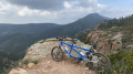
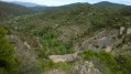
Esterel mountain bike training route

A pleasant route, with a track all the way. The descent is easy but requires concentration.
The climb up to the Porfait canteen is long and steady.

Details

1068
Creation:
Last update:
Last review:
  • Mountain biking
    Activity: Mountain biking
  • ↔
    Distance: 11.91 mi
  • ◔
    Duration according to the author: 1.5 hrs 
  • ▲
    Difficulty: Moderate

  • ⚐
    Back to start: Yes
  • ↗
    Ascent: + 1,168 ft
  • ↘
    Descent: - 1,152 ft

  • ▲
    Highest point: 1,119 ft
  • ▼
    Lowest point: 157 ft
  • ⚐ Country: France
  • ⚐
    Area: Esterel
  • ⚐ City: Fréjus (83600)
  • ⚑
    Start/End: N 43.45479° / E 6.7732°
  • ❏
    IGN map(s): Ref. 3544ET

  • ◶
    Type of surface:
  •  
     
     
     33% Road  34% Byway  33% Path
  • ⇧
    Bike carrying: No
  • ▲
    Difficulty: Not specified
  • Hour-by-hour weather

Description of the route

The walk starts at the junction of the cul-de-sac and Avenue du Golf, where you can park your car.

(S) Walk up Avenue du Golf (track), turn left onto the Plan Guinet track and continue along this track.

(1) Walk past the ‘Maison forestière de la Louve’
.
(2) Colle Douce crossroads. At the top of the track, by the gate, turn left (Piste du Porfait).

(3) Pass the Col des Sacs and follow this track to the Cantine du Porfait.

(4) There you’ll find a spring, a house on the left and a shed on the right. Take the path on the right.
At the bottom of a short descent onto a plateau, take the path well to the left (the one on the right is a dead end).
Long descent; keep taking the paths on the right (long descent into the Vallon de la Cabre).

(5) Pass the Col de l’Essuyadou

(6) After the small lakes, at the Castelli crossroads, turn right onto the Castelli track.

Turn left and head back up the track to reach the Col de la Douce junction (2). Cross the road and head back down the path leading to the Maison Forestière de la Louve, then continue to the starting point (E).


Waypoints

  1. S/E : mi 0 - alt. 194 ft - Dead end on Avenue du Golf
  2. 1 : mi 1.13 - alt. 220 ft - La Louve forest lodge
  3. 2 : mi 1.6 - alt. 358 ft - Colle Douce junction
  4. 3 : mi 2.39 - alt. 515 ft - Col des Sacs (156m)
  5. 4 : mi 5.15 - alt. 1,119 ft - Porfait Canteen
  6. 5 : mi 7.84 - alt. 574 ft - Col de l'Essuyadou (171m)
  7. 6 : mi 9.28 - alt. 315 ft - Turn right onto the Castelli track
  8. S/E : mi 11.92 - alt. 194 ft - Dead end at Avenue du Golf

Reviews and comments

3.9 / 5
Based on 3 reviews

Reliability of the description
3.3 / 5
Ease of following the route
4 / 5
Route interest
4.3 / 5
MAILLOUX3
MAILLOUX3

Hi,
YES, absolutely, and the weather isn’t going to make things any better.
Thierry

Machine-translated

jkp5225
jkp5225

Overall rating : 4 / 5

Date of your route : Feb 25, 2019
Reliability of the description : ★★★★☆ Good
Ease of following the route : ★★★★☆ Good
Route interest : ★★★★☆ Good

It should be noted that, from the forester’s lodge onwards, the track is very narrow, runs through thick undergrowth, is very stony and has some very deep ruts; it is not recommended for beginners.

Machine-translated

MAILLOUX3
MAILLOUX3

Overall rating : 3.7 / 5

Date of your route : Aug 29, 2018
Reliability of the description : ★★★☆☆ Average
Ease of following the route : ★★★★☆ Good
Route interest : ★★★★☆ Good

Hello,
I started the ride from point No. 4 (setting off from the Col du Testanier car park next to the Adrets de l’Estérel) at the Maison Forestière du Malpey. So straight down the Cabre Valley. PLEASE NOTE: the path is quite badly worn; vegetation has grown back and the weather has eroded the track, so you sometimes have to get off your bike – a shame, as the route looked like it would be a nice ride.
By starting at Point No. 4, you complete the entire descent in the first half, then there’s the climb left to finish the circular route.
Thierry

Machine-translated

gazok54
gazok54 ★
• Edited:

Hello, and thank you, bondibeachfr.
Thank you for this information, which may be useful to the author of the walk in helping to improve it.
Now, I think you’ve made a mistake by setting off without a map. A map is an essential complement to the route description.
Print out the full PDF for your next outing.

Machine-translated

bondibeachfr
bondibeachfr

Overall rating : 4 / 5

Date of your route : Aug 16, 2015
Reliability of the description : ★★★☆☆ Average
Ease of following the route : ★★★★☆ Good
Route interest : ★★★★★ Very good

A brilliant hike, though I did get lost twice just following the description. So, when you reach the bottom of the descent into the Cabre Valley, you need to turn right at the first bridge; the path then climbs back up to the Col de l’Essuyandou (there’s a sign when you reach the top). Once you reach this pass, take the path opposite (there are two – it’s the wider one) and you’ll then reach the Col de la Colle Douce junction. Just so you know, I didn’t see any signs for the Castelli trail. Personally, I find the descent through the Cabre Valley quite technical as there are lots of large boulders, so it’s a bit of a bumpy ride ;-)
But that doesn’t take away from the fact that it’s an excellent route – I’ve done it twice and I’ll definitely do it again!

Machine-translated

Other walks in the area

For more walks, use our search engine .

The GPS track and description are the property of this route's author. Please do not copy them without permission.