Lautenbach-Zell circular walk via the Devil’s Cauldron

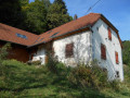
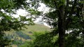
Lautenbach-Zell is a small village situated in the Lauch Valley. It is surrounded by mountain ranges and various peaks, including the Hohrupf and the Petit Ballon. This circular walk is of intermediate difficulty and passes by various viewpoints, including the Chaudron du Diable. A touch of history can be added with a visit to the Vivarium du Moulin in Lautenbach-Zell. Almost the entire route runs through woodland. 

Details

n°70292747
Creation:
Last update:
Last review:
  • Walking
    Activity: Walking
  • ↔
    Distance: 8.14 mi
  • ◔
    Average duration: 4h 55 
  • ▲
    Difficulty: Moderate

  • ⚐
    Back to start: Yes
  • ↗
    Ascent: + 1,381 ft
  • ↘
    Descent: - 1,381 ft

  • ▲
    Highest point: 2,024 ft
  • ▼
    Lowest point: 1,263 ft

Description of the walk

Park in the car park next to the Vivarium du Moulin in Lautenbach-Zell

No signposting

(S/E) With your back to the car park, take the road on the left towards the river and cross it. Then turn left onto the main road before crossing it carefully.

Red Triangle signposting

(1) Follow the first track leading uphill to the right towards the Chaudron du Diable. Take two hairpin bends on a moderate slope to reach a Fork in the road.

(2) Turn right towards the Chaudron du Diable. You’ll reach a viewpoint.

(3) There is a bench here from which to enjoy the view of the Grand Ballon and the Lauch Valley. Continue along the path until you reach a spot just below a picnic table: turn right towards the Chaudron du Diable viewpoint.

(4) Return to the track and follow it to the right until you reach a four-way junction.

(5) Head straight on towards Lautenbach. Then pass a path on the left, followed by another leading down to the right, until you reach another Fork in the road.

(6) Turn right-hand side towards the buildings and go round them on the right. Then keep going straight ahead until you reach the road: follow it to its end on the Rue Principale (D429).

No signposting

(7) Head up the street to the right as far as Lautenbach Town Hall. Walk past it, round the bend and reach the church.

(8) Head straight on along Rue Edmond Gerrer to reach the departmental road.

(9) First turn left then right to cross the Lauch and take Rue du Geffental.

Blue Disc signposting

Follow it to its end: carry on straight ahead until you reach a Fork in the road just past the hamlet of Geffenthal.

(10) Head up to the right. At the end of the path, turn sharply left and continue to the junction of the trails.

Yellow Cross markings

(11) Take the path that starts on the right with some steps and leads to the Col de Schrangen.

Red Triangle signpost

(12) Continue along the track on the right, the Sentier Duc, to reach a picnic table and a viewpoint over the Lauch Valley and the Petit Ballon.

(13) Continue along the track. Ignore a path climbing steeply to the left and turn right. Following the mountainside, the path makes two left-hand bends before reaching an X-junction with the Chemin du Lautenbach Zell.

Unmarked

(14) Continue downhill, straight ahead, to reach another Fork in the road.

Signpost: Red Rectangle with a white cross

(15) Head down the track to the right until you reach the stream.

(16) Ignore the path on the right and continue along the left bank. At the end, follow the tarmac road to reach a Fork in the road with the Grand Rue.

No signposting

(17) Turn right, then left after the cemetery and the church to reach the car park (S/E). 

Waypoints

  1. S/E : mi 0 - alt. 1,345 ft - Vivarium du Moulin
  2. 1 : mi 0.12 - alt. 1,352 ft - Junction with the departmental road and the track - La Lauch
  3. 2 : mi 0.97 - alt. 1,880 ft - Fork in the road
  4. 3 : mi 1.26 - alt. 1,982 ft - Viewpoint
  5. 4 : mi 1.62 - alt. 1,952 ft - Le Chaudron du Diable
  6. 5 : mi 1.85 - alt. 1,900 ft - Four-way junction
  7. 6 : mi 2.53 - alt. 1,552 ft - Junction at a bend in the road
  8. 7 : mi 3.05 - alt. 1,276 ft - Rue Principale, D429
  9. 8 : mi 3.49 - alt. 1,296 ft - Église Saint-Jean-Baptiste (Lautenbach)
  10. 9 : mi 3.57 - alt. 1,293 ft - County road
  11. 10 : mi 3.94 - alt. 1,299 ft - Crossroads
  12. 11 : mi 4.68 - alt. 1,512 ft - Path junction
  13. 12 : mi 4.96 - alt. 1,798 ft - Col de Schrangen (549 m)
  14. 13 : mi 5.14 - alt. 1,831 ft - Viewpoint
  15. 14 : mi 6.73 - alt. 1,946 ft - Crossroads
  16. 15 : mi 6.92 - alt. 1,880 ft - Crossroads
  17. 16 : mi 7.12 - alt. 1,791 ft - Stream
  18. 17 : mi 7.93 - alt. 1,388 ft - Grand Rue
  19. S/E : mi 8.14 - alt. 1,345 ft - Vivarium du Moulin - La Lauch

Notes

- Bench at (3) 

- Tables at (4) and (13) 

Worth a visit

- Vivarium du Moulin (S/E)

- Viewpoints at (3), (4) and (13)

- Lautenbach Church (8) 

Reviews and comments

4.7 / 5
Based on 1 review

Reliability of the description
5 / 5
Ease of following the route
5 / 5
Route interest
4 / 5
Nature57
Nature57
• Edited:

Overall rating : 4.7 / 5

Date of your route : Mar 25, 2026
Reliability of the description : ★★★★★ Very good
Ease of following the route : ★★★★★ Very good
Route interest : ★★★★☆ Good
Very busy route : No

A lovely walk around Lautenbach-Zell, offering a chance to explore the two hillsides that flank the village. We encountered very few people today on the wide forest paths that make up this walk, which offers some lovely views of the valley. There are also several benches and tables dotted along this very pleasant route, which presents no particular difficulties.

Machine-translated

Other walks in the area

For more walks, use our search engine .

The GPS track and description are the property of this route's author. Please do not copy them without permission.