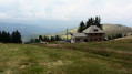
Route des chapelles de Linthal

This family-friendly walk, suitable for most people, presents no particular difficulties. It
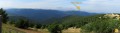
offers beautiful views of the village of Linthal and the surrounding mountains.

Details

n°44181708
Creation:
Last update:
Last review:
  • Walking
    Activity: Walking
  • ↔
    Distance: 3.41 mi
  • ◔
    Average duration: 2h 10 
  • ▲
    Difficulty: Easy

  • ⚐
    Back to start: Yes
  • ↗
    Ascent: + 653 ft
  • ↘
    Descent: - 656 ft

  • ▲
    Highest point: 2,224 ft
  • ▼
    Lowest point: 1,568 ft

Description of the walk

There is a car park behind St Mary Magdalene’s Church

(S/E) From the church, head up the road. Continue straight on until you reach the next chapel. Pass the lane on your right and head straight ahead to reach a Fork in the road.

(1) Take the road on the right, then immediately afterwards take the Chemin de la Langmatt on the right. Follow the Red Ring signposting. Keep left at the Fork in the road until you reach the next houses. Then turn right to reach a track.

(2) Follow it to the right. Continue until you reach the blockhouse.

(3) Follow the path down to the right. Keep to the right until you reach a lane.

(4) As you leave the Chemin du Breitstein, turn left onto Rue du Hilsenfirst. Walk down it in the opposite direction to your outward journey until you reach the starting point (S/E).

Waypoints

  1. S/E : mi 0 - alt. 1,572 ft - Église Sainte-Marie-Madeleine (Linthal)
  2. 1 : mi 0.63 - alt. 1,827 ft - Y-junction
  3. 2 : mi 1.16 - alt. 2,224 ft - Trail
  4. 3 : mi 2.05 - alt. 2,037 ft - Blockhouse
  5. 4 : mi 2.9 - alt. 1,749 ft - Path
  6. S/E : mi 3.41 - alt. 1,568 ft - St Mary Magdalene’s Church (Linthal). Near - La Lauch

Worth a visit

- St Mary Magdalene’s Church (S/E)
- Linthal War Memorial

Reviews and comments

4.7 / 5
Based on 1 review

Reliability of the description
5 / 5
Ease of following the route
5 / 5
Route interest
4 / 5
User 29651741

Overall rating : 4.7 / 5

Date of your route : Jul 23, 2026
Reliability of the description : ★★★★★ Very good
Ease of following the route : ★★★★★ Very good
Route interest : ★★★★☆ Good
Very busy route : No

A generally easy, shaded route – through a forest of beautiful, majestic trees

Machine-translated

Other walks in the area

For more walks, use our search engine .

The GPS track and description are the property of this route's author. Please do not copy them without permission.