A short walk around Lake Flaine via the Chemin des Grottes

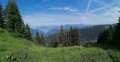
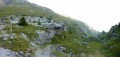
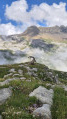
A short walk in the area around Flaine. Best chosen if you’re short on time, if the weather is uncertain, or if the DMC is closed. Once you’ve passed the initial section on the road, a path through the woods leads to a mountain pasture overlooking the lake. A pleasant mountain landscape where you can enjoy nature and perhaps spot a herd of cows.
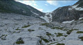
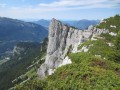
On the way back, the path takes you across a scree slope at the foot of the north face, then through a woodland. From a distance, you can make out a few caves at the foot of the cliff. Only one of them, in the wooded section, can be reached without too much risk.
Take care on the descent through the woods; there is a slightly steep section with chains.

Details

38585202
Creation:
Last update:
Last review:
  • Walking
    Activity: Walking
  • ↔
    Distance: 2.63 mi
  • ◔
    Average duration: 1h 40 
  • ▲
    Difficulty: Moderate

  • ⚐
    Back to start: Yes
  • ↗
    Ascent: + 525 ft
  • ↘
    Descent: - 538 ft

  • ▲
    Highest point: 5,161 ft
  • ▼
    Lowest point: 4,646 ft

Description of the walk

Park in car park P1 at Flaine, which is free in summer and accessible via the D106 from Magland via Arâches-la-Frasse and Les Carroz d’Arâches in the Grand Massif resort. Follow the road; the car park is located at the bottom of the resort.

Preliminary note: the signposting for this walk consists solely of signs indicating direction and duration; there are no specific trail markings. The paths and tracks are easy to spot and follow.

(S/E) Take the road heading down towards the west and follow it towards the ice climbing route. You will reach a crossroads in the Crêt neighbourhood.

(1) Turn left to reach the recycling centre and the ice racing route.

(2) Cross the circuit to reach the path that starts at the far end, on the edge of the woods. Look out for the signposts. Follow this path downhill to the mountain pasture. Please note: the descent can be challenging, with a section requiring chains and a slippery, stony stretch. Continue on to the western end of the lake, following the southern shore.

(3) Take the path towards Flaine, running along the northern shore of the lake. Reach the junction with the ‘Sentier des Grottes’.

(4) Turn left here, then right at the next junction. Continue across the scree and through the forest to reach the junction you passed on the way out.

(1) Turn left and, following the route in reverse to the one taken on the way there, return to car park P1 (S/E).

Waypoints

  1. S/E : mi 0 - alt. 5,161 ft - Flaine Car Park P1
  2. 1 : mi 0.28 - alt. 5,052 ft - Crossroads on the circular loop
  3. 2 : mi 0.43 - alt. 4,967 ft - Ice running route
  4. 3 : mi 1.43 - alt. 4,701 ft - Lac de Flaine
  5. 4 : mi 1.75 - alt. 4,685 ft - Caves Trail
  6. S/E : mi 2.63 - alt. 5,161 ft - Flaine Car Park P1

Notes

  • Make sure you have a good pair of shoes, ideally hiking boots.
  • Make sure you bring plenty of water. There are no places to top up your supplies during the walk.
  • Dogs on a lead are permitted.
  • You can quench your thirst and have a bite to eat on your return at the resort’s establishments.
  • You may need to cross a few fences used to pen in livestock. Please remember to close them behind you.

Worth a visit

From (2) to (3), enjoy the view of the lake and the mountain pastures.

Reviews and comments

4.2 / 5
Based on 3 reviews

Reliability of the description
4 / 5
Ease of following the route
4.3 / 5
Route interest
4.3 / 5
clucion
clucion

Overall rating : 4.7 / 5

Date of your route : Jun 28, 2026
Reliability of the description : ★★★★★ Very good
Ease of following the route : ★★★★☆ Good
Route interest : ★★★★★ Very good
Very busy route : No

Technical rock section with a chain – please mark this clearly: difficult when wet

Machine-translated

Mourey Titi
Mourey Titi
• Edited:

Overall rating : 4.7 / 5

Date of your route : Jun 24, 2024
Reliability of the description : ★★★★★ Very good
Ease of following the route : ★★★★★ Very good
Route interest : ★★★★☆ Good
Very busy route : Yes

A short route with not too much of a climb – perfect for a leisurely stroll whilst exploring the lake

Machine-translated

Jona67
Jona67

Hello,
I’m sorry to hear you found the descent so difficult. As a new route author on Visorando, I was initially unsure whether to increase the difficulty rating, but I eventually decided to stick with the rating suggested by the editing software, which is based solely on the length and elevation gain of the walk.
I’m still quite surprised, however, that you found the path “impassable”. When we took it, we certainly had to be careful, but we were able to make it all the way down with our 8-year-old daughter. Other walkers ahead of or behind us were able to do the same with their children. Perhaps the weather conditions over the last few weeks have caused the path to deteriorate between the time we walked it and the time you did.
Nevertheless, I will take your constructive comments on board and update the details for this walk.

Machine-translated

Muller Françoise
Muller Françoise

Overall rating : 3.3 / 5

Date of your route : Sep 03, 2023
Reliability of the description : ★★☆☆☆ Disappointing
Ease of following the route : ★★★★☆ Good
Route interest : ★★★★☆ Good
Very busy route : No

The descent on the way down is impassable and dangerous for average walkers: we had to turn back halfway down. We were very disappointed, as the route had been advertised as easy!

Machine-translated

Other walks in the area

For more walks, use our search engine .

The GPS track and description are the property of this route's author. Please do not copy them without permission.