


Refine your search for walks in Tête de la Maye (2518m)
Tête de la Maye (2518m) walks


 Visorando Member
Walks near Tête de la Maye (2518m)
 Alpe de Villar d'Arêne Mountain Hut - Monêtier-les-Bains
 9.66 mi
 +1,266 ft
 -3,271 ft
 5h 35
5h 35
 Difficult
 Departure from Villar-d'Arêne (Hautes-Alpes)
Stage9 of this route links the Refuge de l’Alpe de Villar-d’Arêne to Monêtier-les-Bains, taking a short detour to the Lac du Glacier d’Arsine, surrounded by the Pics de Chamoissière, d’Arsine, de Neige Cordier, the Pointe Cézanne and the Montagne des Agneaux. Unfortunately, the Arsine Glacier is suffering from global warming. The section starting from the pass along the Petit Tabuc stream in the valley, known as the Réou d'Arsine, is magnificent and very wild.
From Alpe de Villard-d'Arène to Monêtier-les-Bains
 9.74 mi
+1,289 ft
-3,261 ft
5h 35
9.74 mi
+1,289 ft
-3,261 ft
5h 35
 Moderate
Departure from Villar-d'Arêne (Hautes-Alpes)
Moderate
Departure from Villar-d'Arêne (Hautes-Alpes)
Stage2 of the Tour du Combeynot: From the Romanche to the Guisane Valley via the Col d'Arsine, this stage takes place at the foot of the Agneaux
Refuge du Pigeonnier – Chalet du Gioberney
 5.79 mi
+909 ft
-3,468 ft
3h 25
Moderate
Departure from La Chapelle-en-Valgaudemar (Hautes-Alpes)
5.79 mi
+909 ft
-3,468 ft
3h 25
Moderate
Departure from La Chapelle-en-Valgaudemar (Hautes-Alpes)
An easy fifth stage, mainly downhill, to recover from the previous days.
The crossing of the Gioberney glacial cirque at its highest point, before descending towards the Aiguille de la Vache (a great spot for a picnic), is fantastic!
La Grave - Alpe de Villar-d'Arêne mountain hut
 6.87 mi
+2,618 ft
-669 ft
5h 25
Difficult
Departure from La Grave (Hautes-Alpes)
6.87 mi
+2,618 ft
-669 ft
5h 25
Difficult
Departure from La Grave (Hautes-Alpes)
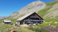
After a rest day in La Grave, set off on this8th stage, which presents no technical difficulties and involves no significant elevation gain. A route that circles La Meije, initially following the Romanche torrent. You will pass close to Villar d'Arène. Thesecond section, starting from Pont d'Arsine, is slightly more challenging and much wilder, taking in the Pas d'Anna Falque and the Plan d'Alpe before reaching the Refuge de l'Alpe de Villar-d'Arêne, which offers breathtaking views of the surrounding mountains.
La Grave – Goléon Mountain Hut
4.72 mi
+3,271 ft
-108 ft
5h 00
Difficult
Departure from La Grave (Hautes-Alpes)
The idea behind this three-day self-supported trek is to link the Goléon massif to the Grandes Rousses massif via the ridges to the north of the Plateau d’Emparis.
It’s a wild hike requiring not only good physical fitness but also the ability to read maps and the terrain.
Thefirst day is just a warm-up.
From Goléon to Les Grandes Rousses: La Grave / Clavans
86.50 mi
+29,537 ft
-26,375 ft
3 days
 Very difficult
Departure from La Grave (Hautes-Alpes)
Very difficult
Departure from La Grave (Hautes-Alpes)
From the Goléon massif to the Grandes Rousses massif, via the ridges between Emparis and Arves.A multi-day hike, with a bivouac, along the ridges between Emparis and Arves.
Chalet du Gioberney – Vallonpierre Mountain Hut
 6.84 mi
+3,442 ft
-1,358 ft
6h 10
Difficult
Departure from La Chapelle-en-Valgaudemar (Hautes-Alpes)
6.84 mi
+3,442 ft
-1,358 ft
6h 10
Difficult
Departure from La Chapelle-en-Valgaudemar (Hautes-Alpes)
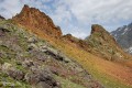
The sixth stage is a fairly easy climb up to the Vallonpierre Refuge.
This allows you to arrive at the refuge early and, if you wish, carry on to the Col des Chevrettes, where marmots are guaranteed.
Refuge du Clot (Xavier Blanc) – Refuge du Pigeonnier
 5.88 mi
+3,963 ft
-610 ft
6h 10
Difficult
Departure from La Chapelle-en-Valgaudemar (Hautes-Alpes)
5.88 mi
+3,963 ft
-610 ft
6h 10
Difficult
Departure from La Chapelle-en-Valgaudemar (Hautes-Alpes)
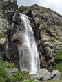
The fourth stage begins gently through the meadows, watched over by marmots, before reaching a major tourist attraction: the stunning Voile de la Mariée waterfall. Once you’ve passed Lac du Lauzon, you’ll find yourself alone again to enjoy the magnificent Lac Bleu. The Pigeonnier mountain refuge, perched on its promontory, is superb with its large bay windows.
Olan Mountain Hut – Clot Mountain Hut (Xavier Blanc)
 8.28 mi
+1,152 ft
-4,216 ft
4h 50
Moderate
Departure from La Chapelle-en-Valgaudemar (Hautes-Alpes)
8.28 mi
+1,152 ft
-4,216 ft
4h 50
Moderate
Departure from La Chapelle-en-Valgaudemar (Hautes-Alpes)
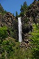
A very beautiful third stage, albeit a little long, mainly at the bottom of the valley along the Séveraisse.
From Rif du Sap to Navette via Le Chapeau
 7.39 mi
+4,045 ft
-4,301 ft
6h 55
Very difficult
Departure from La Chapelle-en-Valgaudemar (Hautes-Alpes)
7.39 mi
+4,045 ft
-4,301 ft
6h 55
Very difficult
Departure from La Chapelle-en-Valgaudemar (Hautes-Alpes)
A beautiful and challenging hike in the hills, varied with some unexpected sections. Stunning views. Be careful, there are many tricky and slippery sections. Avoid in wet weather.